Rochedale South, Queensland
| Rochedale South Logan City, Queensland | |||||||||||||||
|---|---|---|---|---|---|---|---|---|---|---|---|---|---|---|---|
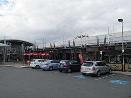 Rochedale Shopping Village (formerly Strathlands), 2013 | |||||||||||||||
 Rochedale South | |||||||||||||||
| Coordinates | 27°36′S 153°8′E / 27.600°S 153.133°ECoordinates: 27°36′S 153°8′E / 27.600°S 153.133°E | ||||||||||||||
| Population | 15,317 (2016 census)[1] | ||||||||||||||
| Established | 1979 | ||||||||||||||
| Postcode(s) | 4123 | ||||||||||||||
| Location | 20 km (12 mi) from Brisbane GPO | ||||||||||||||
| LGA(s) | Logan City | ||||||||||||||
| State electorate(s) | Springwood | ||||||||||||||
| Federal Division(s) | Rankin | ||||||||||||||
| |||||||||||||||
Rochedale South is a northern residential suburb of Logan City Council, 19 km (12 miles) south of Brisbane CBD, Australia. It borders Rochedale, Eight Mile Plains, Priestdale, Springwood and Underwood. At the 2016 Australian Census the suburb recorded a population of 15,317.[1]
It is adjacent the Pacific Highway (Brisbane/Gold Coast Highway) and in close proximity to the Gateway Motorway, and Southeast Freeway
Closest Bus Depots are in adjacent suburbs Springwood and Eight Mile Plains (South East Busway)
Closest Train Station is in Kuruby 4 km west
Demographics
In the 2011 census, Rochedale South recorded a population of 14,996 people, 51.3% female and 48.7% male.[2] The median age of the Rochedale South population was 35 years, 2 years below the national median of 37. 71.9% of people living in Rochedale South were born in Australia. The other top responses for country of birth were New Zealand 6.5%, England 4.3%, South Africa 1.1%, India 0.6%, Fiji 0.6%. 86.1% of people spoke only English at home; the next most common languages were 0.9% Cantonese, 0.9% Mandarin, 0.6% Arabic, 0.5% Hindi, 0.4% Greek.
Geography
Rochedale South is 19 km from Brisbane City, or 15 minutes drive,[3] 56 km or 35 minutes drive from Surfers Paradise in the Gold Coast and 28 km or 21 minutes drive from Brisbane Airport. Its Northern boundaries of Priestdale and Underwood Road form the Logan/Brisbane local council boundary. Part of the suburb's western boundary follows the Pacific Motorway. In the past Rochedale was known for its rich, red soil that is good for crops. Yet due to recent years of drought in the area, much of the farming has been abandoned and are now commercialised.
History
In 1952, the Gill family ran a poultry farm and piggery and in 1967 developed the land into the first sewered estate in the region. They named some of the streets after the towns and streets in England from where they originated in 1951. Some of the streets were Ridgeway Street, Green Way, Edgeware Drive and Gills Close.
In 1979, the suburb was split off from the larger Rochedale.[4]
The Strathlands shopping centre opened in 1970 but was later renamed Rochedale Shopping Village.[4] A number of churches and school were established in the following decades as the population of the suburb expanded with estate developments.
Schools
Nearby high schools include Springwood State High School, Rochedale State High School and Redeemer Lutheran College. Rochedale South State School, Springwood Road State School are within the suburb whereas Eight Mile Plains State School, St Peters Catholic Primary School and Rochedale State School are all marginally outside the suburb's boundary.
Sports
Rochedale is home to the 2010 Brisbane Premier League champions, Rochedale Rovers Football Club. They play out of Underwood Park, Priestdale.
References
- 1 2 Australian Bureau of Statistics (27 June 2017). "Rochedale South (State Suburb)". 2016 Census QuickStats. Retrieved 29 March 2018.

- ↑ Australian Bureau of Statistics (31 October 2012). "Rochedale South (State Suburb)". 2011 Census QuickStats. Retrieved 28 December 2013.
- ↑ RACQ Trip Planner. Missing or empty
|title=(help); Missing or empty|url=(help) - 1 2 "Rochedale South". Logan City Council. 1 May 2013. Retrieved 28 December 2013.