Cedar Grove, Queensland
| Cedar Grove Logan City, Queensland | |||||||||||||||
|---|---|---|---|---|---|---|---|---|---|---|---|---|---|---|---|
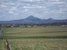 Teviot Range from Cedar Grove, 2016 | |||||||||||||||
| Population | 2,020 (2011 census)[1] | ||||||||||||||
| Postcode(s) | 4285 | ||||||||||||||
| Location | 44 km (27 mi) south of Brisbane GPO | ||||||||||||||
| LGA(s) | Logan City | ||||||||||||||
| State electorate(s) | Scenic Rim | ||||||||||||||
| Federal Division(s) | Wright | ||||||||||||||
| |||||||||||||||
Cedar Grove is a locality in the Logan City, Queensland, Australia.[2] In the 2011 census, Cedar Grove had a population of 2,020.[1]
Geography
The western and part of the northern boundary of Cedar Grove follows the Logan River. Also on the northern boundary is the Cedar Grove Weir which began operations in 2008.
History

Disused Beaudesert railway line, 2016
When the railway line to Beaudesert was built in 1888, the station in the area was called Cedar Pocket.[3] Cedar Grove State School opened in 1923 and closed in 1965.[4] Formerly in the Shire of Beaudesert, Cedar Grove became part of Logan City following the local government amalgamations in March 2008.
References
- 1 2 Australian Bureau of Statistics (31 October 2012). "Cedar Grove (SSC)". 2011 Census QuickStats. Retrieved 6 May 2014.

- ↑ "Cedar Grove - locality in Logan City (entry 45257)". Queensland Place Names. Queensland Government. Retrieved 26 October 2017.
- ↑ "Cedar Grove". Suburbs. Logan City Council.
- ↑ "Agency ID6292, Cedar Grove State School". Queensland State Archives. Retrieved 11 May 2014.
External links
| Wikimedia Commons has media related to Cedar Grove, Queensland. |
- "Cedar Grove and Cedar Vale". Queensland Places. Centre for the Government of Queensland, University of Queensland.
Coordinates: 27°51′36″S 152°58′27″E / 27.86000°S 152.97417°E
This article is issued from
Wikipedia.
The text is licensed under Creative Commons - Attribution - Sharealike.
Additional terms may apply for the media files.