James River (Missouri)
| James River | |
| Stream | |
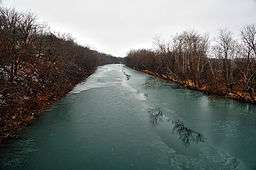 James River near Springfield | |
| Country | United States |
|---|---|
| State | Missouri |
| Region | Webster, Christian, Greene, and Stone counties |
| Municipality | Springfield, Missouri |
| Tributaries | |
| - left | Finley Creek |
| - right | Wilson Creek |
| Source | |
| - location | Eastern Webster County |
| - elevation | 1,650 ft (503 m) |
| - coordinates | 37°13′11″N 92°43′44″W / 37.21977°N 92.72878°W[1] |
| Mouth | |
| - location | Table Rock Lake, Stone County |
| - elevation | 1,125 ft (343 m) |
| - coordinates | 36°47′11″N 93°29′56″W / 36.78626°N 93.49885°WCoordinates: 36°47′11″N 93°29′56″W / 36.78626°N 93.49885°W[2] |
| Length | 130 mi (209 km) |
The James River is a 130-mile-long (210 km)[3] river in southern Missouri. It flows from northeast Webster County until it is impounded into Table Rock Lake. It is part of the White River watershed. The river forms Lake Springfield and supplies drinking water for the city of Springfield.
Course
Its source is northeast of the town of Seymour in Webster County. Its headwaters initially flow south then turns west to northwesterly north of Seymour and turns southwest near Northview and passes down the east side of Springfield where it is impounded to form Lake Springfield.[4][5] From Springfield, it flows west and then south past Galena where it enters Table Rock Lake, a reservoir on the White River.
Major tributaries into the James River include: Pearson Creek, Wilson Creek, Finley Creek, Crane Creek, and Flat Creek.[6]
Recreation
Large sections of the James River are floatable by canoe or kayak. A solid 3-day float from the public access on the downstream side of the dam to Galena is possible when the levels are high enough.[7]
The James River is a source of drinking water for the city of Springfield. Lake Springfield is the primary source of water for the cooling system at the James River Power Plant which sits by the dam. The lake is a popular fishing and kayaking destination with docks and access points made by the Missouri Conservation Department. The river contains bass, catfish, crappie and bluegill.[8]
Dams
The dam on the James River creates Lake Springfield and serves as the cooling reservoir for the James River Power Plant.
The river flows into the White River upstream from the hydroelectric Table Rock Dam, operated by the Army Corp of Engineers.
Name
The river's name most likely is a transfer from the James River located in Virginia.[9] James River Freeway on the city's south side is named after the river.
References
- ↑ Mansfield NW, Missouri, 7.5 Minute Topographic Quadrangle, USGS, 1952 (1985 Revision)
- ↑ U.S. Geological Survey Geographic Names Information System: James River (Missouri)
- ↑ U.S. Geological Survey. National Hydrography Dataset high-resolution flowline data. The National Map Archived 2012-04-05 at WebCite, accessed March 9, 2011
- ↑ Missouri Atlas & Gazetteer, DeLorme, 1998, First edition, p. 52-53, ISBN 0-89933-224-2
- ↑ Missouri Department of Conservation Area Summary
- ↑ "James River | Missouri Department of Conservation". mdc.mo.gov. Retrieved 2017-07-20.
- ↑ Missouri Department of Conservation Mile-by-Mile Description and Map. , accessed 5/16/2013.
- ↑ "James River | MDC Fisheries". fishing.mdc.mo.gov. Retrieved 2017-07-20.
- ↑ "Greene County Place Names, 1928–1945 (archived)". The State Historical Society of Missouri. Archived from the original on 24 June 2016. Retrieved 3 October 2016.