Zenar, Missouri
Zenar is a community in southwest Webster County in the Ozarks of southwest Missouri.[1] The location ison the southern edge of the Springfield Plateau at an elevation of 1,503 ft (458 m).[1] The townsite is located southwest of Fordland.[2] The community is located just east of Missouri Route U 2.5 miles south of U.S. Route 60. The headwaters of Pedelo Creek lie just to the west and the Webster-Christian county line is one half mile to the south. The community of Olga lies about three miles to the east.[3]
References
- 1 2 U.S. Geological Survey Geographic Names Information System: Zenar, Missouri
- ↑ Arthur Paul Moser : A Directory of Towns, Villages, and Hamlets Past and Present of Webster County, Missouri
- ↑ Missouri Atlas & Gazetteer, DeLorme, 2007, Third edition, p. 62, ISBN 0-89933-353-2
Municipalities and communities of Webster County, Missouri, United States | ||
|---|---|---|
| Cities | 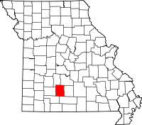 | |
| Village | ||
| Townships |
| |
| Unincorporated communities | ||
| Ghost towns | ||
| Footnotes | ‡This populated place also has portions in an adjacent county or counties | |
Coordinates: 37°05′42″N 92°58′14″W / 37.09500°N 92.97056°W
This article is issued from
Wikipedia.
The text is licensed under Creative Commons - Attribution - Sharealike.
Additional terms may apply for the media files.