Longreach Region
| Longreach Region Queensland | |||||||||||||||
|---|---|---|---|---|---|---|---|---|---|---|---|---|---|---|---|
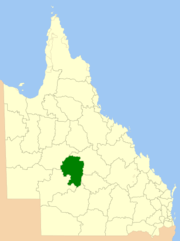 Location within Queensland | |||||||||||||||
| Population | 3,660 (2016 census)[1] | ||||||||||||||
| • Density | 0.09010/km2 (0.2334/sq mi) | ||||||||||||||
| Established | 2008 | ||||||||||||||
| Area | 40,619.5 km2 (15,683.3 sq mi) | ||||||||||||||
| Mayor | Ed Warren | ||||||||||||||
| Council seat | Longreach | ||||||||||||||
| Region | Central West Queensland | ||||||||||||||
| State electorate(s) | Gregory | ||||||||||||||
| Federal Division(s) | Flynn | ||||||||||||||
|
| |||||||||||||||
| Website | Longreach Region | ||||||||||||||
| |||||||||||||||
The Longreach Region is a local government area in Central West Queensland, Australia. Established in 2008, it superseded three previous local government areas that had existed for more than a century.
It has an estimated operating budget of A$22.3m.
Traditionally, pastoral activities, tourism, and rural education have been the areas of focus within the region, with a major agricultural college and attractions such as the Australian Stockman's Hall of Fame and the Qantas Founders Outback Museum.
History
Prior to the 2008 amalgamation, the Longreach Region existed as three distinct local government areas:
- the Shire of Longreach;
- the Shire of Ilfracombe;
- and the Shire of Isisford.
In July 2007, the Local Government Reform Commission released its report recommending that the three areas amalgamate. Ilfracombe was rated by a Treasury sustainability review as very weak with a negative outlook, while the other two were rated as moderate. All three councils opposed the amalgamation.[2] The legislation passed to effect the merger on 10 August 2007. A Local Transition Committee made up of staff and councillors of the three dissolving entities was formed to manage the process. On 15 March 2008, the three Shires formally ceased to exist, and elections were held on the same day to elect councillors and a mayor to the Regional Council.
Wards
The Region has six divisions, each represented by one councillor, with a directly elected mayor serving the whole region.
Towns and localities
The Longreach Region includes the following settlements:
Amenities
Longreach Regional Council operates public libraries at Ilfracombe, Isisford, and Longreach.[3]
Population
The populations given relate to the component entities prior to 2008 and combined population after amalgamation. The population has been in steady decline since the early 1960's.
| Year | Population (Total) |
(Longreach) | (Ilfracombe) | (Isisford) |
|---|---|---|---|---|
| 1933 | 6,079 | 4,564 | 642 | 873 |
| 1947 | 5,244 | 4,137 | 450 | 657 |
| 1954 | 5,694 | 4,343 | 544 | 807 |
| 1961 | 6,533 | 5,013 | 653 | 867 |
| 1966 | 6,366 | 4,959 | 660 | 747 |
| 1971 | 5,142 | 4,300 | 389 | 453 |
| 1976 | 4,911 | 4,052 | 428 | 431 |
| 1981 | 4,911 | 3,846 | 460 | 605 |
| 1986 | 4,663 | 3,871 | 327 | 465 |
| 1991 | 5,153 | 4,369 | 344 | 440 |
| 1996 | 5,054 | 4,419 | 333 | 302 |
| 2001 | 5,037 | 4,368 | 356 | 313 |
| 2006 | 4,806 | 4,180 | 279 | 347 |
References
- ↑ Australian Bureau of Statistics (27 June 2017). "Longreach (R)". 2016 Census QuickStats. Retrieved 26 November 2017.

- ↑ Queensland Local Government Reform Commission (July 2007). Report of the Local Government Reform Commission (PDF). 2. pp. 194–198. ISBN 1-921057-11-4. Retrieved 5 June 2010.
- ↑ "Longreach Regional Council". Public Libraries Connect. State Library of Queensland. 20 September 2016. Archived from the original on 6 February 2018. Retrieved 6 February 2018.