Shire of Cloncurry
| Shire of Cloncurry Queensland | |||||||||||||||
|---|---|---|---|---|---|---|---|---|---|---|---|---|---|---|---|
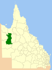 Location within Queensland | |||||||||||||||
| Population | 3,032 (2016 census)[1] | ||||||||||||||
| • Density | 0.063018/km2 (0.163216/sq mi) | ||||||||||||||
| Established | 1884 | ||||||||||||||
| Area | 48,113.3 km2 (18,576.6 sq mi) | ||||||||||||||
| Mayor | Greg Campbell | ||||||||||||||
| Council seat | Cloncurry | ||||||||||||||
| Region | North West Queensland | ||||||||||||||
| State electorate(s) | Traeger | ||||||||||||||
| Federal Division(s) | Kennedy | ||||||||||||||
|
| |||||||||||||||
| Website | Shire of Cloncurry | ||||||||||||||
| |||||||||||||||
The Shire of Cloncurry is a local government area in North West Queensland, Australia. It covers an area of 48,113.3 square kilometres (18,576.6 sq mi), and has existed as a local government entity since 1884. The major town and administrative centre of the shire is Cloncurry.
Prior to European settlement the area was home to the Mitakoodi, Kalkadoon and Pitta Pitta Aboriginal people.
The ghost town of Mary Kathleen, a town servicing a uranium mine since closed, is in the shire.
History

The Doonmunya Division was created on 11 November 1879 as one of 74 divisions around Queensland under the Divisional Boards Act 1879 with a population of 396.[2] However, the divisional board appeared to be completely inactive, perhaps because the division was so large (being the area surrounding the southern part of the Gulf of Carpentaria) and was very sparsely settled.[3] Nonetheless some of the citizens were unhappy about this.[4] Consequently, on 11 January 1883, the Doonmunya Division was abolished and a new Carpentaria Division was created to replace it.[5][6][7]
Given the size of the Carpentaria Division, the distance to its headquarters in Normanton was an issue for residents in the Cloncurry area, leading to a desire to create their own local division.[8] On 7 February 1884, part of Carpentaria Division was separated to create the new Cloncurry Division.[9][10][11]
On 30 January 1885, adjustments were made to boundaries of the Cloncurry Division when the Burke Division was also split off from the Carpentaria Division.[12][13][14]
On 31 March 1903, Cloncurry Division became the Shire of Cloncurry.[11][15]
Libraries
The Cloncurry Shire Council operates a public library in Cloncurry.[16]
Towns and localities
The Shire of Cloncurry includes the following settlements:
Population
| Year | Population |
|---|---|
| 1933 | 6,184 |
| 1947 | 6,267 |
| 1954 | 3,052 |
| 1961 | 4,869 |
| 1966 | 3,348 |
| 1971 | 3,623 |
| 1976 | 4,036 |
| 1981 | 3,651 |
| 1986 | 3,194 |
| 1991 | 3,382 |
| 1996 | 3,878 |
| 2001 | 4,795 |
| 2006 | 3,970 |
| 2011 | 3,229 |
| 2016 | 3,032 |
Chairmen and mayors
- 1884: George Seymour[17]
- 1919: J. Hedleffe[18]
- 1927: Walter Angus Rose[19]
- 2008–2016 : Andrew Daniels[20]
- 2016: Greg Campbell[21]
Other notable members of the council included:
- 1924—1930 (deputy chairman 1927—1930) Tom Aikens, Member of the Queensland Legislative Assembly for Munndingburra and Townsville South[22]
References
- ↑ Australian Bureau of Statistics (27 June 2017). "Cloncurry (S)". 2016 Census QuickStats. Retrieved 4 May 2018.

- ↑ "Proclamation [Doonmunya Division constituted]". Queensland Government Gazette. 11 November 1879. p. 25:1007.
- ↑ "Local Government Practically Applied". The Queenslander. Brisbane: National Library of Australia. 15 January 1881. p. 71. Retrieved 4 October 2013.
- ↑ "NORMANTON". The Brisbane Courier. National Library of Australia. 12 January 1883. p. 6. Retrieved 4 October 2013.
- ↑ "Proclamation [Doonmunya Division abolished]". Queensland Government Gazette. 13 January 1883. p. 32:98.
- ↑ "Proclamation [Carpentaria Division constituted]". Queensland Government Gazette. 13 January 1883. p. 32:98.
- ↑ "Agency ID556, Carpentaria Divisional Board". Queensland State Archives. Retrieved 12 September 2013.
- ↑ "CLONCURRY". The Brisbane Courier. National Library of Australia. 23 January 1884. p. 6. Retrieved 5 October 2013.
- ↑ "Proclamation [Cloncurry Division constituted]". Queensland Government Gazette. 9 February 1884. p. 34:326-327.
- ↑ "Proclamation [Carpentaria Division amended]". Queensland Government Gazette. 9 February 1884. p. 34:326.
- 1 2 "Agency ID578, Cloncurry Divisional Board". Queensland State Archives. Retrieved 5 October 2013.
- ↑ "Proclamation [Burke Division constituted]". Queensland Government Gazette. 31 January 1885. p. 36:328-329.
- ↑ "Proclamation [Carpentaria Division amended]". Queensland Government Gazette. 31 January 1885. p. 36:328.
- ↑ "Proclamation [Cloncurry Division amended]". Queensland Government Gazette. 31 January 1885. p. 36:327-328.
- ↑ "Agency ID579, Cloncurry Shire Council". Queensland State Archives. Retrieved 5 October 2013.
- ↑ "Cloncurry Shire Council". Public Libraries Connect. State Library of Queensland. 20 September 2016. Archived from the original on 5 February 2018. Retrieved 6 February 2018.
- ↑ "Memorable Jubilee". The Longreach Leader (Qld. : 1923 – 1954). Qld.: National Library of Australia. 12 February 1944. p. 12. Retrieved 10 July 2014.
- ↑ Consolidated Index to Queensland Government Gazette 1859–1919. Queensland Family History Society. 2004. ISBN 1 876613 79 3.
- ↑ Pugh, Theophilus Parsons (1927). Pugh's Almanac for 1927. Retrieved 13 June 2014.
- ↑ "Elected Representatives". Cloncurry Shire Council. Cloncurry Shire Council. Archived from the original on 15 June 2014. Retrieved 15 June 2014.
- ↑ "2016 Cloncurry Shire Council - Mayoral Election - Election Summary". Electoral Commission of Queensland. 20 April 2016. Archived from the original on 31 May 2016. Retrieved 16 March 2017.
- ↑ "Aikens, Mr Thomas (Tom)". Re-Member Database. Queensland Parliament. Retrieved 18 June 2014.
External links
- "Cloncurry Shire". Queensland Places. Centre for the Government of Queensland, University of Queensland.
Coordinates: 20°42′16″S 140°30′20″E / 20.70444°S 140.50556°E