Shire of Mornington (Queensland)
| Mornington Shire Queensland | |||||||||||||||
|---|---|---|---|---|---|---|---|---|---|---|---|---|---|---|---|
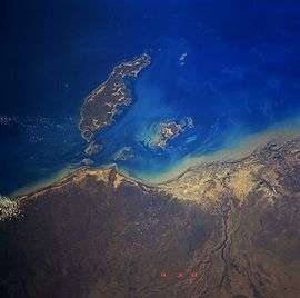 Mornington Island from space, September 1991 | |||||||||||||||
| Population | 1,143 (2016 census)[1] | ||||||||||||||
| • Density | 0.9278/km2 (2.4029/sq mi) | ||||||||||||||
| Established | 1978 | ||||||||||||||
| Area | 1,232 km2 (475.7 sq mi) | ||||||||||||||
| Mayor | Bradley Wilson | ||||||||||||||
| Council seat | Gununa | ||||||||||||||
| State electorate(s) | Traeger | ||||||||||||||
| Federal Division(s) | Kennedy | ||||||||||||||
|
| |||||||||||||||
| Website | Mornington Shire | ||||||||||||||
| |||||||||||||||
Mornington Shire is a local government area in north-west Queensland, Australia. The Shire covers Mornington Island and neighbouring islands in the Wellesley Islands group in the Gulf of Carpentaria. The Shire Council employees are 93% local indigenous residents.
The administrative centre for the shire is the township of Gununa, on Mornington Island. In 2001 the Shire had a population of 934 of which 88.2% were Aboriginal.[2] By the 2016 census, the population of the shire had risen to 1,143; with 86.1% of residents being Aboriginal or Torres Strait Islander.[1]
The shire was formed in 1978 as a result of the Queensland Government's decision to take over control of the islands from the Uniting Church. The local community sought the assistance of the Federal Government to overturn the decision. The establishment of self-governance for the community under a Local Government model was the result of the ensuing discussions.[3]
Amenities
The Mornington Shire Council does not operate any public libraries.[4]
Mayors
References
- 1 2 Australian Bureau of Statistics (27 June 2017). "Mornington (S)". 2016 Census QuickStats. Retrieved 5 October 2018.

- ↑ Australian Bureau of Statistics (9 March 2006). "Mornington (S) (Local Government Area)". 2001 Census QuickStats. Retrieved 2007-06-30.
- ↑ James Cook University - Mount Isa Centre for Rural and Remote Health Archived 2006-09-27 at the Wayback Machine. - Mornington Island page. Retrieved 21 December 2006.
- ↑ "Mornington Shire". Public Libraries Connect. State Library of Queensland. 3 April 2014. Archived from the original on 5 February 2018. Retrieved 6 February 2018.
- ↑ "2008 Mornington Shire - Mayoral Election - Election Summary". results.ecq.qld.gov.au. Retrieved 2017-12-04.
- ↑ "2012 Mornington Shire - Mayoral Election - Election Summary". results.ecq.qld.gov.au. Retrieved 2017-12-04.
- ↑ "2016 Mornington Shire Council - Mayoral Election - Election Summary". results.ecq.qld.gov.au. Retrieved 2017-12-04.
Coordinates: 20°43′29″S 139°29′37″E / 20.72472°S 139.49361°E