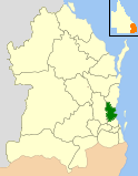
Moreton Bay Region
| Moreton Bay Region Queensland | |||||||||||||||
|---|---|---|---|---|---|---|---|---|---|---|---|---|---|---|---|
 Moreton Bay in south-eastern Queensland | |||||||||||||||
| Population | 425,302 (2016)[1] (3rd) | ||||||||||||||
| • Density | 208.79/km2 (540.76/sq mi) | ||||||||||||||
| Established | 2008 | ||||||||||||||
| Area | 2,037 km2 (786.5 sq mi) | ||||||||||||||
| Mayor | Allan Sutherland[2] | ||||||||||||||
| Council seat | Strathpine, Caboolture, Redcliffe | ||||||||||||||
| Region | South East Queensland | ||||||||||||||
| State electorate(s) | Bancroft, Ferny Grove, Kurwongbah, Morayfield, Glass House, Murrumba, Pumicestone, Redcliffe, Everton, Pine Rivers | ||||||||||||||
| Federal Division(s) | Petrie, Dickson, Longman | ||||||||||||||
 | |||||||||||||||
| Website | Moreton Bay Region | ||||||||||||||
| |||||||||||||||
The Moreton Bay Region is a local government area in the north of the Brisbane metropolitan area in South East Queensland, Australia. Established in 2008, it replaced three established local government areas, the City of Redcliffe and the Shires of Pine Rivers and Caboolture.
With an estimated operating budget of A$391 million and a population of over 425,000, Moreton Bay Region is the third largest local government area in Australia behind the City of Brisbane and City of Gold Coast, both of which are also amalgamated entities.[3]
History
Prior to 2008, the new Moreton Bay Region was an entire area of three previous and distinct local government areas:
- the City of Redcliffe;
- the Shire of Pine Rivers;
- and the Shire of Caboolture.
At the time the Divisional Boards Act 1879 came into force on 11 November 1879, the present Morton Bay Region was entirely contained within the Caboolture Division, which also included the Sunshine Coast. By 1890, Caboolture Division had shrunk considerably with the separate incorporation of the Pine Division (21 January 1888), Redcliffe Division (5 April 1888) and Maroochy Division (5 July 1890).
With the passage of the Local Authorities Act 1902, Caboolture, Pine and Redcliffe (as well as Maroochy) became Shires on 31 March 1903. Redcliffe was proclaimed a Town on 28 May 1921 and a City on 13 June 1959. A few weeks earlier, on 23 May 1959, Pine was renamed the Shire of Pine Rivers.
In July 2007, the Local Government Reform Commission released its report and recommended that the three areas amalgamate.[4] It argued that the area was part of the South East Queensland Regional Plan's Urban Footprint, and would attract 11% of the region's population and housing growth to 2006. A very strong community of interest was identified through the region's links and dependencies to Brisbane. The councils disagreed with the Commission's plans although, with the exception of Redcliffe, did not oppose alternative amalgamation options. On 15 March 2008, the City and Shires formally ceased to exist, and elections were held on the same day to elect councillors and a mayor to the Regional Council. In 2012, following the election of the LNP state government, Redcliffe sought to enter a de-amalgamation process; however, a deadline to gather signatures on a petition by 29 August 2012 was missed. The Hills District sought in 2011 to transfer to Brisbane City Council, but the local government Change Commissioner declined the proposal on cost grounds.
Wards and councillors
Moreton Bay Region is divided into 12 divisions, each of which elects one councillor to the Regional Council. Additionally, the entire Region elects a mayor. Allan Sutherland was elected as the Region's first mayor at the 2008 elections. The councillors elected were:
- Division 1 – Gary Parsons
- Division 2 – Chris Whiting
- Division 3 – Greg Chippendale (Deputy Mayor)
- Division 4 – Julie Greer
- Division 5 – James Houghton
- Division 6 – Rae Frawley
- Division 7 – David Dwyer
- Division 8 – Mick Gillam
- Division 9 – Mike Charlton
- Division 10 – Brian Battersby
- Division 11 – Bob Millar
- Division 12 – Adrian Raedel
Councillors elected to Moreton Bay Regional Council in March 2012:
- Mayor – Allan Sutherland
- Division 1 – Gary Parsons
- Division 2 – Peter Flannery
- Division 3 – Greg Chippendale
- Division 4 – Julie Greer
- Division 5 – James Houghton
- Division 6 – Koliana Winchester
- Division 7 – David Dwyer
- Division 8 – Mick Gillam
- Division 9 – Mike Charlton (Deputy Mayor)
- Division 10 – Brian Battersby
- Division 11 – Bob Millar
- Division 12 – Adrian Raedel
The most recent Local Government elections were held in March 2016, resulting in the following list:[5][6]
- Mayor – Allan Sutherland
- Division 1 – Brooke Savige (replacing Gary Parsons, who retired at this election)
- Division 2 – Peter Flannery
- Division 3 – Adam Hain (replacing Greg Chippendale, who retired at this election)
- Division 4 – Julie Greer
- Division 5 – James Houghton
- Division 6 – Koliana Winchester
- Division 7 – Denise Sims (replacing David Dwyer, who chose not to stand for re-election)
- Division 8 – Mick Gillam
- Division 9 – Mike Charlton (Deputy Mayor)
- Division 10 – Matt Constance (replacing Brian Battersby, who retired at this election)
- Division 11 – Darren Grimwade (replacing Bob Millar)
- Division 12 – Adrian Raedel (Re-elected unopposed)
Mayors
Unitywater
On 1 July 2010, Moreton Bay Regional Council's Water Services (along with Sunshine Coast Regional Council), moved over to the recently created water body, Unitywater. Unitywater was created by the Queensland Government as part of the State's takeover of South East Queensland's water facilities, dams and water supply networks. Moreton Bay, Sunshine Coast Regional Council and Noosa Shire Council are joint owners of Unitywater.
Suburbs
The Moreton Bay Region include the following settlements:
Redcliffe area
Pine Rivers area
Urban suburbs:
|
|
|
Rural localities:
Caboolture area
Population
The populations given relate to the component entities prior to 2008. The 2011 census was the first for the amalgamated council region.
| Year | Population (Total) |
(Caboolture) | (Pine Rivers) | (Redcliffe) |
|---|---|---|---|---|
| 1933 | 11,928 | 5,316 | 4,604 | 2,008 |
| 1947 | 19,402 | 5,716 | 4,815 | 8,871 |
| 1954 | 27,267 | 7,101 | 6,309 | 13,857 |
| 1961 | 39,312 | 8,877 | 8,761 | 21,674 |
| 1966 | 50,785 | 10,149 | 13,309 | 27,327 |
| 1971 | 72,955 | 12,207 | 26,187 | 34,561 |
| 1976 | 103,669 | 19,404 | 45,192 | 39,073 |
| 1981 | 133,056 | 32,644 | 58,189 | 42,223 |
| 1986 | 166,210 | 47,494 | 73,783 | 44,933 |
| 1991 | 205,743 | 70,052 | 87,892 | 47,799 |
| 1996 | 250,077 | 98,859 | 103,192 | 48,026 |
| 2001 | 286,532 | 114,338 | 122,303 | 49,891 |
| 2005 | 325,067 | 131,667 | 141,380 | 52,020 |
| 2007 | 344,878 | 140,288 | 150,871 | 53,719 |
| 2009 | 371,155 | 151,290 | 163,510 | 56,355 |
| 2011 | 389,684 | 158,988 | 172,593 | 58,103 |
Facilities
The Moreton Bay Regional Council operates libraries at Albany Creek, Arana Hills, Bongaree (Bribie Island), Burpengary, Caboolture, Deception Bay, North Lakes, Redcliffe, Strathpine, and Woodford.[10] It also operates a mobile library service on a fortnightly basis serving the suburbs of Beachmere, Bray Park, Dayboro, Donnybrook, Lawnton, Mount Glorious, Mount Mee, Mount Nebo, Mount Samson Petrie, Samford, Toorbul and Warner.[11]
References
- ↑ "3218.0 – Regional Population Growth, Australia, 2014–15". Australian Bureau of Statistics. Retrieved 29 September 2016.
- ↑ Election summary Archived 5 October 2009 at the Wayback Machine. (ECQ)
- ↑ "Table 1: Population growth and turnover in Local Government Areas (LGAs), 2006 to 2011". Australian Bureau of Statistics. Retrieved 10 August 2015.
- ↑ Queensland Local Government Reform Commission (July 2007). Report of the Local Government Reform Commission (PDF). 2. pp. 234–239. ISBN 1-921057-11-4. Archived from the original (PDF) on 17 March 2011. Retrieved 3 June 2010.
- ↑ "2016 Moreton Bay Regional Council - Mayoral Election - Election Summary". results.ecq.qld.gov.au. Retrieved 2016-04-09.
- ↑ "2016 Moreton Bay Regional Council - Councillor Election - Election Summary". results.ecq.qld.gov.au. Retrieved 2016-04-09.
- ↑ "2008 Moreton Bay Regional Council - Mayoral Election - Election Summary". results.ecq.qld.gov.au. Retrieved 2017-12-04.
- ↑ "2012 Moreton Bay Regional Council - Mayoral Election - Election Summary". results.ecq.qld.gov.au. Retrieved 2017-12-04.
- ↑ "2016 Moreton Bay Regional Council - Mayoral Election - Election Summary". results.ecq.qld.gov.au. Retrieved 2017-12-04.
- ↑ "Library locations & opening hours - Libraries". Moreton Bay Regional Council. Retrieved 2018-01-22.
- ↑ "Mobile Library - Libraries". Moreton Bay Regional Council. Retrieved 2018-01-22.
External links
- Moreton Bay Regional Council
- Live weather in Moreton Bay Region. (Near the Caboolture offices)
- Moreton Bay Symphony Orchestra
Coordinates: 27°17′36″S 152°55′48″E / 27.29333°S 152.93000°E