Santiago de la Puebla
| Santiago de la Puebla | ||
|---|---|---|
| Municipality | ||
| ||
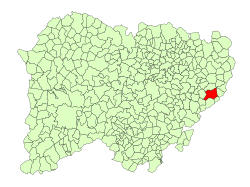 Location in Salamanca | ||
| Coordinates: 40°28′7″N 5°1′43″W / 40.46861°N 5.02861°WCoordinates: 40°28′7″N 5°1′43″W / 40.46861°N 5.02861°W | ||
| Country | Spain | |
| Autonomous community | Castile and León | |
| Province | Salamanca | |
| Comarca | Tierra de Peñaranda | |
| Government | ||
| • Alcalde (Mayor) | Casimiro García Pérez (2011) (PSOE) | |
| Area[1] | ||
| • Total | 53 km2 (20 sq mi) | |
| Elevation[1] | 867 m (2,844 ft) | |
| Population (2016)[2] | ||
| • Total | 353 | |
| • Density | 6.7/km2 (17/sq mi) | |
| Time zone | UTC+1 (CET) | |
| • Summer (DST) | UTC+2 (CEST) | |
| Postal code | 37311 | |
| Dialing code | 923 | |
| Website | santiagodelapuebla.es | |

Santiago de la Puebla is a village and municipality in the province of Salamanca, western Spain, part of the autonomous community of Castile-Leon. It is located 54 kilometres from the provincial capital city of Salamanca and has a population of 417 people.
Geography
The municipality covers an area of 53 km². It lies 824 metres above sea level.
Economy
The economy is based primarily on agriculture and olive groving.
See also
External links
References
- 1 2 "Municipio:Santiago de la Puebla". www.lasalina.es. Retrieved 2017-11-06.
- ↑ "Salamanca: Población por municipios y sexo". www.ine.es (in Spanish). Retrieved 2017-11-06.
This article is issued from
Wikipedia.
The text is licensed under Creative Commons - Attribution - Sharealike.
Additional terms may apply for the media files.