Garcibuey
| Garcibuey | |
|---|---|
| Municipality | |
 | |
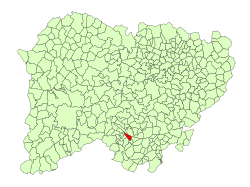 Location in Salamanca | |
 Garcibuey Location in Spain | |
| Coordinates: 40°31′N 5°59′W / 40.517°N 5.983°WCoordinates: 40°31′N 5°59′W / 40.517°N 5.983°W | |
| Country |
|
| Autonomous community | Castile and León |
| Province | Salamanca |
| Comarca | Sierra de Francia |
| Judicial district | Béjar |
| Government | |
| • Mayor | José Miguel Mata Andrés (People's Party) |
| Area[1] | |
| • Total | 13 km2 (5 sq mi) |
| Elevation[1] | 691 m (2,267 ft) |
| Population (2016)[2] | |
| • Total | 196 |
| • Density | 15/km2 (39/sq mi) |
| Demonym(s) | garcibueño, -a |
| Time zone | UTC+1 (CET) |
| • Summer (DST) | UTC+2 (CEST) |
| Postal code | 37658 |
| Dialing code | 923 |
Garcibuey is a village and municipality in the province of Salamanca, western Spain, part of the autonomous community of Castile-Leon. It is located 82 kilometres (51 mi) from the provincial capital city of Salamanca and has a population of 232 people.
Geography
The municipality covers an area of 13 km2 (5.0 sq mi). It lies 691 metres (2,267 ft) above sea level and the post code is 37658. The village has a small reservoir built in 1940.

Nearby reservoir
References
- 1 2 "Municipio: Garcibuey". www.lasalina.es (in Spanish). Retrieved 2017-11-07.
- ↑ "Salamanca: Población por municipios y sexo". www.ine.es (in Spanish). Retrieved 2017-11-07.
This article is issued from
Wikipedia.
The text is licensed under Creative Commons - Attribution - Sharealike.
Additional terms may apply for the media files.