La Alameda de Gardón
| La Alameda de Gardón | ||
|---|---|---|
| Municipality | ||
| ||
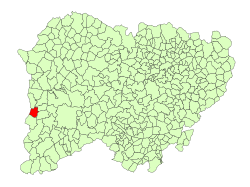 Location in Salamanca | ||
 La Alameda de Gardón Location in Spain | ||
| Coordinates: 40°39′3″N 6°45′31″W / 40.65083°N 6.75861°WCoordinates: 40°39′3″N 6°45′31″W / 40.65083°N 6.75861°W | ||
| Country | Spain | |
| Autonomous community | Castile and León | |
| Province | Salamanca | |
| Comarca | Comarca de Ciudad Rodrigo | |
| Subcomarca | Campo de Argañán | |
| Government | ||
| • Mayor | Lorenzo Patino Galán (People's Party) | |
| Area[1] | ||
| • Total | 32 km2 (12 sq mi) | |
| Elevation[1] | 714 m (2,343 ft) | |
| Population (2016)[2] | ||
| • Total | 83 | |
| • Density | 2.6/km2 (6.7/sq mi) | |
| Time zone | UTC+1 (CET) | |
| • Summer (DST) | UTC+2 (CEST) | |
| Postal code | 37497 | |

La Alameda de Gardón is a village and municipality in the province of Salamanca, western Spain, part of the autonomous community of Castile-Leon. It has a population of 83 people.
Geography
The municipality covers an area of 32 km2 (12 sq mi). It lies 714 metres (2,343 ft) above sea level.
References
- 1 2 "Municipio:Alameda de Gardón (La)". www.lasalina.es. Retrieved 2017-10-25.
- ↑ "Salamanca: Población por municipios y sexo". www.ine.es (in Spanish). Retrieved 2017-10-25.
This article is issued from
Wikipedia.
The text is licensed under Creative Commons - Attribution - Sharealike.
Additional terms may apply for the media files.