Cerezal de Peñahorcada
| Cerezal de Peñahorcada | |
|---|---|
| Municipality | |
 Location in Salamanca | |
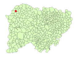
 Cerezal de Peñahorcada Location in Spain | |
| Coordinates: 41°07′50″N 6°39′16″W / 41.13056°N 6.65444°WCoordinates: 41°07′50″N 6°39′16″W / 41.13056°N 6.65444°W | |
| Country | Spain |
| Autonomous community | Castile and León |
| Province | Salamanca |
| Comarca | Vitigudino |
| Subcomarca | La Ramajería |
| Government | |
| • Mayor | Jesús Javier Calvo Rodríguez (People's Party) |
| Area[1] | |
| • Total | 18 km2 (7 sq mi) |
| Elevation[1] | 702 m (2,303 ft) |
| Population (2016)[2] | |
| • Total | 80 |
| • Density | 4.4/km2 (12/sq mi) |
| Time zone | UTC+1 (CET) |
| • Summer (DST) | UTC+2 (CEST) |
| Postal code | 37254 |
Cerezal de Peñahorcada is a village and municipality in the province of Salamanca, western Spain, part of the autonomous community of Castile and León. It is 93 kilometres (58 mi) from the provincial capital city of Salamanca and has a population of 80 people. The municipality covers an area of 18 km2 (6.9 sq mi). It lies 702 metres (2,303 ft) above sea level and the post code is 37254.[1]
References
- 1 2 3 "Municipio:Cerezal de Peñahorcada". www.lasalina.es. Retrieved 2017-10-28.
- ↑ "Salamanca: Población por municipios y sexo". www.ine.es (in Spanish). Retrieved 2017-10-28.
This article is issued from
Wikipedia.
The text is licensed under Creative Commons - Attribution - Sharealike.
Additional terms may apply for the media files.