El Cubo de Don Sancho
| El Cubo de Don Sancho | ||
|---|---|---|
| Municipality | ||
| ||
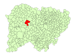 Location in Salamanca | ||
 El Cubo de Don Sancho Location in Spain | ||
| Coordinates: 40°53′N 6°18′W / 40.883°N 6.300°WCoordinates: 40°53′N 6°18′W / 40.883°N 6.300°W | ||
| Country | Spain | |
| Autonomous community | Castile and León | |
| Province | Salamanca | |
| Comarca | Vitigudino | |
| Subcomarca | Tierra de Vitigudino | |
| Government | ||
| • Mayor | Emiliano Muñoz Corral (People's Party) | |
| Area[1] | ||
| • Total | 91 km2 (35 sq mi) | |
| Elevation[1] | 736 m (2,415 ft) | |
| Population (2016)[2] | ||
| • Total | 463 | |
| • Density | 5.1/km2 (13/sq mi) | |
| Time zone | UTC+1 (CET) | |
| • Summer (DST) | UTC+2 (CEST) | |
| Postal code | 37281 | |

El Cubo de Don Sancho is a large municipality in the province of Salamanca, western Spain, part of the autonomous community of Castile-Leon. It is located 66 kilometres (41 mi) from the provincial capital city of Salamanca and as of 2016 has a population of 463 people.
Geography
The municipality covers an area of 91 km2 (35 sq mi). It lies 736 metres (2,415 ft) above sea level and the post code is 37281.[1]
References
- 1 2 3 "Municipio:Cubo de Don Sancho, (El)". www.lasalina.es (in Spanish). Retrieved 2017-10-29.
- ↑ "Salamanca: Población por municipios y sexo". www.ine.es (in Spanish). Retrieved 2017-10-29.
This article is issued from
Wikipedia.
The text is licensed under Creative Commons - Attribution - Sharealike.
Additional terms may apply for the media files.