Santa María de Sando
| Santa María de Sando | |
|---|---|
| Municipality | |
 Location in Salamanca | |
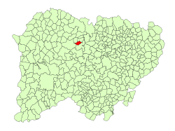
 Santa María de Sando Location in Spain | |
| Coordinates: 40°58′42″N 6°06′48″W / 40.97833°N 6.11333°WCoordinates: 40°58′42″N 6°06′48″W / 40.97833°N 6.11333°W | |
| Country | Spain |
| Autonomous community | Castile and León |
| Province | Salamanca |
| Comarca | Tierra de Ledesma |
| Government | |
| • Mayor | Luisa García (People's Party) |
| Area[1] | |
| • Total | 14 km2 (5 sq mi) |
| Elevation[1] | 826 m (2,710 ft) |
| Population (2016)[2] | |
| • Total | 119 |
| • Density | 8.5/km2 (22/sq mi) |
| Time zone | UTC+1 (CET) |
| • Summer (DST) | UTC+2 (CEST) |
| Postal code | 37468 |
Santa María de Sando is a municipality located in the province of Salamanca, Castile and León, Spain. As of 2016 the municipality has a population of 119 inhabitants. Its postal code is 37468[3]
References
- 1 2 "Municipio:Santa María de Sando". www.lasalina.es (in Spanish). Retrieved 2017-10-28.
- ↑ "Salamanca: Población por municipios y sexo". www.ine.es (in Spanish). Retrieved 2017-10-28.
- ↑ http://www.codigo-postal.info/en/salamanca/santa-maria-de-sando
This article is issued from
Wikipedia.
The text is licensed under Creative Commons - Attribution - Sharealike.
Additional terms may apply for the media files.