Carpio de Azaba
| Carpio de Azaba | |
|---|---|
| Municipality | |
 Location in Salamanca | |
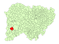
 Carpio de Azaba Location in Spain | |
| Coordinates: 40°36′N 6°38′W / 40.600°N 6.633°WCoordinates: 40°36′N 6°38′W / 40.600°N 6.633°W | |
| Country | Spain |
| Autonomous community | Castile and León |
| Province | Salamanca |
| Comarca | Comarca de Ciudad Rodrigo |
| Subcomarca | Campo de Argañán |
| Government | |
| • Mayor | Vidal Arturo Gómez Tabernero (People's Party) |
| Area[1] | |
| • Total | 70 km2 (30 sq mi) |
| Elevation[1] | 681 m (2,234 ft) |
| Population (2016)[2] | |
| • Total | 101 |
| • Density | 1.4/km2 (3.7/sq mi) |
| Time zone | UTC+1 (CET) |
| • Summer (DST) | UTC+2 (CEST) |
| Postal code | 37496 |
Carpio de Azaba is a village and municipality in the province of Salamanca, western Spain, part of the autonomous community of Castile-Leon. It is located 100 kilometres (62 mi) west of the city of Salamanca and as of 2016 has a population of 101 people. The municipality covers an area of 70 km2 (27 sq mi).
The village lies 681 metres (2,234 ft) above sea level and the post code is 37496.
References
- 1 2 "Municipio:Carpio de Azaba". www.lasalina.es (in Spanish). Retrieved 2017-11-02.
- ↑ "Salamanca: Población por municipios y sexo". www.ine.es (in Spanish). Retrieved 2017-11-02.
This article is issued from
Wikipedia.
The text is licensed under Creative Commons - Attribution - Sharealike.
Additional terms may apply for the media files.