Colmenar de Montemayor
| Colmenar de Montemayor | |
|---|---|
| Municipality | |
 Location in Salamanca | |
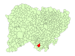
 Colmenar de Montemayor Location in Spain | |
| Coordinates: 40°23′58″N 5°57′34″W / 40.39944°N 5.95944°WCoordinates: 40°23′58″N 5°57′34″W / 40.39944°N 5.95944°W | |
| Country | Spain |
| Autonomous community | Castile and León |
| Province | Salamanca |
| Comarca | Sierra de Béjar |
| Government | |
| • Mayor | Jaime Macia Viñals (People's Party) |
| Area[1] | |
| • Total | 40 km2 (20 sq mi) |
| Elevation[1] | 830 m (2,720 ft) |
| Time zone | UTC+1 (CET) |
| • Summer (DST) | UTC+2 (CEST) |
| Postal code | 37711 |
Colmenar de Montemayor is a municipality in the province of Salamanca, in the autonomous community of Castile and Leon, Spain. Its post code is 37711.
Geography
It is located 100 kilometres (62 mi) from the provincial capital city of Salamanca, at 830 metres (2,720 ft) above sea level. The municipality covers an area of 40 km2 (15 sq mi).
History
It was founded by the king Alfonso IX of Leon in the 13th century.
Demographics
It has a population of 189 people (2015).
Monuments
- Church of Nuestra Señora de la Asunción.
- House of the nobleman.
- House of the Chantre.
- Hermitage of Nuestra Señora de la Consolación.
References
- 1 2 "Municipio:Colmenar de Montemayor". www.lasalina.es (in Spanish). Retrieved 2017-11-01.
This article is issued from
Wikipedia.
The text is licensed under Creative Commons - Attribution - Sharealike.
Additional terms may apply for the media files.