Encinas de Abajo
| Encinas de Abajo | |
|---|---|
| Municipality | |
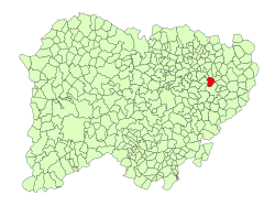 Location in Salamanca | |
 Encinas de Abajo Location in Spain | |
| Coordinates: 40°56′N 5°28′W / 40.933°N 5.467°WCoordinates: 40°56′N 5°28′W / 40.933°N 5.467°W | |
| Country | Spain |
| Autonomous community | Castile and León |
| Province | Salamanca |
| Comarca | Las Villas |
| Government | |
| • Mayor | José Luis Haro Sánchez (People's Party) |
| Area[1] | |
| • Total | 21 km2 (8 sq mi) |
| Elevation[1] | 796 m (2,612 ft) |
| Population (2016)[2] | |
| • Total | 666 |
| • Density | 32/km2 (82/sq mi) |
| Time zone | UTC+1 (CET) |
| • Summer (DST) | UTC+2 (CEST) |
| Postal code | 37182 |
Encinas de Abajo is a village and municipality in the province of Salamanca, Spain, which is part of the autonomous community of Castile-Leon. It is located 17 kilometres (11 mi) from the provincial capital city of Salamanca, and had a population in 2016 of 666.
Geography
The municipality covers an area of 201 km2 (78 sq mi) and lies 796 metres (2,612 ft) above sea level. The post code is 37182.
Economy
- The basis of the economy is agriculture.
See also
References
- 1 2 "Municipio:Encinas de Abajo". www.lasalina.es (in Spanish). Retrieved 2 November 2017.
- ↑ "Salamanca: Población por municipios y sexo". www.ine.es (in Spanish). Retrieved 2 November 2017.
External links
- Summary page of Encinas de Abajo (in Spanish)
This article is issued from
Wikipedia.
The text is licensed under Creative Commons - Attribution - Sharealike.
Additional terms may apply for the media files.