Carrascal de Barregas
| Carrascal de Barregas | ||
|---|---|---|
| municipality | ||
| ||
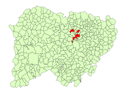 Location in Salamanca | ||
 Carrascal de Barregas Location in Spain | ||
| Coordinates: 40°58′41″N 5°45′45″W / 40.97806°N 5.76250°WCoordinates: 40°58′41″N 5°45′45″W / 40.97806°N 5.76250°W | ||
| Country | Spain | |
| Autonomous community | Castile and León | |
| Province | Salamanca | |
| Comarca | Campo de Salamanca | |
| Government | ||
| • Mayor | Cándido Cabezas Martínez (Union, Progress and Democracy) | |
| Area[1] | ||
| • Total | 76.6 km2 (29.6 sq mi) | |
| Elevation[1] | 797 m (2,615 ft) | |
| Population (2016)[2] | ||
| • Total | 1,117 | |
| • Density | 15/km2 (38/sq mi) | |
| Time zone | UTC+1 (CET) | |
| • Summer (DST) | UTC+2 (CEST) | |
| Postal code | 37129 | |
| Website |
www | |

Carrascal de Barregas is a village and municipality in the province of Salamanca, western Spain, part of the autonomous community of Castile-Leon. It is located 10 kilometres (6.2 mi) from the city of Salamanca and as of 2016 has a population of 1,117 people. The municipality covers an area of 77 km2 (30 sq mi).
The village lies 797 metres (2,615 ft) above sea level.
References
- 1 2 "Municipio: Carrascal de Barregas". www.lasalina.es (in Spanish). Retrieved 2017-11-07.
- ↑ "Salamanca: Población por municipios y sexo". www.ine.es (in Spanish). Retrieved 2017-11-07.
This article is issued from
Wikipedia.
The text is licensed under Creative Commons - Attribution - Sharealike.
Additional terms may apply for the media files.