Carrascal del Obispo
| Carrascal del Obispo | ||
|---|---|---|
| municipality | ||
| ||
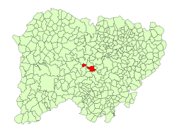 Location in Salamanca | ||
 Carrascal del Obispo Location in Spain | ||
| Coordinates: 40°45′49″N 5°59′57″W / 40.76361°N 5.99917°WCoordinates: 40°45′49″N 5°59′57″W / 40.76361°N 5.99917°W | ||
| Country | Spain | |
| Autonomous community | Castile and León | |
| Province | Salamanca | |
| Comarca | Campo de Salamanca | |
| Government | ||
| • Mayor | Manuel Martín Rodríguez (Spanish Socialist Workers' Party) | |
| Area[1] | ||
| • Total | 41 km2 (16 sq mi) | |
| Elevation[1] | 903 m (2,963 ft) | |
| Population (2016)[2] | ||
| • Total | 222 | |
| • Density | 5.4/km2 (14/sq mi) | |
| Time zone | UTC+1 (CET) | |
| • Summer (DST) | UTC+2 (CEST) | |
| Postal code | 37451 | |

Carrascal del Obispo is a village and municipality in the province of Salamanca, western Spain, part of the autonomous community of Castile-Leon. It is located 45 kilometres (28 mi) from the city of Salamanca and as of 2016 has a population of 222 people. The municipality covers an area of 41 km2 (16 sq mi).
The village lies 903 metres (2,963 ft) above sea level and the postal code is 37451.
References
- 1 2 "Municipio: Carrascal del Obispo". www.lasalina.es (in Spanish). Retrieved 2017-11-07.
- ↑ "Salamanca: Población por municipios y sexo". www.ine.es (in Spanish). Retrieved 2017-11-07.
This article is issued from
Wikipedia.
The text is licensed under Creative Commons - Attribution - Sharealike.
Additional terms may apply for the media files.