Calzada de Don Diego
| Calzada de Don Diego | ||
|---|---|---|
| Municipality | ||
| ||
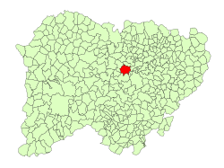 Location in Salamanca | ||
 Calzada de Don Diego Location in Spain | ||
| Coordinates: 40°54′22″N 5°54′08″W / 40.90611°N 5.90222°WCoordinates: 40°54′22″N 5°54′08″W / 40.90611°N 5.90222°W | ||
| Country | Spain | |
| Autonomous community | Castile and León | |
| Province | Salamanca | |
| Comarca | Campo de Salamanca | |
| Government | ||
| • Mayor | María Isabel Sánchez Bernal (People's Party) | |
| Area[1] | ||
| • Total | 44 km2 (17 sq mi) | |
| Elevation[1] | 815 m (2,674 ft) | |
| Population (2016)[2] | ||
| • Total | 174 | |
| • Density | 4.0/km2 (10/sq mi) | |
| Time zone | UTC+1 (CET) | |
| • Summer (DST) | UTC+2 (CEST) | |
| Postal code | 37448 | |

Calzada de Don Diego is a village and municipality in the province of Salamanca, western Spain, part of the autonomous community of Castile and León. It is 24 kilometres (15 mi) from the provincial capital city of Salamanca and as of 2014 had a population of 174 people . The municipality covers an area of 44 square kilometres (17 sq mi) and lies 815 metres (2,674 ft) above sea level. The postal code is 37448.
References
- 1 2 "Municipio:Calzada de Don Diego". www.lasalina.es (in Spanish). Retrieved 2017-11-07.
- ↑ "Salamanca: Población por municipios y sexo". www.ine.es (in Spanish). Retrieved 2017-11-07.
This article is issued from
Wikipedia.
The text is licensed under Creative Commons - Attribution - Sharealike.
Additional terms may apply for the media files.