Séligné
| Séligné | |
|---|---|
| Commune | |
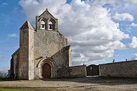 The church of Our Lady, in Séligné | |
 Séligné Location within Nouvelle-Aquitaine region  Séligné | |
| Coordinates: 46°08′42″N 0°16′58″W / 46.145°N 0.2828°WCoordinates: 46°08′42″N 0°16′58″W / 46.145°N 0.2828°W | |
| Country | France |
| Region | Nouvelle-Aquitaine |
| Department | Deux-Sèvres |
| Arrondissement | Niort |
| Canton | Mignon-et-Boutonne |
| Intercommunality | Val de Boutonne |
| Government | |
| • Mayor (2008–2014) | Jocelyne Bernardin |
| Area1 | 9.83 km2 (3.80 sq mi) |
| Population (2006)2 | 128 |
| • Density | 13/km2 (34/sq mi) |
| Time zone | UTC+1 (CET) |
| • Summer (DST) | UTC+2 (CEST) |
| INSEE/Postal code | 79312 /79170 |
| Elevation |
41–60 m (135–197 ft) (avg. 47 m or 154 ft) |
|
1 French Land Register data, which excludes lakes, ponds, glaciers > 1 km2 (0.386 sq mi or 247 acres) and river estuaries. 2 Population without double counting: residents of multiple communes (e.g., students and military personnel) only counted once. | |
Séligné is a commune in the Deux-Sèvres department in western France.
Geography
The commune is traversed by the river Boutonne.
See also
References
| Wikimedia Commons has media related to Séligné. |
This article is issued from
Wikipedia.
The text is licensed under Creative Commons - Attribution - Sharealike.
Additional terms may apply for the media files.