Champdeniers-Saint-Denis
| Champdeniers-Saint-Denis | ||
|---|---|---|
| Commune | ||
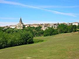 A general view of Champdeniers-Saint-Denis | ||
| ||
 Champdeniers-Saint-Denis Location within Nouvelle-Aquitaine region  Champdeniers-Saint-Denis | ||
| Coordinates: 46°29′06″N 0°24′14″W / 46.485°N 0.4039°WCoordinates: 46°29′06″N 0°24′14″W / 46.485°N 0.4039°W | ||
| Country | France | |
| Region | Nouvelle-Aquitaine | |
| Department | Deux-Sèvres | |
| Arrondissement | Niort | |
| Canton | Autize-Égray | |
| Intercommunality | Val d'Egray | |
| Government | ||
| • Mayor (2014–2020) | Jean-François Ferron | |
| Area1 | 21.81 km2 (8.42 sq mi) | |
| Population (2006)2 | 1,596 | |
| • Density | 73/km2 (190/sq mi) | |
| Time zone | UTC+1 (CET) | |
| • Summer (DST) | UTC+2 (CEST) | |
| INSEE/Postal code | 79066 /79220 | |
| Elevation |
67–171 m (220–561 ft) (avg. 120 m or 390 ft) | |
|
1 French Land Register data, which excludes lakes, ponds, glaciers > 1 km2 (0.386 sq mi or 247 acres) and river estuaries. 2 Population without double counting: residents of multiple communes (e.g., students and military personnel) only counted once. | ||

Champdeniers-Saint-Denis commune in the Deux-Sèvres department in the Nouvelle-Aquitaine region in western France.
See also
References
| Wikimedia Commons has media related to Champdeniers-Saint-Denis. |
This article is issued from
Wikipedia.
The text is licensed under Creative Commons - Attribution - Sharealike.
Additional terms may apply for the media files.