La Rochénard
| La Rochénard | |
|---|---|
| Commune | |
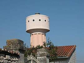 The water tower in La Rochénard | |
 La Rochénard Location within Nouvelle-Aquitaine region  La Rochénard | |
| Coordinates: 46°12′23″N 0°35′06″W / 46.2064°N 0.585°WCoordinates: 46°12′23″N 0°35′06″W / 46.2064°N 0.585°W | |
| Country | France |
| Region | Nouvelle-Aquitaine |
| Department | Deux-Sèvres |
| Arrondissement | Niort |
| Canton | Mignon-et-Boutonne |
| Intercommunality | Niort |
| Government | |
| • Mayor (2008–2014) | Sylvie Deboeuf |
| Area1 | 8.55 km2 (3.30 sq mi) |
| Population (2006)2 | 448 |
| • Density | 52/km2 (140/sq mi) |
| Time zone | UTC+1 (CET) |
| • Summer (DST) | UTC+2 (CEST) |
| INSEE/Postal code | 79229 /79270 |
| Elevation |
27–72 m (89–236 ft) (avg. 30 m or 98 ft) |
|
1 French Land Register data, which excludes lakes, ponds, glaciers > 1 km2 (0.386 sq mi or 247 acres) and river estuaries. 2 Population without double counting: residents of multiple communes (e.g., students and military personnel) only counted once. | |
La Rochénard is a commune in the Deux-Sèvres department in western France.
See also
References
| Wikimedia Commons has media related to La Rochénard. |
This article is issued from
Wikipedia.
The text is licensed under Creative Commons - Attribution - Sharealike.
Additional terms may apply for the media files.