Secondigny
| Secondigny | |
|---|---|
| Commune | |
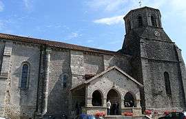 The church in Secondigny | |
 Secondigny Location within Nouvelle-Aquitaine region  Secondigny | |
| Coordinates: 46°36′33″N 0°25′10″W / 46.6091°N 0.4195°WCoordinates: 46°36′33″N 0°25′10″W / 46.6091°N 0.4195°W | |
| Country | France |
| Region | Nouvelle-Aquitaine |
| Department | Deux-Sèvres |
| Arrondissement | Parthenay |
| Canton | La Gâtine |
| Intercommunality | CC Parthenay-Gâtine |
| Area1 | 37 km2 (14 sq mi) |
| Population (2006)2 | 1,763 |
| • Density | 48/km2 (120/sq mi) |
| Time zone | UTC+1 (CET) |
| • Summer (DST) | UTC+2 (CEST) |
| INSEE/Postal code | 79311 / |
|
1 French Land Register data, which excludes lakes, ponds, glaciers > 1 km2 (0.386 sq mi or 247 acres) and river estuaries. 2 Population without double counting: residents of multiple communes (e.g., students and military personnel) only counted once. | |
Secondigny is a commune in the Deux-Sèvres department in western France.
It is situated about 14 km west of the town of Parthenay and 35 km north of Niort.
Secondigny is the source of the Thouet, a river that flows east and then north before joining the Loire near Saumur. Just to the west of Secondigny is the source of the Sèvre Nantaise, which flows west and north to join the Loire in Nantes.[1]
See also
References
- ↑ Carte de Promenade - 33 - Cholet Niort. Institut Geographique National.
| Wikimedia Commons has media related to Secondigny. |
This article is issued from
Wikipedia.
The text is licensed under Creative Commons - Attribution - Sharealike.
Additional terms may apply for the media files.