Boutonne
| Boutonne | |
|---|---|
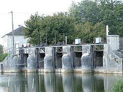 The Boutonne at Saint-Jean-d'Angély | |
| Country | France |
| Physical characteristics | |
| Main source |
Chef-Boutonne 85 m (279 ft) 46°06′46″N 00°03′57″W / 46.11278°N 0.06583°W |
| River mouth |
Charente 4 m (13 ft) 45°54′32″N 00°49′35″W / 45.90889°N 0.82639°WCoordinates: 45°54′32″N 00°49′35″W / 45.90889°N 0.82639°W |
| Length | 98.8 km (61.4 mi) |
| Discharge |
|
| Basin features | |
| Progression | Charente→ Atlantic Ocean |
| Basin size | 1,320 km2 (510 sq mi) |
The Boutonne (French: la Boutonne) is a 98.8 km (61.4 mi) long river in the Deux-Sèvres and Charente-Maritime départements, western France.[1] Its source is in the village of Chef-Boutonne (French: head of the Boutonne). It flows generally southwest. It is a right tributary of the Charente into which it flows near Cabariot.[1]
Départements and communes along its course
This list is ordered from source to mouth:
- Deux-Sèvres: Chef-Boutonne, Fontenille-Saint-Martin-d'Entraigues, Chérigné, Lusseray, Brioux-sur-Boutonne, Vernoux-sur-Boutonne, Séligné, Brieuil-sur-Chizé, Villefollet, Villiers-sur-Chizé, Chizé, Le Vert
- Charente-Maritime: Dampierre-sur-Boutonne, Saint-Séverin-sur-Boutonne, Coivert, Blanzay-sur-Boutonne, Saint-Georges-de-Longuepierre, Saint-Martial, Saint-Pierre-de-l'Isle, Nuaillé-sur-Boutonne, Saint-Pardoult, Les Églises-d'Argenteuil, Antezant-la-Chapelle, Vervant, Poursay-Garnaud, Courcelles, Saint-Julien-de-l'Escap, Saint-Jean-d'Angély, Ternant, La Vergne, Voissay, Torxé, Les Nouillers, Tonnay-Boutonne, Puy-du-Lac, Archingeay, Saint-Coutant-le-Grand, Champdolent, Lussant, Cabariot,
Notes
| Wikimedia Commons has media related to Boutonne. |
- This article is based on the equivalent article from the French Wikipedia, consulted on March 5th 2009.
References
This article is issued from
Wikipedia.
The text is licensed under Creative Commons - Attribution - Sharealike.
Additional terms may apply for the media files.