Tourtenay
| Tourtenay | |
|---|---|
| Commune | |
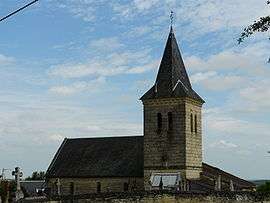 The church in Tourtenay | |
 Tourtenay Location within Nouvelle-Aquitaine region  Tourtenay | |
| Coordinates: 47°02′20″N 0°07′00″W / 47.0389°N 0.1167°WCoordinates: 47°02′20″N 0°07′00″W / 47.0389°N 0.1167°W | |
| Country | France |
| Region | Nouvelle-Aquitaine |
| Department | Deux-Sèvres |
| Arrondissement | Bressuire |
| Canton | Le Val de Thouet |
| Government | |
| • Mayor (2008–2014) | Michel Douarre |
| Area1 | 7.72 km2 (2.98 sq mi) |
| Population (2006)2 | 142 |
| • Density | 18/km2 (48/sq mi) |
| Time zone | UTC+1 (CET) |
| • Summer (DST) | UTC+2 (CEST) |
| INSEE/Postal code | 79331 /79100 |
| Elevation |
36–113 m (118–371 ft) (avg. 116 m or 381 ft) |
|
1 French Land Register data, which excludes lakes, ponds, glaciers > 1 km2 (0.386 sq mi or 247 acres) and river estuaries. 2 Population without double counting: residents of multiple communes (e.g., students and military personnel) only counted once. | |
Tourtenay is a commune in the Deux-Sèvres department in western France.
See also
References
| Wikimedia Commons has media related to Tourtenay. |
This article is issued from
Wikipedia.
The text is licensed under Creative Commons - Attribution - Sharealike.
Additional terms may apply for the media files.