Sainte-Soline
| Sainte-Soline | |
|---|---|
| Commune | |
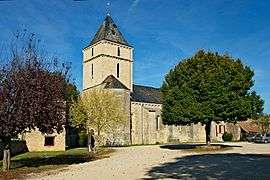 The church of Sainte-Maixent, in Sainte-Soline | |
 Sainte-Soline Location within Nouvelle-Aquitaine region  Sainte-Soline | |
| Coordinates: 46°14′50″N 0°02′13″E / 46.2472°N 0.0369°ECoordinates: 46°14′50″N 0°02′13″E / 46.2472°N 0.0369°E | |
| Country | France |
| Region | Nouvelle-Aquitaine |
| Department | Deux-Sèvres |
| Arrondissement | Niort |
| Canton | Celles-sur-Belle |
| Government | |
| • Mayor (2008–2014) | Dany Michelet |
| Area1 | 25.65 km2 (9.90 sq mi) |
| Population (2006)2 | 411 |
| • Density | 16/km2 (42/sq mi) |
| Time zone | UTC+1 (CET) |
| • Summer (DST) | UTC+2 (CEST) |
| INSEE/Postal code | 79297 /79120 |
| Elevation |
117–145 m (384–476 ft) (avg. 128 m or 420 ft) |
|
1 French Land Register data, which excludes lakes, ponds, glaciers > 1 km2 (0.386 sq mi or 247 acres) and river estuaries. 2 Population without double counting: residents of multiple communes (e.g., students and military personnel) only counted once. | |
Sainte-Soline is a commune in the Deux-Sèvres department in western France.
See also
References
| Wikimedia Commons has media related to Sainte-Soline. |
This article is issued from
Wikipedia.
The text is licensed under Creative Commons - Attribution - Sharealike.
Additional terms may apply for the media files.