Augé, Deux-Sèvres
| Augé | ||
|---|---|---|
| Commune | ||
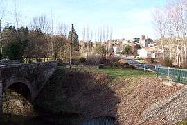 The road into Augé | ||
| ||
 Augé Location within Nouvelle-Aquitaine region  Augé | ||
| Coordinates: 46°26′23″N 0°17′10″W / 46.4397°N 0.2861°WCoordinates: 46°26′23″N 0°17′10″W / 46.4397°N 0.2861°W | ||
| Country | France | |
| Region | Nouvelle-Aquitaine | |
| Department | Deux-Sèvres | |
| Arrondissement | Niort | |
| Canton | Saint-Maixent-l'École | |
| Intercommunality | CC Haut Val Sèvre | |
| Government | ||
| • Mayor (2014-2020) | Gérard Perrin | |
| Area1 | 23.33 km2 (9.01 sq mi) | |
| Population (2015)2 | 944 | |
| • Density | 40/km2 (100/sq mi) | |
| Time zone | UTC+1 (CET) | |
| • Summer (DST) | UTC+2 (CEST) | |
| INSEE/Postal code | 79020 /79400 | |
| Elevation | 49–189 m (161–620 ft) | |
|
1 French Land Register data, which excludes lakes, ponds, glaciers > 1 km2 (0.386 sq mi or 247 acres) and river estuaries. 2 Population without double counting: residents of multiple communes (e.g., students and military personnel) only counted once. | ||

Augé is a commune in the Deux-Sèvres department in the Nouvelle-Aquitaine region in western France.
See also
References
| Wikimedia Commons has media related to Augé. |
This article is issued from
Wikipedia.
The text is licensed under Creative Commons - Attribution - Sharealike.
Additional terms may apply for the media files.