Châtillon-sur-Thouet
| Châtillon-sur-Thouet | |
|---|---|
| Commune | |
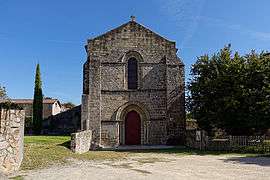 The church in Châtillon-sur-Thouet | |
 Châtillon-sur-Thouet Location within Nouvelle-Aquitaine region  Châtillon-sur-Thouet | |
| Coordinates: 46°39′43″N 0°14′23″W / 46.6619°N 0.2396°WCoordinates: 46°39′43″N 0°14′23″W / 46.6619°N 0.2396°W | |
| Country | France |
| Region | Nouvelle-Aquitaine |
| Department | Deux-Sèvres |
| Arrondissement | Parthenay |
| Canton | Parthenay |
| Intercommunality | CC Parthenay-Gâtine |
| Government | |
| • Mayor (2014–2020) | Jean-Michel Morin |
| Area1 | 16 km2 (6 sq mi) |
| Population (2006)2 | 2,949 |
| • Density | 180/km2 (480/sq mi) |
| Time zone | UTC+1 (CET) |
| • Summer (DST) | UTC+2 (CEST) |
| INSEE/Postal code | 79080 / |
|
1 French Land Register data, which excludes lakes, ponds, glaciers > 1 km2 (0.386 sq mi or 247 acres) and river estuaries. 2 Population without double counting: residents of multiple communes (e.g., students and military personnel) only counted once. | |
Châtillon-sur-Thouet is a village and commune in the Deux-Sèvres department of the Nouvelle-Aquitaine region in western France. The village is situated on the River Thouet to the north of the town of Parthenay, with which it forms a contiguous built-up area.
The commune of Châtillon-sur-Thouet has joined together with 38 neighbouring communes to establish the Communauté de communes de Parthenay-Gâtine which provides a framework within which local tasks are carried out together.[1][2]
See also
References
- ↑ "Intercommunalité-Métropole de CC de Parthenay-Gâtine (200041333) − COG". Insee. Retrieved 2017-08-10.
- ↑ "Communauté de communes de Parthenay-Gâtine". Communauté de communes de Parthenay-Gâtine. Retrieved 2017-08-10.
| Wikimedia Commons has media related to Châtillon-sur-Thouet. |
This article is issued from
Wikipedia.
The text is licensed under Creative Commons - Attribution - Sharealike.
Additional terms may apply for the media files.