Aubigné, Deux-Sèvres
| Aubigné | |
|---|---|
| Commune | |
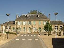 The town hall in Aubigné | |
 Aubigné Location within Nouvelle-Aquitaine region  Aubigné | |
| Coordinates: 46°03′25″N 0°08′28″W / 46.0569°N 0.1411°WCoordinates: 46°03′25″N 0°08′28″W / 46.0569°N 0.1411°W | |
| Country | France |
| Region | Nouvelle-Aquitaine |
| Department | Deux-Sèvres |
| Arrondissement | Niort |
| Canton | Melle |
| Intercommunality | CC Cœur Poitou |
| Government | |
| • Mayor (2014-2020) | Yvan-Pierre Royer |
| Area1 | 29.15 km2 (11.25 sq mi) |
| Population (2015)2 | 215 |
| • Density | 7.4/km2 (19/sq mi) |
| Time zone | UTC+1 (CET) |
| • Summer (DST) | UTC+2 (CEST) |
| INSEE/Postal code | 79018 /79110 |
| Elevation | 99–159 m (325–522 ft) |
|
1 French Land Register data, which excludes lakes, ponds, glaciers > 1 km2 (0.386 sq mi or 247 acres) and river estuaries. 2 Population without double counting: residents of multiple communes (e.g., students and military personnel) only counted once. | |
Aubigné is a commune in the Deux-Sèvres department in the Nouvelle-Aquitaine region in western France.
See also
References
| Wikimedia Commons has media related to Aubigné (Deux-Sèvres). |
This article is issued from
Wikipedia.
The text is licensed under Creative Commons - Attribution - Sharealike.
Additional terms may apply for the media files.