Germond-Rouvre
| Germond-Rouvre | |
|---|---|
| Commune | |
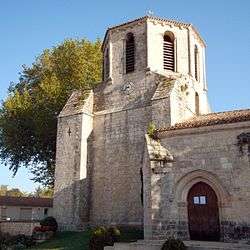 Church in Germond-Rouvre | |
 Germond-Rouvre Location within Nouvelle-Aquitaine region  Germond-Rouvre | |
| Coordinates: 46°27′22″N 0°25′13″W / 46.4561°N 0.4203°WCoordinates: 46°27′22″N 0°25′13″W / 46.4561°N 0.4203°W | |
| Country | France |
| Region | Nouvelle-Aquitaine |
| Department | Deux-Sèvres |
| Arrondissement | Niort |
| Canton | Autize-Égray |
| Intercommunality | Val d'Egray |
| Government | |
| • Mayor (2008–2014) | Gérard Époulet |
| Area1 | 17.88 km2 (6.90 sq mi) |
| Population (2006)2 | 1,076 |
| • Density | 60/km2 (160/sq mi) |
| Time zone | UTC+1 (CET) |
| • Summer (DST) | UTC+2 (CEST) |
| INSEE/Postal code | 79133 /79220 |
| Elevation |
33–123 m (108–404 ft) (avg. 80 m or 260 ft) |
|
1 French Land Register data, which excludes lakes, ponds, glaciers > 1 km2 (0.386 sq mi or 247 acres) and river estuaries. 2 Population without double counting: residents of multiple communes (e.g., students and military personnel) only counted once. | |
Germond-Rouvre is a commune in the Deux-Sèvres department in the Nouvelle-Aquitaine region in western France.
See also
References
| Wikimedia Commons has media related to Germond-Rouvre. |
This article is issued from
Wikipedia.
The text is licensed under Creative Commons - Attribution - Sharealike.
Additional terms may apply for the media files.