Saint-Léger-de-Montbrun
| Saint-Léger-de-Montbrun | |
|---|---|
| Commune | |
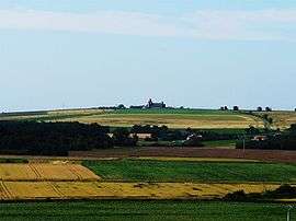 A general view of Saint-Léger-de-Montbrun | |
 Saint-Léger-de-Montbrun Location within Nouvelle-Aquitaine region  Saint-Léger-de-Montbrun | |
| Coordinates: 46°59′32″N 0°06′59″W / 46.9922°N 0.1164°WCoordinates: 46°59′32″N 0°06′59″W / 46.9922°N 0.1164°W | |
| Country | France |
| Region | Nouvelle-Aquitaine |
| Department | Deux-Sèvres |
| Arrondissement | Bressuire |
| Canton | Le Val de Thouet |
| Intercommunality | Thouarsais |
| Government | |
| • Mayor (2008–2014) | Jean-Jacques Petit |
| Area1 | 30.72 km2 (11.86 sq mi) |
| Population (2006)2 | 1,196 |
| • Density | 39/km2 (100/sq mi) |
| Time zone | UTC+1 (CET) |
| • Summer (DST) | UTC+2 (CEST) |
| INSEE/Postal code | 79265 /79100 |
| Elevation |
46–105 m (151–344 ft) (avg. 77 m or 253 ft) |
|
1 French Land Register data, which excludes lakes, ponds, glaciers > 1 km2 (0.386 sq mi or 247 acres) and river estuaries. 2 Population without double counting: residents of multiple communes (e.g., students and military personnel) only counted once. | |
Saint-Léger-de-Montbrun is a commune in the Deux-Sèvres department in western France.
See also
References
| Wikimedia Commons has media related to Saint-Léger-de-Montbrun. |
This article is issued from
Wikipedia.
The text is licensed under Creative Commons - Attribution - Sharealike.
Additional terms may apply for the media files.