Moncoutant
| Moncoutant | |
|---|---|
| Commune | |
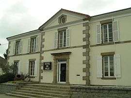 The town hall in Moncoutant | |
 Moncoutant Location within Nouvelle-Aquitaine region  Moncoutant | |
| Coordinates: 46°43′28″N 0°35′15″W / 46.7244°N 0.5875°WCoordinates: 46°43′28″N 0°35′15″W / 46.7244°N 0.5875°W | |
| Country | France |
| Region | Nouvelle-Aquitaine |
| Department | Deux-Sèvres |
| Arrondissement | Parthenay |
| Canton | Cerizay |
| Intercommunality | Terre de Sèvre |
| Government | |
| • Mayor (2008–2014) | Philippe Mouiller |
| Area1 | 26.32 km2 (10.16 sq mi) |
| Population (2006)2 | 3,100 |
| • Density | 120/km2 (310/sq mi) |
| Time zone | UTC+1 (CET) |
| • Summer (DST) | UTC+2 (CEST) |
| INSEE/Postal code | 79179 /79320 |
| Elevation |
153–226 m (502–741 ft) (avg. 180 m or 590 ft) |
|
1 French Land Register data, which excludes lakes, ponds, glaciers > 1 km2 (0.386 sq mi or 247 acres) and river estuaries. 2 Population without double counting: residents of multiple communes (e.g., students and military personnel) only counted once. | |
Moncoutant is a commune in the Deux-Sèvres department in western France.
Geography
Moncoutant is located in a bocage area in northern Deux-Sèvres, on the Sèvre Nantaise, 50 km north of Niort and 15 km south of Bressuire.
Economy
Moncoutant is a mainly agricultural town. However, it also has numerous shops and a few industries. Since 2001, it has also become a tourist center, thanks to the opening of the fishing holiday center Pescalis.
See also
References
| Wikimedia Commons has media related to Moncoutant. |
This article is issued from
Wikipedia.
The text is licensed under Creative Commons - Attribution - Sharealike.
Additional terms may apply for the media files.