Chef-Boutonne
| Chef-Boutonne | ||
|---|---|---|
| Commune | ||
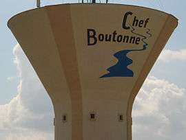 The water tower in Chef-Boutonne | ||
| ||
 Chef-Boutonne Location within Nouvelle-Aquitaine region  Chef-Boutonne | ||
| Coordinates: 46°06′38″N 0°04′06″W / 46.1106°N 0.0683°WCoordinates: 46°06′38″N 0°04′06″W / 46.1106°N 0.0683°W | ||
| Country | France | |
| Region | Nouvelle-Aquitaine | |
| Department | Deux-Sèvres | |
| Arrondissement | Niort | |
| Canton | Melle | |
| Intercommunality | Cœur du Poitou | |
| Government | ||
| • Mayor (2014–2020) | Fabrice Michelet | |
| Area1 | 19.81 km2 (7.65 sq mi) | |
| Population (2006)2 | 2,311 | |
| • Density | 120/km2 (300/sq mi) | |
| Time zone | UTC+1 (CET) | |
| • Summer (DST) | UTC+2 (CEST) | |
| INSEE/Postal code | 79083 /79110 | |
| Elevation |
71–146 m (233–479 ft) (avg. 73 m or 240 ft) | |
|
1 French Land Register data, which excludes lakes, ponds, glaciers > 1 km2 (0.386 sq mi or 247 acres) and river estuaries. 2 Population without double counting: residents of multiple communes (e.g., students and military personnel) only counted once. | ||

Chef-Boutonne is a commune in the Deux-Sèvres department in the Nouvelle-Aquitaine region in western France.
Geography
The Boutonne has its source in the commune, hence its name, Chef-Boutonne meaning head of the Boutonne.
See also
References
| Wikimedia Commons has media related to Chef-Boutonne. |
This article is issued from
Wikipedia.
The text is licensed under Creative Commons - Attribution - Sharealike.
Additional terms may apply for the media files.