Pueblo County, Colorado
| Pueblo County, Colorado | ||
|---|---|---|
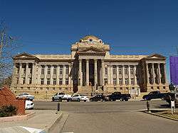 The Pueblo County Courthouse with brass dome in Pueblo | ||
| ||
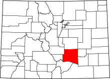 Location in the U.S. state of Colorado | ||
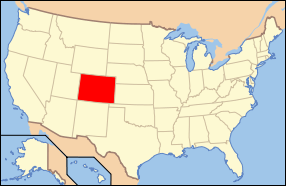 Colorado's location in the U.S. | ||
| Founded | November 1, 1861 | |
| Named for | City of Pueblo | |
| Seat | Pueblo | |
| Largest city | Pueblo | |
| Area | ||
| • Total | 2,398 sq mi (6,211 km2) | |
| • Land | 2,386 sq mi (6,180 km2) | |
| • Water | 12 sq mi (31 km2), 0.5% | |
| Population (est.) | ||
| • (2015) | 163,591 | |
| • Density | 67/sq mi (26/km2) | |
| Congressional district | 3rd | |
| Time zone | Mountain: UTC−7/−6 | |
| Website |
www | |

Pueblo County (/ˈpwɛbloʊ/ or /ˈpjɛbloʊ/) is one of the 64 counties in the U.S. state of Colorado. As of the 2010 census, the population was 159,063.[1] The county seat is Pueblo.[2] The county was named for the historic city of Pueblo which took its name from the Spanish language word meaning "town" or "village".
Pueblo County comprises the Pueblo, CO Metropolitan Statistical Area.[3][4]
Geography
According to the U.S. Census Bureau, the county has a total area of 2,398 square miles (6,210 km2), of which 2,386 square miles (6,180 km2) is land and 12 square miles (31 km2) (0.5%) is water.[5]
Adjacent counties
- El Paso County - north
- Lincoln County - northeast
- Crowley County - east
- Otero County - east
- Las Animas County - south
- Huerfano County - southwest
- Custer County - west
- Fremont County - northwest
National protected areas
Trails and byways
- American Discovery Trail
- Frontier Pathways National Scenic and Historic Byway
- TransAmerica Trail Bicycle Route
- Western Express Bicycle Route
Demographics
| Historical population | |||
|---|---|---|---|
| Census | Pop. | %± | |
| 1870 | 2,265 | — | |
| 1880 | 7,167 | 216.4% | |
| 1890 | 31,191 | 335.2% | |
| 1900 | 34,418 | 10.3% | |
| 1910 | 52,223 | 51.7% | |
| 1920 | 57,368 | 9.9% | |
| 1930 | 66,033 | 15.1% | |
| 1940 | 68,870 | 4.3% | |
| 1950 | 90,188 | 31.0% | |
| 1960 | 118,685 | 31.6% | |
| 1970 | 118,238 | −0.4% | |
| 1980 | 120,984 | 2.3% | |
| 1990 | 123,051 | 1.7% | |
| 2000 | 141,472 | 15.0% | |
| 2010 | 159,063 | 12.4% | |
| Est. 2016 | 165,123 | [6] | 3.8% |
| U.S. Decennial Census[7] 1790-1960[8] 1900-1990[9] 1990-2000[10] 2010-2015[1] | |||
As of the Census 2007 statistical update, there were 154,712 people, 59,956 households, and 40,084 families residing in the county. The population density was 59 people per square mile (23/km²). There were 67,314 housing units at an average density of 25 per square mile (10/km²). The racial makeup of the county was 79.47% Caucasian, 1.90% Black or African American, 1.59% Native American, 0.65% Asian, 0.07% Pacific Islander, 12.93% from other races, and 3.38% from two or more races. 37.97% of the population were Hispanic or Latino of any race. 11.6% were of German, 8.8% Italian, 6.7% English, 6.6% American and 6.5% Irish ancestry.
There were 59,956 households out of which 31.50% had children under the age of 18 living with them, 50.10% were married couples living together, 13.30% had a female householder with no husband present, and 31.60% were non-families. 26.60% of all households were made up of individuals and 11.10% had someone living alone who was 65 years of age or older. The average household size was 2.52 and the average family size was 3.04.
In the county, the population was spread out with 25.80% under the age of 18, 9.40% from 18 to 24, 27.20% from 25 to 44, 22.40% from 45 to 64, and 15.20% who were 65 years of age or older. The median age was 37 years. For every 100 females there were 95.80 males. For every 100 females age 18 and over, there were 92.50 males.
The median income for a household in the county was $41,283, and the median income for a family was $50,143. The per capita income for the county was $21,656. About 11.20% of families and 14.90% of the population were below the poverty line, including 19.70% of those under age 18 and 8.70% of those age 65 or over.
Politics
| Year | Republican | Democratic | Others |
|---|---|---|---|
| 2016 | 46.1% 36,265 | 45.6% 35,875 | 8.3% 6,506 |
| 2012 | 41.7% 31,894 | 55.7% 42,551 | 2.6% 1,974 |
| 2008 | 41.8% 30,257 | 56.7% 41,097 | 1.5% 1,073 |
| 2004 | 46.3% 31,117 | 52.6% 35,369 | 1.0% 701 |
| 2000 | 42.3% 22,827 | 53.6% 28,888 | 4.1% 2,231 |
| 1996 | 34.6% 17,402 | 57.2% 28,791 | 8.2% 4,108 |
| 1992 | 28.6% 16,120 | 53.6% 30,261 | 17.8% 10,057 |
| 1988 | 37.7% 20,119 | 61.5% 32,788 | 0.8% 411 |
| 1984 | 47.2% 24,634 | 52.0% 27,126 | 0.8% 440 |
| 1980 | 44.7% 20,770 | 47.1% 21,874 | 8.2% 3,797 |
| 1976 | 41.0% 18,518 | 57.2% 25,841 | 1.7% 784 |
| 1972 | 54.4% 25,607 | 41.7% 19,620 | 3.9% 1,818 |
| 1968 | 34.5% 16,646 | 56.4% 27,215 | 9.2% 4,430 |
| 1964 | 27.0% 13,103 | 72.0% 34,933 | 1.0% 500 |
| 1960 | 42.4% 20,579 | 56.4% 27,421 | 1.2% 582 |
| 1956 | 52.3% 23,454 | 45.6% 20,433 | 2.1% 927 |
| 1952 | 48.8% 20,333 | 49.5% 20,613 | 1.7% 713 |
| 1948 | 36.4% 12,756 | 61.8% 21,637 | 1.9% 648 |
| 1944 | 42.0% 13,848 | 57.7% 19,039 | 0.3% 96 |
| 1940 | 42.8% 14,185 | 56.8% 18,805 | 0.4% 125 |
| 1936 | 34.5% 10,071 | 63.9% 18,660 | 1.7% 493 |
| 1932 | 39.5% 10,414 | 58.2% 15,325 | 2.3% 615 |
| 1928 | 65.7% 15,541 | 33.3% 7,881 | 1.1% 251 |
| 1924 | 52.9% 10,577 | 24.6% 4,917 | 22.6% 4,515 |
| 1920 | 53.1% 9,621 | 43.4% 7,863 | 3.5% 625 |
| 1916 | 36.1% 6,545 | 59.0% 10,710 | 4.9% 886 |
| 1912 | 19.6% 3,050 | 49.2% 7,643 | 31.2% 4,840 |
Communities
City
Towns
Census-designated places
Education
School districts serving the county include:[12]
- Pueblo City Schools (District 60)
- Pueblo County School District 70
- Edison School District 54-JT
- Fowler School District R-4J
Pueblo County has thirteen high schools.
Recreation
- Sangre de Cristo Arts & Conference Center
- El Pueblo State History Museum
- Lake Pueblo State Park
- Pueblo Memorial Airport
- Pueblo Historical Aircraft Society
- Pueblo Weisbrod Aircraft Museum
- Pueblo Zoo
- Arkansas River kayak course
- Historic Arkansas Riverwalk of Pueblo
See also
References
- 1 2 "State & County QuickFacts". United States Census Bureau. Retrieved June 10, 2014.
- ↑ "Find a County". National Association of Counties. Retrieved June 7, 2011.
- ↑ "OMB Bulletin No. 10-02: Update of Statistical Area Definitions and Guidance on Their Uses" (PDF). United States Office of Management and Budget. December 1, 2009. Archived from the original (PDF) on March 16, 2012. Retrieved April 19, 2012.
- ↑ See the Colorado census statistical areas.
- ↑ "US Gazetteer files: 2010, 2000, and 1990". United States Census Bureau. February 12, 2011. Retrieved April 23, 2011.
- ↑ "Population and Housing Unit Estimates". Retrieved June 9, 2017.
- ↑ "U.S. Decennial Census". United States Census Bureau. Retrieved June 10, 2014.
- ↑ "Historical Census Browser". University of Virginia Library. Retrieved June 10, 2014.
- ↑ "Population of Counties by Decennial Census: 1900 to 1990". United States Census Bureau. Retrieved June 10, 2014.
- ↑ "Census 2000 PHC-T-4. Ranking Tables for Counties: 1990 and 2000" (PDF). United States Census Bureau. Retrieved June 10, 2014.
- ↑ Leip, David. "Dave Leip's Atlas of U.S. Presidential Elections". uselectionatlas.org. Retrieved May 26, 2017.
- ↑ "SCHOOL DISTRICT REFERENCE MAP (2010 CENSUS): Pueblo County, CO." U.S. Census Bureau. Retrieved on July 2, 2017.
External links
- Pueblo County Government website
- Pueblo County Geographic Information Systems website

- Colorado County Evolution by Don Stanwyck
- Colorado Historical Society
Places adjacent to Pueblo County, Colorado | ||||||||||
|---|---|---|---|---|---|---|---|---|---|---|
| ||||||||||
Municipalities and communities of Pueblo County, Colorado, United States | ||
|---|---|---|
| City | | |
| Towns | ||
| CDPs | ||
| Unincorporated communities | ||
| Ghost town | ||
