Polarforschung Glacier
| Polarforschung Glacier | |
|---|---|
 Location of Princess Elizabeth Land | |
 Location of Polarforschung Glacier in Antarctica | |
| Type | heavily crevassed |
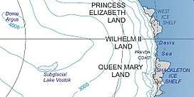
| Location | Princess Elizabeth Land |
| Coordinates | 69°50′S 75°7′E / 69.833°S 75.117°E / -69.833; 75.117 |
| Thickness | unknown |
| Terminus | Publications Ice Shelf |
| Status | unknown |
Polarforschung Glacier (69°50′S 75°7′E / 69.833°S 75.117°E / -69.833; 75.117Coordinates: 69°50′S 75°7′E / 69.833°S 75.117°E / -69.833; 75.117) is a heavily crevassed glacier flowing northward along the west side of Meknattane Nunataks to Publications Ice Shelf. Vestknatten Nunatak lies within the mouth of the glacier. Delineated in 1952 by John H. Roscoe from aerial photographs taken by U.S. Navy Operation Highjump (1946–47), and named by him after the journal Polarforschung, issued in Kiel (West Germany).
See also
References

| Types | |||||||
|---|---|---|---|---|---|---|---|
| Anatomy | |||||||
| Processes | |||||||
| Measurements | |||||||
| Volcanic relations | |||||||
| Landforms |
| ||||||
| |||||||
Glaciers of Princess Elizabeth Land | |
|---|---|
This article is issued from
Wikipedia.
The text is licensed under Creative Commons - Attribution - Sharealike.
Additional terms may apply for the media files.