| [3] |
Name on the Register[4] |
Image |
Date listed[5] |
Location |
City or town |
Description |
|---|
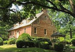
| 1 |
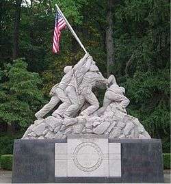
Bel Air |
|
February 26, 1970
(#70000823) |
General Washington Dr.
38°38′26″N 77°21′47″W / 38.640556°N 77.363056°W / 38.640556; -77.363056 (Bel Air) |
Woodbridge |
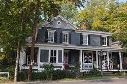
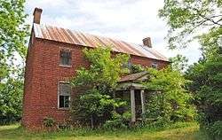
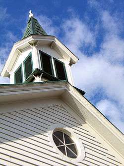
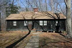
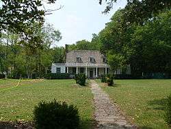
Historic plantation manor house built c. 1740 by Charles Ewell. It was the home of Mason Locke Weems (1759 – 1825), the first biographer of George Washington and the creator of the cherry tree story ("I cannot tell a lie, I did it with my little hatchet"). It is one of the few remaining colonial era plantation homes in northern Virginia. |
| 2 |
Ben Lomond |
|
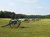
July 30, 1980
(#80004214) |
Northwest of Manassas at 10914 Sudley Manor Dr.[6]
38°47′20″N 77°30′23″W / 38.788750°N 77.506389°W / 38.788750; -77.506389 (Ben Lomond) |
Bull Run |
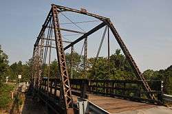
|
| 3 |
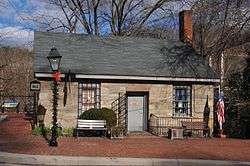
Beverley Mill |
|
February 23, 1972
(#72001411) |
Junction of State Route 55 and Beverleys Mill Rd.
38°49′28″N 77°42′38″W / 38.824583°N 77.710417°W / 38.824583; -77.710417 (Beverley Mill) |
The Plains |
|
| 4 |
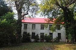
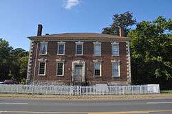
Brentsville Courthouse and Jail |
|
August 18, 1989
(#89001060) |
12239 and 12249 Bristow Rd.
38°41′23″N 77°30′00″W / 38.689722°N 77.500000°W / 38.689722; -77.500000 (Brentsville Courthouse and Jail) |
Brentsville |
|
| 5 |
Brentsville Historic District |
|
December 21, 1990
(#90001829) |
Roughly Bristow Rd. from Old Church Rd. to Isaac Walton Rd.
38°41′23″N 77°30′06″W / 38.689722°N 77.501667°W / 38.689722; -77.501667 (Brentsville Historic District) |
Bristow |
|
| 6 |
Broad Run-Little Georgetown Rural Historic District |
|
April 21, 2016
(#16000205) |
Roughly bounded by The Plains, Bull Run Mountains, State Route 55, Bust Head Rd., and Hopewell Rd.
38°49′28″N 77°42′37″W / 38.824444°N 77.710278°W / 38.824444; -77.710278 (Broad Run-Little Georgetown Rural Historic District) |
Broad Run |
Extends into Fauquier County; only a small portion is in Prince William County. |
| 7 |
Buckland Historic District |
|
June 17, 1988
(#88000681) |
7980-8205 Buckland Mill Rd. and 16206, 16208, 16210, and 16211 U.S. Routes 15/29; also parts of Buckland Mill and Cerro Gordo Rds., and U.S. Routes 15/29
38°46′50″N 77°40′29″W / 38.780556°N 77.674722°W / 38.780556; -77.674722 (Buckland Historic District) |
Buckland |
Second set of addresses represents a boundary increase of March 27, 2008 |
| 8 |
Cabin Branch Pyrite Mine Historic District |
|
December 12, 2002
(#02001517) |
Prince William Forest Park
38°34′39″N 77°21′13″W / 38.577500°N 77.353611°W / 38.577500; -77.353611 (Cabin Branch Pyrite Mine Historic District) |
Triangle |
|
| 9 |
Camp French |
|
November 12, 2008
(#08001055) |
Fuller Rd. on the Medal of Honor Golf Course[7]
38°31′48″N 77°18′20″W / 38.530000°N 77.305556°W / 38.530000; -77.305556 (Camp French) |
Marine Corps Base Quantico |
|
| 10 |
Commanding General's Quarters, Quantico Marine Base |
|
July 17, 2009
(#09000540) |
100 block of Neville Rd. at Quantico Marine Base
38°31′36″N 77°18′01″W / 38.526667°N 77.300278°W / 38.526667; -77.300278 (Commanding General's Quarters, Quantico Marine Base) |
Quantico |
|
| 11 |
Davis-Beard House |
|
November 9, 1989
(#89001794) |
10726 Bristow Rd.
38°43′24″N 77°32′13″W / 38.723472°N 77.536944°W / 38.723472; -77.536944 (Davis-Beard House) |
Bristow |
|
| 12 |
Effingham |
|
November 9, 1989
(#89001793) |
14103 Aden Rd.
38°38′17″N 77°31′20″W / 38.638056°N 77.522167°W / 38.638056; -77.522167 (Effingham) |
Aden |
|
| 13 |
Evergreen |
|
March 27, 2008
(#08000247) |
15900 Berkeley Dr.
38°53′02″N 77°39′42″W / 38.883889°N 77.661667°W / 38.883889; -77.661667 (Evergreen) |
Haymarket |
|
| 14 |
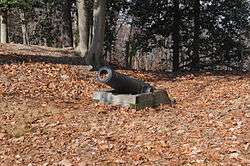
Freestone Point Confederate Battery |
|
August 18, 1989
(#89001059) |
At the Potomac River off Neabsco Rd. in Leesylvania State Park
38°35′34″N 77°14′57″W / 38.592778°N 77.249167°W / 38.592778; -77.249167 (Freestone Point Confederate Battery) |
Woodbridge |
|
| 15 |
Goodwill Historic District, Chopawamsic RDA Camp 1 |
|
June 12, 1989
(#89000456) |
Off State Route 234 west of Interstate 95
38°35′49″N 77°21′23″W / 38.596944°N 77.356389°W / 38.596944; -77.356389 (Goodwill Historic District, Chopawamsic RDA Camp 1) |
Triangle |
|
| 16 |
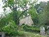
Greenwich Presbyterian Church and Cemetery |
|
August 18, 1989
(#89001065) |
9510 Burwell Rd.
38°44′56″N 77°38′52″W / 38.748889°N 77.647778°W / 38.748889; -77.647778 (Greenwich Presbyterian Church and Cemetery) |
Greenwich |
|
| 17 |
The Lawn |
|
October 30, 1989
(#89001798) |
15027 State Route 215
38°44′59″N 77°38′43″W / 38.749722°N 77.645278°W / 38.749722; -77.645278 (The Lawn) |
Nokesville |
|
| 18 |
Leesylvania Archeological Site (44PW7) |
|
September 13, 1984
(#84003565) |
Leesylvania State Park[8]
38°35′39″N 77°15′21″W / 38.594167°N 77.255833°W / 38.594167; -77.255833 (Leesylvania Archeological Site (44PW7)) |
Dumfries |
|
| 19 |
Locust Bottom |
|
February 11, 1991
(#89001796) |
2520 Logmill Rd.
38°53′38″N 77°38′27″W / 38.893750°N 77.640833°W / 38.893750; -77.640833 (Locust Bottom) |
Haymarket |
|
| 20 |
Manassas National Battlefield Park |
|
October 15, 1966
(#66000039) |
Less than 1 mile (1.6 km) east of Gainesville, approximately 5 miles (8.0 km) northwest of Manassas off State Route 215
38°48′46″N 77°31′18″W / 38.812778°N 77.521667°W / 38.812778; -77.521667 (Manassas National Battlefield Park) |
Gainesville |
|
| 21 |
Mawavi Historic District, Chopawamsic RDA Camp 2 |
|
June 12, 1989
(#89000457) |
Off Joplin Rd. west of Interstate 95
38°34′53″N 77°24′57″W / 38.581389°N 77.415833°W / 38.581389; -77.415833 (Mawavi Historic District, Chopawamsic RDA Camp 2) |
Triangle |
|
| 22 |
Mitchell's Ford Entrenchments |
|
August 8, 1989
(#89001064) |
Bull Run east of Manassas Park[9]
38°47′45″N 77°27′13″W / 38.795833°N 77.453611°W / 38.795833; -77.453611 (Mitchell's Ford Entrenchments) |
Manassas Park |
Near Manassas Park, but in the county |
| 23 |
Moor Green |
|
November 17, 1978
(#78003039) |
1.3 miles (2.1 km) north of Brentsville off Lucasville Rd.
38°42′26″N 77°29′47″W / 38.707222°N 77.496389°W / 38.707222; -77.496389 (Moor Green) |
Brentsville |
|
| 24 |
Mt. Atlas |
|
October 30, 1989
(#89001799) |
4105 Mt. Atlas Ln.
38°52′07″N 77°39′46″W / 38.868611°N 77.662778°W / 38.868611; -77.662778 (Mt. Atlas) |
Haymarket |
|
| 25 |
Nokesville Truss Bridge |
|
April 15, 1978
(#78003040) |
Northeast of Nokesville on Aden Rd.
38°42′25″N 77°33′52″W / 38.706944°N 77.564444°W / 38.706944; -77.564444 (Nokesville Truss Bridge) |
Nokesville |
|
| 26 |
Occoquan Historic District |
|
October 6, 1983
(#83004255) |
Roughly bounded by the Occoquan River, Center Lane, Washington St., and the western end of Mill St.
38°41′02″N 77°15′41″W / 38.683889°N 77.261389°W / 38.683889; -77.261389 (Occoquan Historic District) |
Occoquan |
|
| 27 |
Old Hotel |
|
November 12, 1969
(#69000273) |
U.S. Route 1
38°34′09″N 77°19′23″W / 38.569028°N 77.323028°W / 38.569028; -77.323028 (Old Hotel) |
Dumfries |
|
| 28 |
Old Town Hall and School |
|
March 1, 2011
(#11000063) |
15025 Washington St.
38°48′44″N 77°38′14″W / 38.812361°N 77.637361°W / 38.812361; -77.637361 (Old Town Hall and School) |
Haymarket |
Now the Haymarket Museum |
| 29 |
Orange and Alexandria Railroad Bridge Piers |
|
August 8, 1989
(#89001061) |
Both sides of Bull Run just east of Manassas Park[10]
38°46′36″N 77°25′19″W / 38.776667°N 77.421944°W / 38.776667; -77.421944 (Orange and Alexandria Railroad Bridge Piers) |
Manassas Park |
Extends into Fairfax County |
| 30 |
Orenda/SP-26 Historic District, Chopawamsic RDA Camp 3 |
|
June 12, 1989
(#89000458) |
Off Joplin Rd. west of Interstate 95
38°33′48″N 77°21′34″W / 38.563333°N 77.359444°W / 38.563333; -77.359444 (Orenda/SP-26 Historic District, Chopawamsic RDA Camp 3) |
Triangle |
|
| 31 |
Park Gate |
|
April 3, 1987
(#87000580) |
11508 Park Gate Dr.
38°40′45″N 77°32′38″W / 38.679167°N 77.543889°W / 38.679167; -77.543889 (Park Gate) |
Nokesville |
|
| 32 |
Pilgrim's Rest |
|
October 30, 1989
(#89001797) |
14102 Carriage Ford Rd.; also 2101 Belmont Grove Rd.
38°39′00″N 77°35′34″W / 38.650000°N 77.592778°W / 38.650000; -77.592778 (Pilgrim's Rest) |
Nokesville |
Belmont Grove represents a boundary increase of January 16, 2004 |
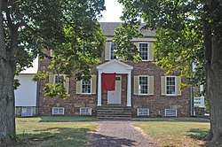
| 33 |
Pleasant Historic District, Chopawamsic RDA Camp 4 |
|
June 12, 1989
(#89000459) |
Off State Route 234 west of Interstate 95
38°35′25″N 77°21′18″W / 38.590278°N 77.355°W / 38.590278; -77.355 (Pleasant Historic District, Chopawamsic RDA Camp 4) |
Triangle |
|
| 34 |
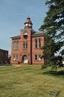
Prince William County Courthouse |
|
February 11, 2004
(#04000039) |
9248 Lee Ave.
38°45′09″N 77°28′34″W / 38.752500°N 77.476111°W / 38.752500; -77.476111 (Prince William County Courthouse) |
Manassas |
In a small county enclave surrounded by the city of Manassas |
| 35 |
Prince William Forest Park Historic District |
|
April 3, 2012
(#12000179) |
18100 Park Headquarters Rd.
38°33′36″N 77°20′50″W / 38.560000°N 77.347222°W / 38.560000; -77.347222 (Prince William Forest Park Historic District) |
Triangle |
|
| 36 |
Quantico Marine Corps Base Historic District |
|
March 26, 2001
(#01000260) |
Marine Corps Base Quantico
38°31′20″N 77°17′24″W / 38.52222°N 77.290000°W / 38.52222; -77.290000 (Quantico Marine Corps Base Historic District) |
Quantico |
Extends into Stafford County |
| 37 |
Rippon Lodge |
|
July 2, 1971
(#71000988) |
0.8 miles (1.3 km) south of the junction of U.S. Route 1 and Rippon Boulevard
38°36′53″N 77°16′42″W / 38.614722°N 77.278333°W / 38.614722; -77.278333 (Rippon Lodge) |
Woodbridge |
|
| 38 |
Rising Hill Camp |
|
November 12, 2008
(#08001057) |
West of the junction of Neville Rd. and Draper St.[11]
38°31′25″N 77°17′53″W / 38.523611°N 77.298056°W / 38.523611; -77.298056 (Rising Hill Camp) |
Marine Corps Base Quantico |
|
| 39 |
Rockledge |
|
June 25, 1973
(#73002051) |
Telegraph Rd.
38°41′06″N 77°15′44″W / 38.685000°N 77.262361°W / 38.685000; -77.262361 (Rockledge) |
Occoquan |
|
| 40 |
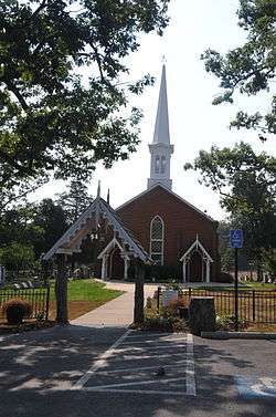
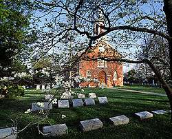
St. Paul's Episcopal Church |
|
January 20, 1975
(#75002031) |
Off State Route 55
38°48′38″N 77°38′21″W / 38.810417°N 77.639167°W / 38.810417; -77.639167 (St. Paul's Episcopal Church) |
Haymarket |
|
| 41 |
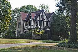
Signal Hill |
|
August 8, 1989
(#89001062) |
9301 Signal View Rd.
38°45′05″N 77°26′18″W / 38.751389°N 77.438333°W / 38.751389; -77.438333 (Signal Hill) |
Manassas |
Near Manassas, but east of the city limits. Across from Signal Hill Park. |
| 42 |
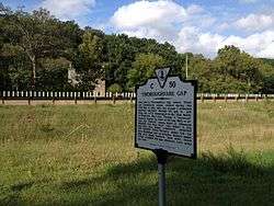
Thoroughfare Gap Battlefield |
|
November 18, 1999
(#99001374) |
Junction of Interstate 66 and State Route 55
38°49′27″N 77°42′30″W / 38.824139°N 77.708333°W / 38.824139; -77.708333 (Thoroughfare Gap Battlefield) |
Broad Run |
Extends into Fauquier County |
| 43 |
Weems-Botts House |
|
May 12, 1975
(#75002029) |
Southwestern corner of the junction of Duke and Cameron Sts.
38°34′07″N 77°19′45″W / 38.568611°N 77.329167°W / 38.568611; -77.329167 (Weems-Botts House) |
Dumfries |
|
| 44 |
White House |
|
October 30, 1989
(#89001795) |
12320 Bristow Rd.
38°41′19″N 77°29′58″W / 38.688611°N 77.499444°W / 38.688611; -77.499444 (White House) |
Brentsville |
|
.jpg)
%2C_Brentsville_(Prince_William_County%2C_Virginia).jpg)

.jpg)
.jpg)

%2C_State_Route_610%2C_Dumfries_vicinity_(Prince_William_County%2C_Virginia).jpg)
.jpg)
.jpg)
.jpg)
.jpg)
.jpg)
_001.jpg)