| [3] |
Name on the Register[4] |
Image |
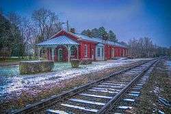
Date listed[5] |
Location |
City or town |
Description |
|---|
| 1 |
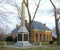
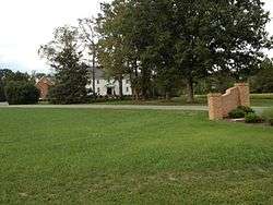
Ashland Historic District |
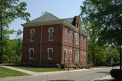
|
February 11, 1983
(#83003284) |
Center, Racecourse, James, Howard, and Clay Sts., and Hanover and Railroad Aves.
37°45′30″N 77°28′50″W / 37.758333°N 77.480556°W / 37.758333; -77.480556 (Ashland Historic District) |
Ashland |
|
| 2 |
Ashland UDC Jefferson Davis Highway Marker |
|
August 27, 2013
(#13000642) |
Junction of U.S. Route 1 and Cedar Lane
37°41′22″N 77°27′46″W / 37.689444°N 77.462889°W / 37.689444; -77.462889 (Ashland UDC Jefferson Davis Highway Marker) |
Glen Allen |
|
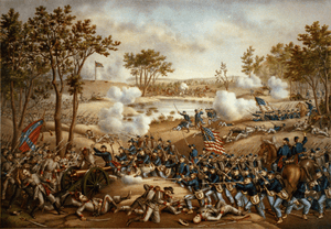
| 3 |
Beaverdam Depot |
|
November 8, 1988
(#88002060) |
On the CSX railroad tracks at the junction of Beaver Dam and Beaverdam School Rds.
37°56′28″N 77°39′12″W / 37.941111°N 77.653333°W / 37.941111; -77.653333 (Beaverdam Depot) |
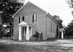
Beaverdam |
|
| 4 |
Church Quarter |
|
November 22, 2000
(#00001436) |
12432 Old Ridge Rd.
37°50′54″N 77°31′31″W / 37.848472°N 77.525139°W / 37.848472; -77.525139 (Church Quarter) |
Doswell |
|
| 5 |
Clover Lea |
|
February 28, 1979
(#79003045) |
East of Mechanicsville off Piping Tree Rd.
37°38′36″N 77°11′05″W / 37.643472°N 77.184861°W / 37.643472; -77.184861 (Clover Lea) |
Mechanicsville |
|
| 6 |
Cold Harbor National Cemetery |
|
August 10, 1995
(#95000922) |
0.5 miles (0.80 km) east of the junction of State Route 156 and Cold Harbor Rd.
37°35′22″N 77°16′48″W / 37.589444°N 77.280000°W / 37.589444; -77.280000 (Cold Harbor National Cemetery) |
Mechanicsville |
|
| 7 |
Cool Well |
|
September 6, 2007
(#07000931) |
8198 Shady Grove Rd.
37°37′35″N 77°22′32″W / 37.626389°N 77.375556°W / 37.626389; -77.375556 (Cool Well) |
Mechanicsville |
|
| 8 |
Dewberry |
|
May 23, 1996
(#96000576) |
Approximately 1 mile (1.6 km) northeast of the junction of Hewlett and Old Ridge Rds.
37°53′41″N 77°35′22″W / 37.894722°N 77.589444°W / 37.894722; -77.589444 (Dewberry) |
Beaverdam |
|
| 9 |
Fork Church |
|
February 26, 1970
(#70000801) |
At the junction of Old Ridge and Rocketts Mill Rds.
37°51′13″N 77°31′52″W / 37.853611°N 77.531111°W / 37.853611; -77.531111 (Fork Church) |
Ashland |
|
| 10 |
Hanover County Courthouse |
|
October 1, 1969
(#69000247) |
Junction of U.S. Route 301 and Library Dr.
37°45′47″N 77°22′01″W / 37.763056°N 77.366944°W / 37.763056; -77.366944 (Hanover County Courthouse) |
Hanover Court House |
|
| 11 |
Hanover County Courthouse Historic District |
|
September 22, 1971
(#71000980) |
U.S. Route 301
37°45′46″N 77°22′00″W / 37.762778°N 77.366667°W / 37.762778; -77.366667 (Hanover County Courthouse Historic District) |
Hanover |
|
| 12 |
Hanover Meeting House |
|
September 4, 1991
(#91001089) |
6411 Heatherwood Dr.[6]
37°38′42″N 77°19′50″W / 37.645000°N 77.330556°W / 37.645000; -77.330556 (Hanover Meeting House) |
Mechanicsville |
Site of the first non-Anglican church in Virginia |
| 13 |
Hanover Town |
|
September 17, 1974
(#74002122) |
River Rd. on the western side of the Pamunkey River[7]
37°41′52″N 77°14′46″W / 37.697778°N 77.246111°W / 37.697778; -77.246111 (Hanover Town) |
Mechanicsville |
|
| 14 |
Hanover Wayside |
|
November 22, 2002
(#02001365) |
8225 Hanover Wayside Rd.
37°42′08″N 77°22′56″W / 37.702222°N 77.382222°W / 37.702222; -77.382222 (Hanover Wayside) |
Hanover |
|
| 15 |
Hickory Hill |
|
November 21, 1974
(#74002121) |
East of Ashland off Hickory Hill Rd.
37°46′27″N 77°24′50″W / 37.774167°N 77.413889°W / 37.774167; -77.413889 (Hickory Hill) |
Ashland |
|
| 16 |
Immanuel Episcopal Church |
|
May 23, 1996
(#96000577) |
Old Church Rd., 1.7 miles (2.7 km) east of its junction with U.S. Route 360
37°38′35″N 77°12′59″W / 37.643056°N 77.216389°W / 37.643056; -77.216389 (Immanuel Episcopal Church) |
Mechanicsville |
|
| 17 |
Laurel Meadow |
|
July 7, 1995
(#95000827) |
Eastern side of Lee Davis Rd., 0.2 miles (0.32 km) south of its junction with Pole Green Rd.
37°38′00″N 77°20′12″W / 37.633333°N 77.336528°W / 37.633333; -77.336528 (Laurel Meadow) |
Mechanicsville |
|
| 18 |
Little River UDC Jefferson Davis Highway Marker |
|
April 17, 2018
(#100002355) |
15400 Washington Hwy.
37°49′49″N 77°28′11″W / 37.830391°N 77.469814°W / 37.830391; -77.469814 (Little River UDC Jefferson Davis Highway Marker) |
Doswell vicinity |
|
| 19 |
Montpelier Historic District |
|
May 16, 2002
(#02000517) |
Roughly along Mountain Rd.
37°49′08″N 77°40′59″W / 37.818889°N 77.683056°W / 37.818889; -77.683056 (Montpelier Historic District) |
Montpelier |
|
| 20 |
Oak Forest |
|
August 23, 1999
(#99000964) |
7400 Rural Point Rd.
37°40′35″N 77°21′07″W / 37.676389°N 77.351944°W / 37.676389; -77.351944 (Oak Forest) |
Mechanicsville |
|
| 21 |
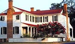
Oakland |
|
July 30, 1974
(#74002123) |
North of Montpelier
37°52′20″N 77°39′42″W / 37.872222°N 77.661667°W / 37.872222; -77.661667 (Oakland) |
Montpelier |
|
| 22 |
Oakley Hill |
|
May 19, 1994
(#94000459) |
Southern side of State Route 156, 2,500 feet (760 m) west of its junction with Lee Davis Rd.
37°35′45″N 77°20′23″W / 37.595972°N 77.339722°W / 37.595972; -77.339722 (Oakley Hill) |
Mechanicsville |
|
| 23 |
Patrick Henry's Birthplace Archeological Site |
|
August 2, 1982
(#82001819) |
9620 Studley Farm Dr.[8]
37°40′09″N 77°17′27″W / 37.669167°N 77.290833°W / 37.669167; -77.290833 (Patrick Henry's Birthplace Archeological Site) |
Studley |
|
| 24 |
Pine Slash |
|
November 19, 1987
(#87001946) |
Rural Point Rd.
37°39′21″N 77°19′31″W / 37.655972°N 77.325278°W / 37.655972; -77.325278 (Pine Slash) |
Studley |
|
| 25 |
Randolph-Macon College Buildings |
|
June 19, 1979
(#79003044) |
Randolph-Macon College campus
37°45′38″N 77°28′47″W / 37.760556°N 77.479722°W / 37.760556; -77.479722 (Randolph-Macon College Buildings) |
Ashland |
|
| 26 |
Richmond National Battlefield Park |
|
October 15, 1966
(#66000836) |
East of Richmond
37°35′24″N 77°17′06″W / 37.590000°N 77.285000°W / 37.590000; -77.285000 (Richmond National Battlefield Park) |
Richmond |
|
| 27 |
Edmund Ruffin Plantation |
|
October 15, 1966
(#66000837) |
11 miles (18 km) northeast of Richmond on U.S. Route 360
37°39′15″N 77°13′21″W / 37.654167°N 77.222500°W / 37.654167; -77.222500 (Edmund Ruffin Plantation) |
Richmond |
Also known as Marlbourne |
| 28 |
Rural Plains |
|
June 5, 1975
(#75002021) |
6 miles (9.7 km) north of Mechanicsville off Studley Rd.
37°39′39″N 77°20′49″W / 37.660833°N 77.346944°W / 37.660833; -77.346944 (Rural Plains) |
Mechanicsville |
|
| 29 |
St. Paul's Episcopal Church |
|
May 19, 1994
(#94000460) |
Southwestern corner of the junction of U.S. Route 301 and State Route 54
37°45′56″N 77°22′15″W / 37.765694°N 77.370833°W / 37.765694; -77.370833 (St. Paul's Episcopal Church) |
Hanover |
|
| 30 |
Scotchtown |
|
October 15, 1966
(#66000835) |
10 miles (16 km) northwest of Ashland on Scotchtown Rd.
37°50′40″N 77°35′10″W / 37.844444°N 77.586111°W / 37.844444; -77.586111 (Scotchtown) |
Ashland |
Also known as the Patrick Henry House |
| 31 |
Selwyn |
|
May 22, 2003
(#03000445) |
6279 Powhite Farm Dr.
37°34′57″N 77°19′12″W / 37.582500°N 77.320000°W / 37.582500; -77.320000 (Selwyn) |
Mechanicsville |
|
| 32 |
Sharp's Oakland |
|
January 24, 2002
(#01001514) |
12308 Verdon Rd.
37°53′57″N 77°30′47″W / 37.899167°N 77.513194°W / 37.899167; -77.513194 (Sharp's Oakland) |
Doswell |
|
| 33 |
Slash Church |
|
September 22, 1972
(#72001399) |
Mt. Hermon Rd., north of its junction with Peaks Rd.
37°43′10″N 77°24′52″W / 37.719306°N 77.414444°W / 37.719306; -77.414444 (Slash Church) |
Ashland |
|
| 34 |
Spring Green |
|
December 31, 2002
(#02000316) |
2160 Old Church Rd.
37°37′50″N 77°10′21″W / 37.630556°N 77.172500°W / 37.630556; -77.172500 (Spring Green) |
Mechanicsville |
|
| 35 |
Springfield |
|
August 16, 1994
(#94000990) |
Southern side of Old Ridge Rd., 0.4 miles (0.64 km) southwest of its junction with Coatesville Rd.
37°51′57″N 77°36′47″W / 37.865833°N 77.613056°W / 37.865833; -77.613056 (Springfield) |
Coatesville |
|
| 36 |
Sycamore Tavern |
|
July 24, 1974
(#74002124) |
West of U.S. Route 33
37°49′23″N 77°41′14″W / 37.822917°N 77.687361°W / 37.822917; -77.687361 (Sycamore Tavern) |
Montpelier |
|
| 37 |
The Tavern at Old Church |
|
May 16, 2016
(#16000260) |
3350-3360 Old Church Rd.
37°38′41″N 77°13′17″W / 37.644722°N 77.221389°W / 37.644722; -77.221389 (The Tavern at Old Church) |
Mechanicsville |
|
| 38 |
Totomoi |
|
December 12, 1976
(#76002108) |
West of Studley on Rural Point Rd.
37°40′08″N 77°22′19″W / 37.668889°N 77.371944°W / 37.668889; -77.371944 (Totomoi) |
Studley |
|
| 39 |
Trinity Church |
|
December 27, 1990
(#90001923) |
Junction of Teman and Goshen Rds.
37°54′04″N 77°37′56″W / 37.901111°N 77.632222°W / 37.901111; -77.632222 (Trinity Church) |
Beaverdam |
|
| 40 |
Virginia Industrial Home School for Colored Girls |
|
October 7, 2016
(#15000926) |
11391 Barrett Center Rd.
37°42′39″N 77°21′42″W / 37.710947°N 77.361564°W / 37.710947; -77.361564 (Virginia Industrial Home School for Colored Girls) |
Mechanicsville |
|
| 41 |
Williamsville |
|
November 18, 1985
(#85002915) |
Off Williamsville Rd.
37°41′50″N 77°18′23″W / 37.697222°N 77.306389°W / 37.697222; -77.306389 (Williamsville) |
Studley |
|
_Station-Visitor's_Center.JPG)
.jpg)
.jpg)
.jpg)
%2C_Richmond_National_Battlefield_Park_(Hanover_County%2C_Virginia).jpg)
_-_front.JPG)
.jpg)