| [3] |
Name on the Register[4] |
Image |
Date listed[5] |
Location |
City or town |
Description |
|---|
| 1 |
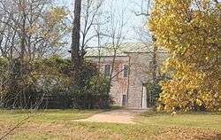
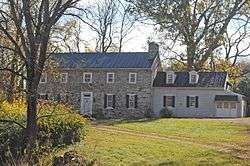
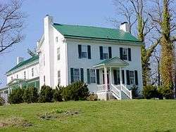
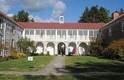
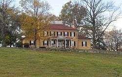
Annefield |
|
November 12, 1969
(#69000231) |
East of the junction of Annfield and Summerville Rds.
39°07′35″N 78°01′40″W / 39.126389°N 78.027778°W / 39.126389; -78.027778 (Annefield) |
Boyce |
|
| 2 |
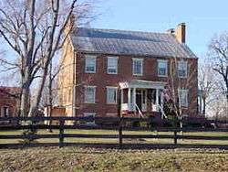
Bear's Den Rural Historic District |
|
May 14, 2009
(#08001112) |
Generally runs along both side of the ridge along parts of Raven Rocks and Blue Ridge Mountain Rds.
39°06′40″N 77°51′15″W / 39.111111°N 77.854167°W / 39.111111; -77.854167 (Bear's Den Rural Historic District) |
Bluemont |
|
| 3 |
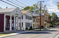
Berryville Historic District |
|
November 3, 1987
(#87001881) |
Junction of U.S. Route 340, State Route 7, and Main, Church, and Buckmarsh Sts.
39°09′04″N 77°58′53″W / 39.151111°N 77.981389°W / 39.151111; -77.981389 (Berryville Historic District) |
Berryville |
|
| 4 |
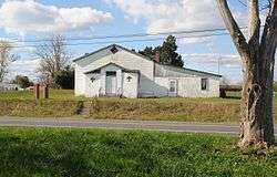
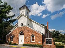
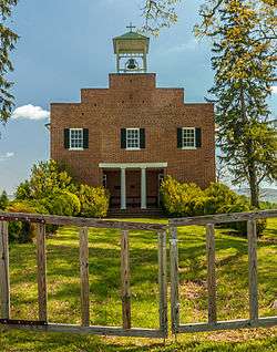
Bethel Memorial Church |
|
February 7, 1991
(#89001927) |
Swift Shoals Rd.
39°01′46″N 78°02′47″W / 39.029444°N 78.046389°W / 39.029444; -78.046389 (Bethel Memorial Church) |
White Post |
|
| 5 |
Blandy Experimental Farm Historic District |
|
November 12, 1992
(#92001580) |
Southern side of U.S. Routes 17/50, 4 miles (6.4 km) west of the Shenandoah River
39°03′50″N 78°03′55″W / 39.063889°N 78.065278°W / 39.063889; -78.065278 (Blandy Experimental Farm Historic District) |
Boyce |
|
| 6 |
Boyce Historic District |
|
March 8, 2004
(#04000155) |
Includes Crescent Sts., Greenway Ave., Huntingdon Ln., Main St., Old Chapel Ave., Railroad Ln., and Saratoga, Virginia, and Whiting
39°05′36″N 78°03′36″W / 39.093333°N 78.060000°W / 39.093333; -78.060000 (Boyce Historic District) |
Boyce |
|
| 7 |
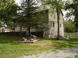
Burwell-Morgan Mill |
|
November 12, 1969
(#69000233) |
At the junction of State Route 255 with Millwood Rd.
39°04′08″N 78°02′17″W / 39.06890°N 78.03805°W / 39.06890; -78.03805 (Burwell-Morgan Mill) |
Millwood |
|
| 8 |
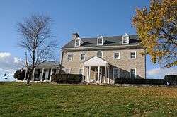
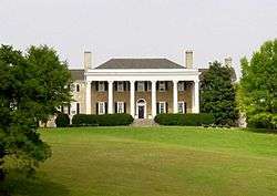
Carter Hall |
|
July 24, 1973
(#73002003) |
Northeast of Millwood off State Route 255
39°04′15″N 78°01′49″W / 39.070833°N 78.030278°W / 39.070833; -78.030278 (Carter Hall) |
Millwood |
|
| 9 |
Chapel Hill |
|
December 30, 2004
(#04000846) |
300 Chapel Hill Ln.
39°06′46″N 78°00′59″W / 39.112778°N 78.016389°W / 39.112778; -78.016389 (Chapel Hill) |
Berryville |
|
| 10 |
Chapel Rural Historic District |
|
February 14, 2014
(#14000010) |
Generally centered along U.S. Route 340
39°05′30″N 78°01′21″W / 39.091667°N 78.022500°W / 39.091667; -78.022500 (Chapel Rural Historic District) |
Millwood |
|
| 11 |
Cleridge |
|
September 8, 2011
(#11000653) |
1649 Old Charles Town Rd.
39°13′26″N 78°03′32″W / 39.223889°N 78.058889°W / 39.223889; -78.058889 (Cleridge) |
Stephenson |
Extends into Frederick County |
| 12 |
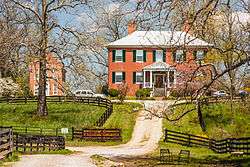
Clermont |
|
July 27, 2005
(#05000767) |
801 E. Main St.
39°08′32″N 77°57′50″W / 39.142222°N 77.963889°W / 39.142222; -77.963889 (Clermont) |
Berryville |
|
| 13 |
Cool Spring Battlefield |
|
June 6, 1997
(#97000492) |
Junction of State Route 7 and the Shenandoah River
39°07′30″N 77°53′24″W / 39.125000°N 77.890000°W / 39.125000; -77.890000 (Cool Spring Battlefield) |
Berryville |
|
| 14 |
Fairfield |
|
February 26, 1970
(#70000787) |
East of the junction of U.S. Route 340 and Clifton Rd.
39°11′05″N 77°56′07″W / 39.184722°N 77.935278°W / 39.184722; -77.935278 (Fairfield) |
Berryville |
|
| 15 |
Farnley |
|
November 2, 1989
(#89001914) |
Sugar Hill Rd. and Bordens Spring Rd.
39°01′21″N 78°06′57″W / 39.022500°N 78.115833°W / 39.022500; -78.115833 (Farnley) |
White Post |
|
| 16 |
Glendale Farm |
|
March 17, 1995
(#95000244) |
Northern side of the junction of Old Charles Town and Crum Church Rds.
39°13′42″N 78°00′42″W / 39.228333°N 78.011667°W / 39.228333; -78.011667 (Glendale Farm) |
Berryville |
|
| 17 |
Greenway Court |
|
October 15, 1966
(#66000829) |
1 mile (1.6 km) south of White Post on State Route 277
39°02′48″N 78°07′09″W / 39.046528°N 78.119167°W / 39.046528; -78.119167 (Greenway Court) |
White Post |
Remnants of 5,000,000-acre (20,000 km2) estate of Thomas Fairfax, 6th Lord Fairfax of Cameron, only British peer in America, where George Washington worked as a surveyor |
| 18 |
Greenway Historic District |
|
November 4, 1993
(#93001133) |
Roughly bounded by the Shenandoah River, the Warren County line, U.S. Route 340, and Locke's Mill Rd.; also the eastern side of State Route 255, approximately 0.2 miles north of its junction with Millwood Rd.; also 14374 U.S. Route 340
39°03′29″N 78°06′14″W / 39.058056°N 78.103889°W / 39.058056; -78.103889 (Greenway Historic District) |
Boyce |
Second set of boundaries and U.S. Route 340 represent boundary increases of February 21, 1997 and October 30, 2007 |
| 19 |
Guilford |
|
February 4, 1993
(#93000004) |
Southern side of Stone Bridge Rd., 0.5 miles (0.80 km) west of its junction with Sugar Hill Rd.
39°01′07″N 78°05′53″W / 39.018611°N 78.098194°W / 39.018611; -78.098194 (Guilford) |
White Post |
|
| 20 |
Huntingdon |
|
May 25, 1979
(#79003035) |
North of Boyce
39°06′09″N 78°03′18″W / 39.102500°N 78.055000°W / 39.102500; -78.055000 (Huntingdon) |
Boyce |
|
| 21 |
Josephine City Historic District |
|
May 18, 2015
(#15000250) |
Josephine St.
39°08′36″N 77°58′55″W / 39.143333°N 77.981944°W / 39.143333; -77.981944 (Josephine City Historic District) |
Berryville |
|
| 22 |
Josephine City School |
|
April 7, 1995
(#95000397) |
301-A Josephine St.
39°08′28″N 77°58′46″W / 39.141111°N 77.979444°W / 39.141111; -77.979444 (Josephine City School) |
Berryville |
|
| 23 |
Long Branch |
|
October 1, 1969
(#69000232) |
West of the junction of Bordens Spring and Red Gate Rds.
39°02′27″N 78°03′21″W / 39.040833°N 78.055833°W / 39.040833; -78.055833 (Long Branch) |
Millwood |
|
| 24 |
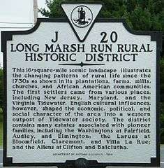
Long Marsh Run Rural Historic District |
|
November 4, 1996
(#96001173) |
Roughly bounded by the West Virginia state line, Wickliffe Rd., Shepherds Mill Rd., State Route 7, and Kimble Rd.
39°09′22″N 77°55′08″W / 39.156111°N 77.918889°W / 39.156111; -77.918889 (Long Marsh Run Rural Historic District) |
Berryville |
|
| 25 |
Lucky Hit |
|
August 12, 1993
(#93000834) |
Southern side of Berrys Ferry Rd., 4,500 feet (1,400 m) northeast of its junction with White Post Rd.
39°03′18″N 78°05′37″W / 39.055000°N 78.093611°W / 39.055000; -78.093611 (Lucky Hit) |
White Post |
|
| 26 |
Meadea |
|
February 8, 1995
(#95000022) |
Southern side of Berrys Ferry Rd., 600 feet (180 m) east of its junction with White Post Rd.
39°03′25″N 78°06′07″W / 39.057083°N 78.101944°W / 39.057083; -78.101944 (Meadea) |
White Post |
|
| 27 |
Millwood Colored School |
|
November 22, 2000
(#00001431) |
1610 Millwood Rd.
39°04′29″N 78°02′31″W / 39.074722°N 78.041944°W / 39.074722; -78.041944 (Millwood Colored School) |
Boyce |
|
| 28 |
Millwood Commercial Historic District |
|
January 31, 2006
(#05001624) |
Parts of Millwood Rd. and Tannery Ln.
39°04′11″N 78°02′17″W / 39.069722°N 78.038056°W / 39.069722; -78.038056 (Millwood Commercial Historic District) |
Millwood |
|
| 29 |
Norwood |
|
September 30, 1994
(#94001180) |
Southern side of State Route 7, 0.9 miles (1.4 km) east of its junction with State Route 7 Business
39°08′22″N 77°57′00″W / 39.139444°N 77.950000°W / 39.139444; -77.950000 (Norwood) |
Berryville |
|
| 30 |
Old Chapel |
|
April 2, 1973
(#73002004) |
3 miles (4.8 km) north of Millwood off U.S. Route 340
39°06′27″N 78°00′51″W / 39.107500°N 78.014167°W / 39.107500; -78.014167 (Old Chapel) |
Millwood |
|
| 31 |
Old Clarke County Courthouse |
|
July 7, 1983
(#83003277) |
104 N. Church St.
39°09′07″N 77°58′49″W / 39.151944°N 77.980278°W / 39.151944; -77.980278 (Old Clarke County Courthouse) |
Berryville |
|
| 32 |
River House |
|
December 23, 1993
(#93001440) |
U.S. Routes 17/50, 2.5 miles (4.0 km) east of Millwood
39°02′32″N 78°00′06″W / 39.042222°N 78.001667°W / 39.042222; -78.001667 (River House) |
Millwood |
|
| 33 |
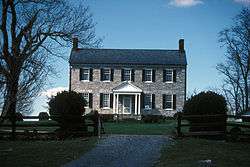
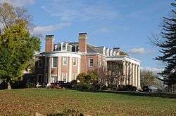
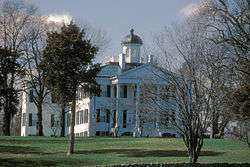
Saratoga |
|
February 26, 1970
(#70000788) |
Millwood Rd.
39°05′00″N 78°03′36″W / 39.083333°N 78.060000°W / 39.083333; -78.060000 (Saratoga) |
Boyce |
Gray limestone Georgian house built by Brig. Gen. Daniel Morgan, best known for his victory over the British at the Battle of Cowpens in 1781. |
| 34 |
Scaleby |
|
December 28, 1990
(#90002000) |
Millwood Rd., south of its junction with U.S. Route 340
39°05′12″N 78°02′55″W / 39.086667°N 78.048611°W / 39.086667; -78.048611 (Scaleby) |
Boyce |
|
| 35 |
Smithfield Farm |
|
February 16, 2001
(#01000148) |
568 Smithfield Ln.
39°10′24″N 77°53′58″W / 39.173333°N 77.899444°W / 39.173333; -77.899444 (Smithfield Farm) |
Berryville |
|
| 36 |
Soldier's Rest |
|
May 23, 1996
(#96000579) |
0.3 miles (0.48 km) north of Fairfax Ave. and approximately 0.5 miles (0.80 km) east of the junction of U.S. Route 340 and State Route 7
39°09′25″N 77°58′16″W / 39.156944°N 77.971111°W / 39.156944; -77.971111 (Soldier's Rest) |
Berryville |
|
| 37 |
The Tuleyries |
|
August 7, 1972
(#72001388) |
1.5 miles (2.4 km) east of White Post off Berrys Ferry Rd.
39°03′57″N 78°04′12″W / 39.065833°N 78.070000°W / 39.065833; -78.070000 (The Tuleyries) |
White Post |
|
| 38 |
White Post Historic District |
|
September 29, 1983
(#83003278) |
Berrys Ferry and White Post Rds.
39°03′29″N 78°06′12″W / 39.058056°N 78.103333°W / 39.058056; -78.103333 (White Post Historic District) |
White Post |
|
| 39 |
Wickliffe Church |
|
March 17, 1995
(#95000241) |
Eastern side of Wickliffe Rd., 0.5 miles (0.80 km) south of the West Virginia line
39°09′59″N 77°53′31″W / 39.166250°N 77.891944°W / 39.166250; -77.891944 (Wickliffe Church) |
Berryville |
|
.jpg)


.jpg)