| [3] |
Name on the Register[4] |
Image |
Date listed[5] |
Location |
Description |
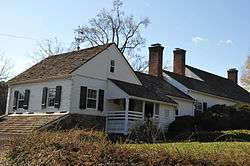
|---|
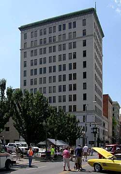
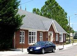
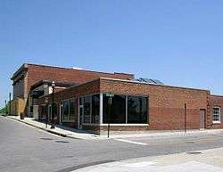
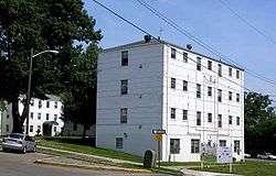
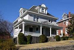
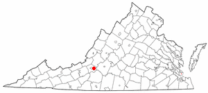
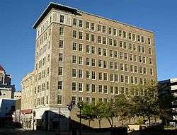
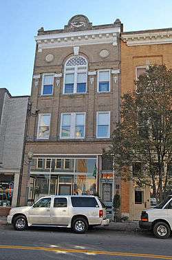
| 1 |
Apartment Building on Windsor Avenue and Brunswick St. |
|
August 23, 2010
(#10000559) |
2049 Windsor Ave., SW.
37°15′47″N 79°58′49″W / 37.263056°N 79.980278°W / 37.263056; -79.980278 (Apartment Building on Windsor Avenue and Brunswick St.) |
|
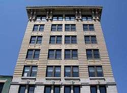
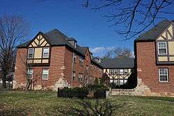
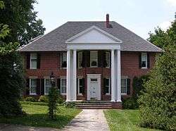
| 2 |
Belle Aire |
|
April 15, 1975
(#75002034) |
U.S. Route 11
37°15′49″N 80°01′03″W / 37.263611°N 80.0175°W / 37.263611; -80.0175 (Belle Aire) |
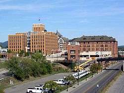
|
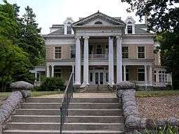
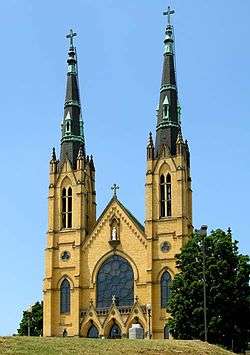
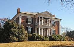
| 3 |
Belmont Methodist-Episcopal Church |
|
August 18, 2011
(#11000551) |
806 Jamison Ave., SE.
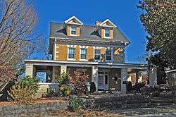
37°16′09″N 79°55′49″W / 37.269167°N 79.930278°W / 37.269167; -79.930278 (Belmont Methodist-Episcopal Church) |
|
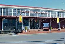
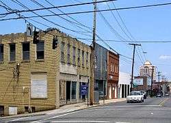
| 4 |
Boxley Building |
|
March 8, 1984
(#84003587) |
416 Jefferson St., SW.
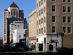
37°16′12″N 79°56′25″W / 37.270000°N 79.940278°W / 37.270000; -79.940278 (Boxley Building) |
|
| 5 |
Boxley-Sprinkle House |
|
November 27, 2004
(#04001275) |
2611 Crystal Spring Ave.
37°14′39″N 79°57′01″W / 37.244167°N 79.950278°W / 37.244167; -79.950278 (Boxley-Sprinkle House) |
|
| 6 |
Buena Vista |
|
July 30, 1974
(#74002244) |
Penmar Ave. and 9th St.
37°15′50″N 79°55′23″W / 37.263889°N 79.923056°W / 37.263889; -79.923056 (Buena Vista) |
|
| 7 |
Burrell Memorial Hospital |
|
September 22, 2003
(#03000450) |
611 McDowell St.
37°16′57″N 79°56′58″W / 37.282500°N 79.949306°W / 37.282500; -79.949306 (Burrell Memorial Hospital) |
|
| 8 |
Campbell Avenue Complex |
|
January 24, 1991
(#90002171) |
118-128 Campbell Ave., SW.
37°16′18″N 79°56′37″W / 37.271667°N 79.943611°W / 37.271667; -79.943611 (Campbell Avenue Complex) |
|
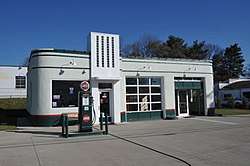
| 9 |
Carlin's Amoco Station |
|
November 20, 2012
(#12000968) |
1721 Williamson Rd., NE.
37°17′17″N 79°56′00″W / 37.288056°N 79.933472°W / 37.288056; -79.933472 (Carlin's Amoco Station) |
|
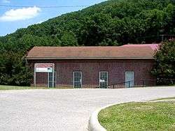
| 10 |
City of Roanoke Fire Station No. 5 |
|
November 18, 2011
(#11000838) |
216 12th St., NW.
37°16′45″N 79°57′32″W / 37.279167°N 79.958889°W / 37.279167; -79.958889 (City of Roanoke Fire Station No. 5) |
|
| 11 |
The Coffee Pot |
|
May 31, 1996
(#96000575) |
2902 Brambleton Ave., SW.
37°14′36″N 79°59′28″W / 37.243333°N 79.991111°W / 37.243333; -79.991111 (The Coffee Pot) |
|
| 12 |
Colonial National Bank |
|
December 17, 1983
(#83004035) |
202-208 Jefferson St.
37°16′18″N 79°56′25″W / 37.271667°N 79.940278°W / 37.271667; -79.940278 (Colonial National Bank) |
|
| 13 |
Crystal Spring Steam Pumping Station |
|
May 23, 1980
(#80004220) |
2016 Lake St., SE
37°14′59″N 79°56′38″W / 37.249722°N 79.943750°W / 37.249722; -79.943750 (Crystal Spring Steam Pumping Station) |
|
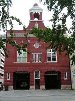
| 14 |
Fire Station No. 1 |
|
May 7, 1973
(#73002224) |
13 E. Church Ave.
37°16′13″N 79°56′24″W / 37.270278°N 79.940000°W / 37.270278; -79.940000 (Fire Station No. 1) |
|
| 15 |
First National Bank |
|
June 14, 1982
(#82004591) |
101 S. Jefferson St.
37°16′20″N 79°56′27″W / 37.272361°N 79.940833°W / 37.272361; -79.940833 (First National Bank) |
|
| 16 |
Gainsboro Branch of the Roanoke City Public Library |
|
December 2, 1996
(#96001448) |
15 Patton Ave., NW.
37°16′38″N 79°56′28″W / 37.277222°N 79.941111°W / 37.277222; -79.941111 (Gainsboro Branch of the Roanoke City Public Library) |
|
| 17 |
Gainsboro Historic District |
|
November 16, 2005
(#05001276) |
Bounded by Wells, Centre, the First Street Bridge, Gilmer, Commonwealth, N. Jefferson, 2nd., Patton, Harrison, and other streets
37°16′36″N 79°56′40″W / 37.276667°N 79.944444°W / 37.276667; -79.944444 (Gainsboro Historic District) |
|
| 18 |
Grandin Road Commercial Historic District |
|
November 27, 2002
(#02001450) |
Grandin Rd., SW., and Memorial Ave.
37°15′57″N 79°58′37″W / 37.265833°N 79.976944°W / 37.265833; -79.976944 (Grandin Road Commercial Historic District) |
|
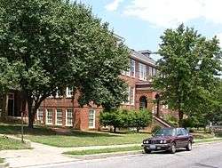
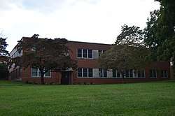
| 19 |
Harrison School |
|
September 9, 1982
(#82004592) |
523 Harrison Ave., NW.
37°16′46″N 79°56′53″W / 37.279444°N 79.948056°W / 37.279444; -79.948056 (Harrison School) |
|
| 20 |
Henry Street Historic District |
|
November 27, 2004
(#04001276) |
100 block of Henry St., NW.
37°16′28″N 79°56′32″W / 37.274444°N 79.942222°W / 37.274444; -79.942222 (Henry Street Historic District) |
|
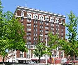
| 21 |
Patrick Henry Hotel |
|
July 3, 1991
(#91000829) |
617 S. Jefferson St.
37°16′07″N 79°56′27″W / 37.268611°N 79.940833°W / 37.268611; -79.940833 (Patrick Henry Hotel) |
|
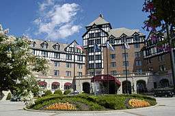
| 22 |
Hotel Roanoke |
|
February 16, 1996
(#96000033) |
110 Shenandoah Ave.
37°16′28″N 79°56′22″W / 37.274444°N 79.939444°W / 37.274444; -79.939444 (Hotel Roanoke) |
|
| 23 |
Huntingdon |
|
November 8, 1991
(#91001598) |
320 Huntingdon Boulevard
37°18′28″N 79°56′15″W / 37.307778°N 79.937500°W / 37.307778; -79.937500 (Huntingdon) |
|
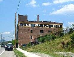
| 24 |
H. L. Lawson & Son Warehouse |
|
September 5, 2008
(#08000830) |
631 Campbell Ave., SE.
37°16′20″N 79°56′00″W / 37.272222°N 79.933333°W / 37.272222; -79.933333 (H. L. Lawson & Son Warehouse) |
|
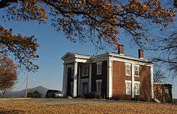
| 25 |
Lone Oaks |
|
April 11, 1973
(#73002054) |
3402 Grandin Rd. Ext., SW.
37°14′57″N 80°00′18″W / 37.249167°N 80.005000°W / 37.249167; -80.005000 (Lone Oaks) |
|
| 26 |
Melrose-Rugby Historic District |
|
August 27, 2013
(#13000645) |
Mercer, Grayson, and Carroll Aves., NW., Rugby Boulevard, NW., and 10th, 11th, 12th, 13th, and 14th Sts., NW.
37°17′14″N 79°57′16″W / 37.287222°N 79.954444°W / 37.287222; -79.954444 (Melrose-Rugby Historic District) |
|
| 27 |
Monterey |
|
July 30, 1974
(#74002146) |
Tinker Creek Lane, NE.
37°18′14″N 79°55′01″W / 37.303889°N 79.916944°W / 37.303889; -79.916944 (Monterey) |
|
| 28 |
Mount Moriah Baptist Church And Cemetery |
|
September 8, 1994
(#94001092) |
3521 E. Orange Ave.
37°18′16″N 79°53′27″W / 37.304306°N 79.890833°W / 37.304306; -79.890833 (Mount Moriah Baptist Church And Cemetery) |
|
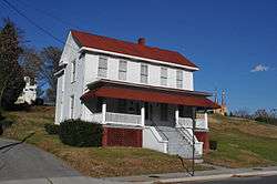
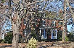
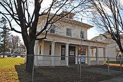
| 29 |
Mountain View |
|
October 31, 1980
(#80004221) |
714 13th St., SW.
37°16′10″N 79°57′50″W / 37.269444°N 79.963889°W / 37.269444; -79.963889 (Mountain View) |
Also known as the Junius Fishburn House |
| 30 |
Norfolk and Western Railway Company Historic District |
|
January 27, 1999
(#99000076) |
88 and 108 Jefferson St., NW., and 209 Shenandoah Ave.
37°16′26″N 79°56′28″W / 37.273889°N 79.941111°W / 37.273889; -79.941111 (Norfolk and Western Railway Company Historic District) |
|
| 31 |
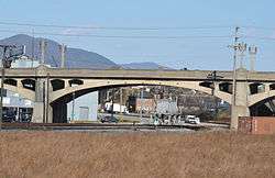
Norfolk & Western Railway Freight Station |
|
November 21, 2012
(#12000969) |
303 Norfolk Ave.
37°16′23″N 79°56′46″W / 37.273056°N 79.946111°W / 37.273056; -79.946111 (Norfolk & Western Railway Freight Station) |
Now serves as the location for the Virginia Museum of Transportation |
| 32 |
Riverland Historic District |
|
August 27, 2013
(#13000646) |
Laural, Primrose, Whitman, and Ivy Sts., Riverland Rd., and Walnut and Arbutus Aves.
37°15′30″N 79°56′03″W / 37.258333°N 79.934167°W / 37.258333; -79.934167 (Riverland Historic District) |
|
| 33 |
Roanoke Apartments |
|
November 9, 2006
(#06000759) |
1402 Maiden Lane
37°15′50″N 79°58′07″W / 37.263889°N 79.968611°W / 37.263889; -79.968611 (Roanoke Apartments) |
|
| 34 |
Roanoke City Firehouse No. 6 |
|
January 24, 1991
(#90002162) |
1015 Jamison Ave., SE.
37°16′11″N 79°55′34″W / 37.269722°N 79.926111°W / 37.269722; -79.926111 (Roanoke City Firehouse No. 6) |
|
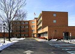
| 35 |
Roanoke City Health Center |
|
May 12, 2016
(#16000263) |
515 8th St., SW.
37°16′14″N 79°57′21″W / 37.270556°N 79.955833°W / 37.270556; -79.955833 (Roanoke City Health Center) |
|
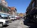
| 36 |
Roanoke City Market Historic District |
|
April 20, 1983
(#83003312) |
Roughly bounded by Williamson Rd., Norfolk Ave., S. Jefferson St., and Church Ave.; also 302 Campbell Ave., SE., and 9 Church Ave., SE.
37°16′18″N 79°56′21″W / 37.271667°N 79.939167°W / 37.271667; -79.939167 (Roanoke City Market Historic District) |
Second set of addresses represents a boundary increase of June 6, 2002 |
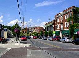
| 37 |
Roanoke Downtown Historic District |
|
September 14, 2002
(#02000978) |
Roughly bounded by 3rd St., Norfolk Ave., Jefferson St., and Bullitt Ave.; also 310-324 Salem Ave., SW.; also the 300-400 blocks of Church and 300-400 blocks of Luck Aves., SW., 600-700 blocks of S. Jefferson St., and 401 3rd and 502 5th Sts., SW.
37°16′16″N 79°56′33″W / 37.271111°N 79.942500°W / 37.271111; -79.942500 (Roanoke Downtown Historic District) |
Second and third sets of boundaries represent boundary increases of March 29, 2007 and August 27, 2013 respectively |
| 38 |
Roanoke River and Railroad Historic District |
|
December 24, 2013
(#13000994) |
Albemarle and Walnut Aves., SE., Williamson Rd., SE., and 4th and Jefferson Sts., SE.
37°15′35″N 79°56′20″W / 37.259722°N 79.938889°W / 37.259722; -79.938889 (Roanoke River and Railroad Historic District) |
|
| 39 |
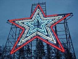
Roanoke Star |
|
November 15, 1999
(#99001375) |
Mill Mountain
37°15′03″N 79°55′57″W / 37.250833°N 79.932500°W / 37.250833; -79.932500 (Roanoke Star) |
|
| 40 |
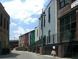
Roanoke Warehouse Historic District |
|
March 29, 1983
(#83003313) |
109-133 Norfolk Ave., SW.
37°16′23″N 79°56′36″W / 37.273056°N 79.943333°W / 37.273056; -79.943333 (Roanoke Warehouse Historic District) |
|
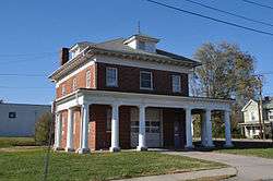
| 41 |
Tayloe Rogers House |
|
November 21, 2012
(#12000970) |
1542 Electric Rd., SW.
37°15′25″N 80°02′01″W / 37.256944°N 80.033611°W / 37.256944; -80.033611 (Tayloe Rogers House) |
|
| 42 |
St. Andrew's Roman Catholic Church |
|
May 7, 1973
(#73002225) |
631 N. Jefferson St.
37°16′42″N 79°56′24″W / 37.278333°N 79.940000°W / 37.278333; -79.940000 (St. Andrew's Roman Catholic Church) |
|
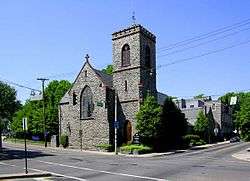
| 43 |
St. John's Episcopal Church |
|
August 23, 1991
(#91001083) |
Southwestern corner of Jefferson St. and Elm Ave.
37°16′00″N 79°56′28″W / 37.266667°N 79.941111°W / 37.266667; -79.941111 (St. John's Episcopal Church) |
|
| 44 |
Salem Avenue-Roanoke Automotive Commercial Historic District |
|
August 8, 2007
(#07000807) |
Generally Salem Ave., Rorer Ave., and Campbell Ave. between 3rd and 6th Sts.; also the 400-600 blocks of Campbell Ave.; also the 700 block of Patterson Ave.
37°16′21″N 79°56′58″W / 37.272500°N 79.949444°W / 37.272500; -79.949444 (Salem Avenue-Roanoke Automotive Commercial Historic District) |
Second and third sets of boundaries represent boundary increases of May 15, 2008 and October 22, 2014 respectively |
| 45 |
Southwest Historic District |
|
June 19, 1985
(#85001349) |
Roughly bounded by Salem Ave., Jefferson St., the Roanoke River, and 20th St.
37°16′08″N 79°57′20″W / 37.268889°N 79.955556°W / 37.268889; -79.955556 (Southwest Historic District) |
|
| 46 |
Villa Heights |
|
June 4, 2018
(#100002532) |
2750 Hoover St.
37°17′33″N 79°58′44″W / 37.292391°N 79.978914°W / 37.292391; -79.978914 (Villa Heights) |
|
| 47 |
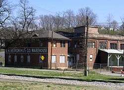
Virginia Can Company-S.H. Heironimus Warehouse |
|
February 22, 2006
(#06000067) |
315 Albemarle Ave., SE.
37°15′47″N 79°56′16″W / 37.263056°N 79.937778°W / 37.263056; -79.937778 (Virginia Can Company-S.H. Heironimus Warehouse) |
Built beside the Virginian Railway in 1912 to house Roanoke's first tin can company; later a clothing factory and then a department store warehouse[6] |
| 48 |
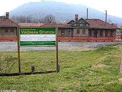
Virginian Railway Passenger Station |
|
May 22, 2003
(#03000456) |
1402 Jefferson St., SE.
37°15′35″N 79°56′28″W / 37.259722°N 79.941111°W / 37.259722; -79.941111 (Virginian Railway Passenger Station) |
|
| 49 |
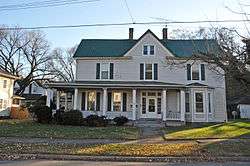
Wasena Historic District |
|
January 3, 2012
(#11000984) |
Wiley Dr., Winchester, Winona, Wasena, Howbert, Valley, Hamilton, Kerns, Floyd, and Summit Aves., Brighton Rd.
37°15′48″N 79°57′36″W / 37.263333°N 79.960000°W / 37.263333; -79.960000 (Wasena Historic District) |
|
.JPG)