| [3] |
Name on the Register[4] |
Image |
Date listed[5] |
Location |
City or town |
Description |
|---|
| 1 |
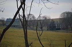
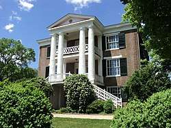
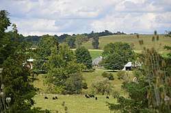
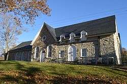
Anderson Hollow Archaeological District |
|
July 21, 1983
(#83003314) |
Western side of Big Hill Rd.[6]
37°51′06″N 79°35′02″W / 37.851667°N 79.583889°W / 37.851667; -79.583889 (Anderson Hollow Archaeological District) |
Lexington |
|
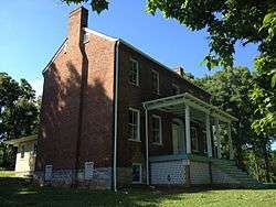
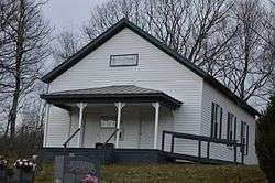
| 2 |
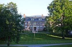
Boxerwood |
|
June 4, 2015
(#15000254) |
963 Ross Rd.
37°46′36″N 79°27′54″W / 37.776667°N 79.465000°W / 37.776667; -79.465000 (Boxerwood) |
Lexington |
|
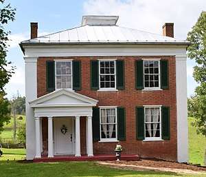
| 3 |
Brownsburg Historic District |
|
July 2, 1973
(#73002055) |
Including the entire village extending 0.5 miles (0.80 km) along State Route 252
37°55′43″N 79°19′09″W / 37.928611°N 79.319167°W / 37.928611; -79.319167 (Brownsburg Historic District) |
Brownsburg |
|
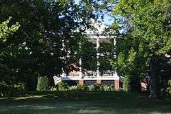
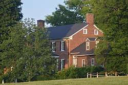
| 4 |
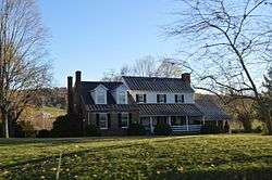
Buffalo Forge (081-0003) |
|
May 26, 2004
(#04000551) |
2694 Forge Rd.
37°41′11″N 79°26′06″W / 37.686389°N 79.435000°W / 37.686389; -79.435000 (Buffalo Forge (081-0003)) |
Glasgow |
|
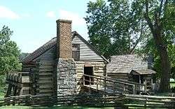
| 5 |
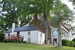
Cedar Hill |
|
July 15, 1994
(#94000726) |
Eastern side of Forge Rd., 2.25 miles (3.62 km) south of its junction with U.S. Route 60
37°43′05″N 79°23′57″W / 37.718056°N 79.399167°W / 37.718056; -79.399167 (Cedar Hill) |
Buena Vista |
|
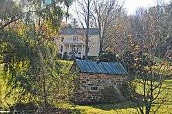
| 6 |
Cedar Hill Church and Cemeteries |
|
February 11, 2002
(#01001570) |
Cedar Hill Church Rd. and Kygers Hill Rd.
37°44′31″N 79°31′34″W / 37.741944°N 79.526111°W / 37.741944; -79.526111 (Cedar Hill Church and Cemeteries) |
Lexington |
|
| 7 |
Chapel Hill |
|
June 8, 2011
(#11000350) |
68 Charming Ln.
37°43′14″N 79°24′45″W / 37.720694°N 79.412500°W / 37.720694; -79.412500 (Chapel Hill) |
Lexington |
|
| 8 |
Church Hill |
|
February 26, 1979
(#79003079) |
6.5 miles (10.5 km) northeast of Lexington off U.S. Route 11 at Interstate 64
37°50′31″N 79°21′32″W / 37.841944°N 79.358889°W / 37.841944; -79.358889 (Church Hill) |
Lexington |
|
| 9 |
Clifton |
|
July 22, 1994
(#94000778) |
Northern side of Old Buena Vista Rd., 2,000 feet (610 m) east of its junction with U.S. Route 11
37°47′29″N 79°25′07″W / 37.791389°N 79.418611°W / 37.791389; -79.418611 (Clifton) |
Lexington |
|
| 10 |
Echols Farm |
|
October 30, 1998
(#98001312) |
Junction of U.S. Route 501 and State Route 130
37°37′47″N 79°26′28″W / 37.629722°N 79.441111°W / 37.629722; -79.441111 (Echols Farm) |
Glasgow |
|
| 11 |
Falling Spring Presbyterian Church Manse |
|
November 16, 2005
(#05001269) |
650 Falling Spring Rd.
37°41′00″N 79°27′34″W / 37.683333°N 79.459444°W / 37.683333; -79.459444 (Falling Spring Presbyterian Church Manse) |
Glasgow |
|
| 12 |
Fancy Hill |
|
September 5, 1997
(#97000957) |
Junction of U.S. Route 11 and Falling Spring Rd.
37°41′23″N 79°29′11″W / 37.689722°N 79.486389°W / 37.689722; -79.486389 (Fancy Hill) |
Glasgow |
|
| 13 |
Glasgow Historic District |
|
October 30, 1995
(#95001170) |
Bounded by 7th, 10th, Gordon, and Powhatan Sts.; also the 900 blocks of Fizlee St. and Rockbridge Rd.
37°38′01″N 79°27′00″W / 37.633611°N 79.450000°W / 37.633611; -79.450000 (Glasgow Historic District) |
Glasgow |
Second set of boundaries represents a boundary increase of May 3, 2006 |
| 14 |
Glen Maury |
|
May 24, 1979
(#79003078) |
West of Buena Vista
37°43′49″N 79°21′46″W / 37.730278°N 79.362778°W / 37.730278; -79.362778 (Glen Maury) |
Buena Vista |
|
| 15 |
Goshen Land Company Bridge |
|
May 15, 1978
(#78003041) |
East of Goshen on Paxton Dr.
37°59′08″N 79°29′38″W / 37.985694°N 79.493889°W / 37.985694; -79.493889 (Goshen Land Company Bridge) |
Goshen |
|
| 16 |
Haines Chapel and Cemetery |
|
February 10, 2014
(#13001174) |
2600 State Route 56
37°53′18″N 79°09′17″W / 37.888333°N 79.154722°W / 37.888333; -79.154722 (Haines Chapel and Cemetery) |
Vesuvius |
Extends into Nelson County |
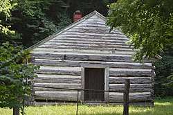
| 17 |
Hamilton Schoolhouse |
|
November 21, 2002
(#02001372) |
S. Buffalo Rd.
37°42′07″N 79°35′49″W / 37.701944°N 79.596944°W / 37.701944; -79.596944 (Hamilton Schoolhouse) |
Lexington |
|
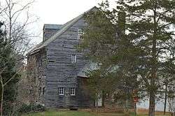
| 18 |
Hays Creek Mill |
|
August 4, 1995
(#95000973) |
Hays Creek Rd., 0.1 miles north of its junction with McElwee Rd.
37°56′08″N 79°20′38″W / 37.935556°N 79.343750°W / 37.935556; -79.343750 (Hays Creek Mill) |
Brownsburg |
|
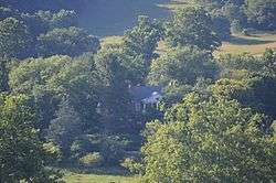
| 19 |
Hickory Hill |
|
August 30, 2006
(#06000760) |
197 Hickory Hill Ln.
37°39′55″N 79°28′43″W / 37.665278°N 79.478611°W / 37.665278; -79.478611 (Hickory Hill) |
Glasgow |
|
| 20 |
Kennedy-Lunsford Farm |
|
June 7, 1996
(#96000592) |
Approximately 0.5 miles south of Raphine Rd. near its junction with Gibbs Run Ln.; also 1194 Raphine Rd.
37°56′13″N 79°16′05″W / 37.937083°N 79.267917°W / 37.937083; -79.267917 (Kennedy-Lunsford Farm) |
Raphine |
1194 Raphine represents a boundary increase of February 22, 1999 |
| 21 |
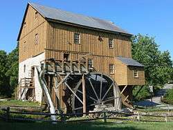
Kennedy-Wade Mill |
|
July 13, 1979
(#79003296) |
2.3 miles northeast of Brownsburg on Raphine Rd.; also Raphine Rd., 2000 feet northeast of its junction with Goose Creek Rd.
37°56′57″N 79°17′10″W / 37.949167°N 79.286111°W / 37.949167; -79.286111 (Kennedy-Wade Mill) |
Raphine |
Second set of boundaries represents a boundary increase of May 26, 1994, the Kennedy-Wade's Mill Historic District |
| 22 |
Level Loop |
|
August 12, 1993
(#93000822) |
Hays Creek Rd., 1 mile west of Brownsburg and 0.5 mile east of McClung's Mill
37°55′57″N 79°20′12″W / 37.932500°N 79.336667°W / 37.932500; -79.336667 (Level Loop) |
Brownsburg |
|
| 23 |
Liberty Hall Site |
|
August 16, 1977
(#77001493) |
West of the Washington and Lee University campus[7]
37°47′34″N 79°27′02″W / 37.792778°N 79.450556°W / 37.792778; -79.450556 (Liberty Hall Site) |
Lexington |
Site of predecessor of Washington and Lee University |
| 24 |
Locust Hill |
|
May 12, 1986
(#86001066) |
Forge Rd.
37°43′55″N 79°24′03″W / 37.731944°N 79.400833°W / 37.731944; -79.400833 (Locust Hill) |
Mechanicsville |
|
| 25 |
William Mackey House |
|
October 29, 1993
(#93001126) |
Timber Ridge Rd., 0.5 miles southeast of its junction with U.S. Route 11
37°50′26″N 79°20′25″W / 37.840556°N 79.340278°W / 37.840556; -79.340278 (William Mackey House) |
Cornwall |
|
| 26 |
Maple Hall |
|
January 29, 1987
(#87000006) |
Junction of Interstates 64 and 81 with U.S. Route 11
37°50′33″N 79°21′51″W / 37.842500°N 79.364167°W / 37.842500; -79.364167 (Maple Hall) |
Lexington |
|
| 27 |
Marlbrook |
|
September 14, 2002
(#02001000) |
4973 Forge Rd.
37°38′48″N 79°29′56″W / 37.646667°N 79.498889°W / 37.646667; -79.498889 (Marlbrook) |
Glasgow |
|
| 28 |
Cyrus McCormick Farm and Workshop |
|
October 15, 1966
(#66000846) |
South of Staunton on U.S. Route 11 and Raphine Rd. at Walnut Grove
37°55′54″N 79°12′52″W / 37.931667°N 79.214444°W / 37.931667; -79.214444 (Cyrus McCormick Farm and Workshop) |
Steeles Tavern |
|
| 29 |
John Moore House |
|
June 25, 1999
(#99000728) |
183 Big Hill Rd.
37°51′42″N 79°33′05″W / 37.861528°N 79.551389°W / 37.861528; -79.551389 (John Moore House) |
Lexington |
|
| 30 |
Mountain View Farm |
|
January 27, 2000
(#99001723) |
199 Fredericksburg Rd.
37°51′50″N 79°29′02″W / 37.863889°N 79.483889°W / 37.863889; -79.483889 (Mountain View Farm) |
Lexington |
|
| 31 |
Mulberry Grove |
|
July 28, 1994
(#94000761) |
Southern side of Hays Creek Rd., 5000 feet southeast of its junction with State Route 252
37°55′24″N 79°18′22″W / 37.923333°N 79.306111°W / 37.923333; -79.306111 (Mulberry Grove) |
Brownsburg |
|
| 32 |
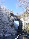
Natural Bridge |
|
November 18, 1997
(#97001401) |
Junction of U.S. Route 11 and State Route 130
37°37′41″N 79°32′41″W / 37.628056°N 79.544722°W / 37.628056; -79.544722 (Natural Bridge) |
Natural Bridge |
|
| 33 |
Natural Bridge Historic District |
|
February 2, 2016
(#15001047) |
U.S. Route 11 and State Route 130
37°37′48″N 79°32′40″W / 37.630000°N 79.544444°W / 37.630000; -79.544444 (Natural Bridge Historic District) |
Natural Bridge |
|
| 34 |
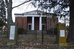
New Providence Presbyterian Church |
|
March 26, 1980
(#80004223) |
Northeast of Brownsburg
37°57′07″N 79°18′08″W / 37.951806°N 79.302222°W / 37.951806; -79.302222 (New Providence Presbyterian Church) |
Brownsburg |
|
| 35 |
Oak Spring Farm |
|
October 19, 1994
(#94000780) |
Borden Grant Trail at its junction with U.S. Route 11
37°54′22″N 79°14′01″W / 37.906111°N 79.233611°W / 37.906111; -79.233611 (Oak Spring Farm) |
Steeles Tavern |
|
| 36 |
Margaret E. Poague House |
|
March 29, 2007
(#07000236) |
4907 S. U.S. Route 11
37°39′41″N 79°30′36″W / 37.661389°N 79.510000°W / 37.661389; -79.510000 (Margaret E. Poague House) |
Lexington |
|
| 37 |
Rockbridge Alum Springs Historic District |
|
January 19, 1989
(#88003204) |
Off Rockbridge Alum Springs Rd.[8]
37°54′27″N 79°36′40″W / 37.907500°N 79.611111°W / 37.907500; -79.611111 (Rockbridge Alum Springs Historic District) |
California |
|
| 38 |
Rockbridge Inn |
|
April 7, 1995
(#95000398) |
Northern side of Herring Hall Rd. at its junction with Rices Hill Rd.
37°39′19″N 79°32′15″W / 37.655278°N 79.537500°W / 37.655278; -79.537500 (Rockbridge Inn) |
Natural Bridge |
|
| 39 |
Scott-Hutton Farm |
|
August 28, 2017
(#100001516) |
1892 Turnpike Rd.
37°47′09″N 79°33′07″W / 37.785833°N 79.551944°W / 37.785833; -79.551944 (Scott-Hutton Farm) |
Lexington |
|
| 40 |
Springdale |
|
February 14, 2006
(#05001273) |
70 Gilmore Ln.
37°44′23″N 79°25′11″W / 37.739861°N 79.419722°W / 37.739861; -79.419722 (Springdale) |
Lexington |
|
| 41 |
Stone House |
|
May 24, 1979
(#79003080) |
West of Lexington on Ross Rd.
37°46′31″N 79°27′35″W / 37.775278°N 79.459722°W / 37.775278; -79.459722 (Stone House) |
Lexington |
|
| 42 |
Sunnyside |
|
September 14, 2002
(#02001003) |
160 Kendal Dr.
37°46′48″N 79°27′38″W / 37.780000°N 79.460556°W / 37.780000; -79.460556 (Sunnyside) |
Lexington |
|
| 43 |
Tankersley Tavern |
|
November 3, 1988
(#88002179) |
Furrs Mill Rd.
37°47′38″N 79°25′42″W / 37.793750°N 79.428333°W / 37.793750; -79.428333 (Tankersley Tavern) |
Lexington |
|
| 44 |
Thorn Hill |
|
June 18, 1975
(#75002035) |
Southwest of Lexington off State Route 251
37°45′49″N 79°27′54″W / 37.763611°N 79.465000°W / 37.763611; -79.465000 (Thorn Hill) |
Lexington |
|
| 45 |
Timber Ridge Presbyterian Church |
|
November 12, 1969
(#69000278) |
Southwest of the junction of U.S. Route 11 and Timber Ridge Rd.
37°50′34″N 79°21′30″W / 37.842778°N 79.358333°W / 37.842778; -79.358333 (Timber Ridge Presbyterian Church) |
Lexington |
|
| 46 |
Vine Forest |
|
August 23, 1991
(#91001084) |
U.S. Route 11, 2 miles west of Natural Bridge
37°37′31″N 79°34′43″W / 37.625278°N 79.578611°W / 37.625278; -79.578611 (Vine Forest) |
Natural Bridge |
|
| 47 |
Virginia Manor |
|
September 10, 1987
(#87001549) |
State Route 130
37°37′06″N 79°29′19″W / 37.618333°N 79.488611°W / 37.618333; -79.488611 (Virginia Manor) |
Natural Bridge |
|
| 48 |
Willson House |
|
December 3, 2009
(#09001049) |
367 Wee Darnock Way
37°47′57″N 79°30′27″W / 37.799167°N 79.507500°W / 37.799167; -79.507500 (Willson House) |
Lexington |
|


.jpg)


.jpg)
.jpg)
.jpg)

