| [3] |
Name on the Register[4] |
Image |
Date listed[5] |
Location |
City or town |
Description |
|---|
| 1 |
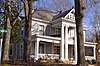
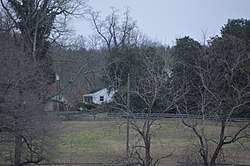
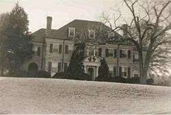
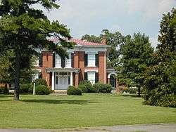
Berry Hill |
|
November 25, 1969
(#69000246) |
South of the junction of River and Berry Hill Rds.
36°41′55″N 78°56′38″W / 36.698611°N 78.943889°W / 36.698611; -78.943889 (Berry Hill) |
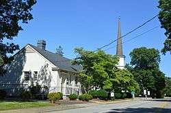
South Boston |
|
| 2 |
Black Walnut |
|
October 29, 1991
(#91001597) |
Black Walnut Rd., 850 feet (260 m) south of its junction with Green Valley Rd.
36°51′49″N 78°43′20″W / 36.863611°N 78.722222°W / 36.863611; -78.722222 (Black Walnut) |
Clover |
|
| 3 |
Bloomsburg (Watkins House) |
|
August 28, 2017
(#100001509) |
9000 U.S. Route 58
36°37′59″N 79°01′16″W / 36.633056°N 79.021111°W / 36.633056; -79.021111 (Bloomsburg (Watkins House)) |
South Boston |
|
| 4 |
Brandon Plantation |
|
April 26, 1996
(#96000495) |
Coleman Dr., 500 feet (150 m) west of its junction with Henderson Rd.
36°34′38″N 79°07′07″W / 36.577222°N 79.118611°W / 36.577222; -79.118611 (Brandon Plantation) |
Alton |
|
| 5 |
Brandon-on-the-Dan |
|
August 28, 2017
(#100001510) |
1072 State Route 119
36°34′51″N 79°08′28″W / 36.580833°N 79.141111°W / 36.580833; -79.141111 (Brandon-on-the-Dan) |
Alton |
|
| 6 |
Brooklyn Store and Post Office |
|
January 22, 1996
(#95001557) |
Northern side of Brooklyn Rd., 0.1 miles (0.16 km) west of its junction with Jeremy Creek Rd.
36°40′38″N 79°09′05″W / 36.677222°N 79.151250°W / 36.677222; -79.151250 (Brooklyn Store and Post Office) |
Brooklyn |
|
| 7 |
Brooklyn Tobacco Factory |
|
January 22, 1996
(#95001559) |
Northern side of River Rd., 0.25 miles (0.40 km) east of its junction with Jeremy Creek Rd.
36°40′45″N 79°08′42″W / 36.679167°N 79.145000°W / 36.679167; -79.145000 (Brooklyn Tobacco Factory) |
Brooklyn |
|
| 8 |
Buckshoal Farm |
|
September 16, 1987
(#87001473) |
Hudson Rd.
36°38′34″N 78°46′14″W / 36.642639°N 78.770556°W / 36.642639; -78.770556 (Buckshoal Farm) |
Omega |
|
| 9 |
Carlbrook |
|
May 26, 2000
(#00000556) |
Carlbrook Rd. at its junction with Hummingbird Ln.
36°43′42″N 79°08′10″W / 36.728333°N 79.136111°W / 36.728333; -79.136111 (Carlbrook) |
Halifax |
|
| 10 |
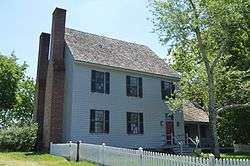
Carter's Tavern |
|
October 11, 1974
(#74002120) |
Southeast of Ingram
36°40′31″N 79°08′03″W / 36.675278°N 79.134167°W / 36.675278; -79.134167 (Carter's Tavern) |
Paces |
|
| 11 |
Cedar Grove |
|
August 28, 2017
(#100001511) |
1083 Blanes Mill Ln.
36°36′37″N 78°59′31″W / 36.610278°N 78.991944°W / 36.610278; -78.991944 (Cedar Grove) |
Alton |
|
| 12 |
Clarkton Bridge |
|
January 26, 2007
(#06000747) |
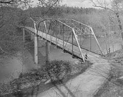
Clarkton Bridge Rd. over the Staunton River
36°58′40″N 78°53′49″W / 36.977778°N 78.896944°W / 36.977778; -78.896944 (Clarkton Bridge) |
Nathalie |
Extends into Charlotte County |
| 13 |
Collins Ferry Historic District |
|
November 28, 2012
(#12000986) |
McKeever Trail and Bull Creek Rd.
37°02′19″N 79°02′23″W / 37.038611°N 79.039722°W / 37.038611; -79.039722 (Collins Ferry Historic District) |
Nathalie |
|
| 14 |
The Cove |
|
May 11, 2006
(#06000407) |
5059 Cove Rd.
36°58′57″N 78°44′40″W / 36.982500°N 78.744444°W / 36.982500; -78.744444 (The Cove) |
Harrisburg |
|
| 15 |
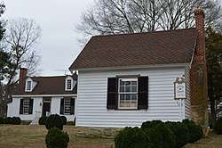
DeJarnette's Tavern |
|
May 2, 2007
(#07000398) |
4080 Stagecoach Rd.
37°00′48″N 79°00′21″W / 37.013333°N 79.005833°W / 37.013333; -79.005833 (DeJarnette's Tavern) |
Nathalie |
Late 18th century stagecoach station and tavern. |
| 16 |
Dewberry Hill |
|
February 13, 2018
(#100002133) |
2181 Wilkins Rd.
36°35′48″N 79°02′52″W / 36.596667°N 79.047778°W / 36.596667; -79.047778 (Dewberry Hill) |
Alton |
|
| 17 |
E. L. Evans House |
|
May 8, 2008
(#08000388) |
1204 Washington Ave.
36°42′16″N 78°54′02″W / 36.704444°N 78.900556°W / 36.704444; -78.900556 (E. L. Evans House) |
South Boston |
|
| 18 |
Fourqurean House |
|
May 6, 1980
(#80004192) |
2.4 miles (3.9 km) southwest of South Boston
36°39′20″N 78°56′28″W / 36.655556°N 78.941111°W / 36.655556; -78.941111 (Fourqurean House) |
South Boston |
|
| 19 |
Glennmary |
|
February 1, 1979
(#79003043) |
Southwest of South Boston on U.S. Route 58
36°40′49″N 78°55′58″W / 36.680139°N 78.932778°W / 36.680139; -78.932778 (Glennmary) |
South Boston |
|
| 20 |
Glenwood |
|
August 28, 2017
(#100001512) |
7040 U.S. Route 58
36°39′08″N 78°59′54″W / 36.652361°N 78.998333°W / 36.652361; -78.998333 (Glenwood) |
South Boston |
|
| 21 |
Halifax County Courthouse |
|
September 16, 1982
(#82004563) |
Junction of U.S. Routes 360 and 501
36°45′56″N 78°55′46″W / 36.765556°N 78.929444°W / 36.765556; -78.929444 (Halifax County Courthouse) |
Halifax |
|
| 22 |
Indian Jim's Cave |
|
August 26, 1982
(#82004562) |
Address Restricted
|
Brookneal |
|
| 23 |
Mountain Road Historic District |
|
October 6, 1983
(#83004245) |
Roughly Mountain Rd. from Mimosa Dr. to Academy St.; also Mountain Rd., Academy St., and Poplar Ln.
36°46′03″N 78°56′03″W / 36.767500°N 78.934167°W / 36.767500; -78.934167 (Mountain Road Historic District) |
Halifax |
Second set of boundaries represents a boundary increase of August 24, 2015 |
| 24 |
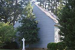
Old Providence Presbyterian Church |
|
July 7, 1988
(#88001013) |
Cole Ferry Rd.
36°56′16″N 78°49′10″W / 36.937778°N 78.819444°W / 36.937778; -78.819444 (Old Providence Presbyterian Church) |
Providence |
|
| 25 |
Pleasant Grove |
|
August 5, 1999
(#99000966) |
Deer Run Rd.
36°43′30″N 79°02′55″W / 36.725000°N 79.048611°W / 36.725000; -79.048611 (Pleasant Grove) |
Halifax |
|
| 26 |
Redfield |
|
September 20, 1978
(#78003020) |
3 miles (4.8 km) southeast of Oak Level on Oak Level Rd.
36°42′02″N 79°04′39″W / 36.700556°N 79.077500°W / 36.700556; -79.077500 (Redfield) |
Oak Level |
|
| 27 |
Reedy Creek Site |
|
April 26, 1978
(#78003187) |
Northern side of the Dan River at the Reedy Creek confluence[6]:154
36°41′40″N 78°52′39″W / 36.694444°N 78.877500°W / 36.694444; -78.877500 (Reedy Creek Site) |
South Boston |
|
| 28 |
Riverside |
|
February 13, 2018
(#100002134) |
11161 River Rd.
36°39′42″N 79°04′26″W / 36.661667°N 79.073889°W / 36.661667; -79.073889 (Riverside) |
Sutherlin |
|
| 29 |
Seaton |
|
May 19, 1980
(#80004193) |
North of South Boston on U.S. Route 501
36°44′41″N 78°55′22″W / 36.744722°N 78.922778°W / 36.744722; -78.922778 (Seaton) |
South Boston |
|
| 30 |
South Boston Historic District |
|
September 26, 1986
(#86002471) |
Along Railroad Ave., Ferry, Factory, and Main Sts., Wilborn Ave., N. Main St., Washington and Peach Aves., and Jeffress; also neighborhoods of Marshall Ave., New Brick Warehouse, Mizpah Church, N. Main St.
36°41′51″N 78°54′05″W / 36.697500°N 78.901389°W / 36.697500; -78.901389 (South Boston Historic District) |
South Boston |
Second set of boundaries represents a boundary increase of June 11, 2009 |
| 31 |
Staunton River Bridge Fortification |
|
November 19, 2014
(#04000577) |
Fort Hill Trail at Staunton River Battlefield State Park[7]
36°52′54″N 78°42′06″W / 36.881667°N 78.701667°W / 36.881667; -78.701667 (Staunton River Bridge Fortification) |
Randolph |
|
| 32 |
Staunton River State Park Historic District |
|
May 4, 2007
(#07000402) |
1170 Staunton Trail
36°41′58″N 78°40′04″W / 36.699444°N 78.667778°W / 36.699444; -78.667778 (Staunton River State Park Historic District) |
Scottsburg |
|
| 33 |
Tarover |
|
September 20, 1978
(#78003021) |
West of South Boston on River Rd.
36°42′02″N 78°57′54″W / 36.700694°N 78.965000°W / 36.700694; -78.965000 (Tarover) |
South Boston |
|
| 34 |
Dr. Richard Thornton House |
|
November 28, 2012
(#12000987) |
Golden Leaf and Tobacco Rds.
36°58′38″N 79°01′58″W / 36.977222°N 79.032778°W / 36.977222; -79.032778 (Dr. Richard Thornton House) |
Nathalie |
|
| 35 |
Town of Halifax Court House Historic District |
|
January 28, 2011
(#10001187) |
Main St., Cemetery St., Prizery St., Edmunds Boulevard, Mary Bethune St., Cowford Rd., Maple Ave., Church St., and Cary St.
36°45′58″N 78°55′43″W / 36.766111°N 78.928611°W / 36.766111; -78.928611 (Town of Halifax Court House Historic District) |
Halifax |
|
| 36 |
Walters-Moshier House |
|
February 14, 2018
(#100002135) |
1421 N. Main St.
36°42′29″N 78°53′56″W / 36.708194°N 78.898889°W / 36.708194; -78.898889 (Walters-Moshier House) |
South Boston |
|
.jpg)
.jpg)
.jpg)
.jpg)
.jpg)
.jpg)
.jpg)