| [3] |
Name on the Register[4] |
Image |
Date listed[5] |
Location |
City or town |
Description |
|---|
| 1 |
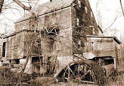
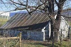
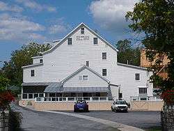
Bauserman Farm |
|
December 27, 2010
(#10001064) |
10107 S. Middle Rd.
38°46′44″N 78°39′04″W / 38.778750°N 78.651111°W / 38.778750; -78.651111 (Bauserman Farm) |
Mount Jackson |
|
| 2 |
Abraham Beydler House |
|
February 7, 2002
(#01001568) |
2748 Zion Church Rd.
38°54′37″N 78°25′42″W / 38.910278°N 78.428333°W / 38.910278; -78.428333 (Abraham Beydler House) |
Maurertown |
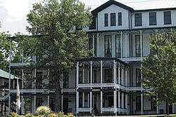
|
| 3 |
Jacob Bowman House |
|
February 21, 2017
(#100000679) |
2470 Polk Rd.
38°48′49″N 78°36′34″W / 38.813611°N 78.609444°W / 38.813611; -78.609444 (Jacob Bowman House) |
Edinburg |
|
| 4 |
Bowman-Zirkle Farm |
|
August 21, 2009
(#09000642) |
12097 S. Middle Rd.
38°47′56″N 78°37′33″W / 38.798889°N 78.625833°W / 38.798889; -78.625833 (Bowman-Zirkle Farm) |
Edinburg |
|
| 5 |
Campbell Farm |
|
August 15, 1990
(#90001416) |
Stoney Creek Rd., near Lantz Mills
38°50′34″N 78°35′34″W / 38.842778°N 78.592778°W / 38.842778; -78.592778 (Campbell Farm) |
Edinburg |
|
| 6 |
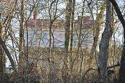
Cedar Creek Battlefield and Belle Grove |
|
August 11, 1969
(#69000243) |
On Interstate 81 between Middletown and Strasburg
38°59′15″N 78°19′24″W / 38.987500°N 78.323333°W / 38.987500; -78.323333 (Cedar Creek Battlefield and Belle Grove) |
Middletown |
Site of the Battle of Cedar Creek; designated a National Historic Landmark District in 1969. Extends into Frederick County. |
| 7 |
Clem-Kagey Farm |
|
August 20, 2009
(#09000643) |
291 Belgravia Rd.
38°47′44″N 78°37′22″W / 38.795417°N 78.622778°W / 38.795417; -78.622778 (Clem-Kagey Farm) |
Edinburg |
|
| 8 |
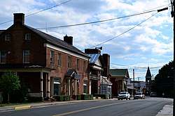
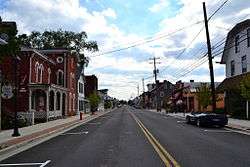
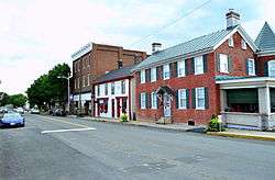
Edinburg Historic District |
|
July 22, 1998
(#98000845) |
Roughly along Stony Creek Boulevard and Shenandoah and Railroad Aves.
38°49′20″N 78°33′52″W / 38.822222°N 78.564444°W / 38.822222; -78.564444 (Edinburg Historic District) |
Edinburg |
|
| 9 |
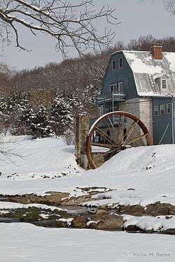
Edinburg Mill |
|
September 7, 1979
(#79003084) |
U.S. Route 11
38°49′16″N 78°34′06″W / 38.821111°N 78.568333°W / 38.821111; -78.568333 (Edinburg Mill) |
Edinburg |
|
| 10 |
Forestville Historic District |
|
November 30, 2011
(#11000874) |
Junction of State Route 42 with Middle and Quicksburg Rds.
38°42′55″N 78°43′23″W / 38.715278°N 78.723056°W / 38.715278; -78.723056 (Forestville Historic District) |
Forestville |
|
| 11 |
Fort Bowman |
|
November 25, 1969
(#69000279) |
Fort Bowman Rd.
39°00′10″N 78°19′31″W / 39.002778°N 78.325278°W / 39.002778; -78.325278 (Fort Bowman) |
Middletown |
|
| 12 |
Funkhouser Farm |
|
June 4, 2018
(#100002533) |
27812 Old Valley Pike
38°57′24″N 78°25′18″W / 38.956667°N 78.421667°W / 38.956667; -78.421667 (Funkhouser Farm) |
Toms Brook |
|
| 13 |
Dr. Christian Hockman House |
|
February 23, 1984
(#84003593) |
U.S. Route 11
38°49′45″N 78°33′04″W / 38.829167°N 78.551111°W / 38.829167; -78.551111 (Dr. Christian Hockman House) |
Edinburg |
|
| 14 |
Hupp House |
|
February 21, 1997
(#97000155) |
551 N. Massanutten St.
38°59′43″N 78°21′20″W / 38.995139°N 78.355556°W / 38.995139; -78.355556 (Hupp House) |
Strasburg |
|
| 15 |
Lantz Hall |
|
December 30, 1992
(#92001711) |
614 S. Main St. (U.S. Route 11)
38°52′33″N 78°30′39″W / 38.875833°N 78.510833°W / 38.875833; -78.510833 (Lantz Hall) |
Woodstock |
|
| 16 |
Lantz Mill |
|
November 1, 2007
(#07001145) |
95 Swover Creek Rd.
38°50′26″N 78°35′43″W / 38.840556°N 78.595278°W / 38.840556; -78.595278 (Lantz Mill) |
Edinburg |
|
| 17 |
John Miley Maphis House |
|
November 22, 2011
(#11000840) |
56 Bell's Ln.
38°50′21″N 78°35′52″W / 38.839167°N 78.597778°W / 38.839167; -78.597778 (John Miley Maphis House) |
Edinburg |
|
| 18 |
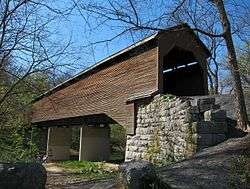
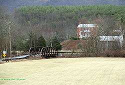
Meems Bottom Covered Bridge |
|
June 10, 1975
(#75002037) |
South of Mt. Jackson on Wissler Rd. over the North Fork of the Shenandoah River
38°43′15″N 78°39′19″W / 38.720833°N 78.655278°W / 38.720833; -78.655278 (Meems Bottom Covered Bridge) |
Mount Jackson |
|
| 19 |
J.W.R. Moore House |
|
November 16, 2005
(#05001275) |
5588 Main St.
38°45′11″N 78°38′01″W / 38.752917°N 78.633611°W / 38.752917; -78.633611 (J.W.R. Moore House) |
Mount Jackson |
|
| 20 |
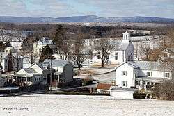
Mount Jackson Historic District |
|
June 17, 1993
(#93000541) |
Main, King, Gospel, Broad, Bridge, Race, Clifford, Tisinger, and Wunder Sts., and Orkney Dr.
38°44′44″N 78°38′35″W / 38.745556°N 78.643056°W / 38.745556; -78.643056 (Mount Jackson Historic District) |
Mount Jackson |
|
| 21 |
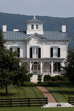
Mount Pleasant |
|
August 18, 2011
(#11000553) |
292 Hite Ln.
39°00′02″N 78°20′04″W / 39.000556°N 78.334444°W / 39.000556; -78.334444 (Mount Pleasant) |
Strasburg |
|
| 22 |
Daniel Munch House |
|
March 13, 2002
(#02000181) |
2588 Seven Fountains Rd.
38°51′15″N 78°24′01″W / 38.854167°N 78.400278°W / 38.854167; -78.400278 (Daniel Munch House) |
Fort Valley |
|
| 23 |
New Market Battlefield Park |
|
September 15, 1970
(#70000824) |
North of the junction of U.S. Routes 11 and 211
38°39′58″N 78°40′06″W / 38.666111°N 78.668333°W / 38.666111; -78.668333 (New Market Battlefield Park) |
New Market |
|
| 24 |
New Market Historic District |
|
September 22, 1972
(#72001416) |
Junction of U.S. Routes 11 and 211
38°38′49″N 78°40′20″W / 38.646944°N 78.672222°W / 38.646944; -78.672222 (New Market Historic District) |
New Market |
|
| 25 |
Orkney Springs Hotel |
|
April 22, 1976
(#76002119) |
State Route 263 west of its junction with Orkney Springs Rd.
38°47′41″N 78°48′56″W / 38.794722°N 78.815556°W / 38.794722; -78.815556 (Orkney Springs Hotel) |
Orkney Springs |
|
| 26 |
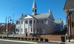
Shenandoah County Courthouse |
|
June 19, 1973
(#73002060) |
W. Court and S. Main Sts.
38°52′56″N 78°30′20″W / 38.882222°N 78.505556°W / 38.882222; -78.505556 (Shenandoah County Courthouse) |
Woodstock |
|
| 27 |
Shenandoah County Farm |
|
October 29, 1993
(#93001122) |
Northern side of Zion Church Rd., 4,000 feet (1,200 m) east of the junction with U.S. Route 11
38°55′54″N 78°27′01″W / 38.931667°N 78.450278°W / 38.931667; -78.450278 (Shenandoah County Farm) |
Maurertown |
|
| 28 |
Snapp House |
|
May 7, 1979
(#79003085) |
Southwest of Fishers Hill on Copp Rd.
38°58′22″N 78°25′29″W / 38.972639°N 78.424722°W / 38.972639; -78.424722 (Snapp House) |
Fishers Hill |
|
| 29 |
Stoner-Keller House and Mill |
|
February 5, 2013
(#12001269) |
2900 Battlefield Rd.
38°59′10″N 78°23′58″W / 38.986111°N 78.399444°W / 38.986111; -78.399444 (Stoner-Keller House and Mill) |
Strasburg |
|
| 30 |
Strasburg Historic District |
|
August 16, 1984
(#84003595) |
Roughly bounded by railroad tracks and 3rd, High, and Massanutten Sts.
38°59′20″N 78°21′54″W / 38.988889°N 78.364972°W / 38.988889; -78.364972 (Strasburg Historic District) |
Strasburg |
|
| 31 |
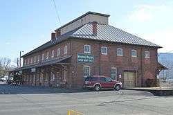
Strasburg Stone and Earthenware Manufacturing Company |
|
June 19, 1979
(#79003086) |
E. King St.
38°59′14″N 78°21′21″W / 38.987361°N 78.355833°W / 38.987361; -78.355833 (Strasburg Stone and Earthenware Manufacturing Company) |
Strasburg |
|
| 32 |
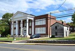
Toms Brook School |
|
August 18, 2011
(#11000554) |
3232 S. Main St.
38°56′37″N 78°26′36″W / 38.943611°N 78.443333°W / 38.943611; -78.443333 (Toms Brook School) |
Toms Brook |
|
| 33 |
Benjamin Wierman House |
|
February 21, 2008
(#08000077) |
4049 Flat Rock Rd.
38°42′57″N 78°45′27″W / 38.715833°N 78.757500°W / 38.715833; -78.757500 (Benjamin Wierman House) |
Quicksburg |
|
| 34 |
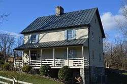
Wilkins Farm |
|
February 10, 2014
(#13001175) |
989 Swover Creek Rd.
38°50′23″N 78°36′34″W / 38.839833°N 78.609583°W / 38.839833; -78.609583 (Wilkins Farm) |
Edinburg |
|
| 35 |
Woodstock Historic District |
|
October 25, 1995
(#95001089) |
Roughly bounded by N. Main, E. North, and Water Sts., Cemetery Rd., and the Norfolk Southern railroad tracks
38°52′55″N 78°30′19″W / 38.881944°N 78.505278°W / 38.881944; -78.505278 (Woodstock Historic District) |
Woodstock |
|
| 36 |
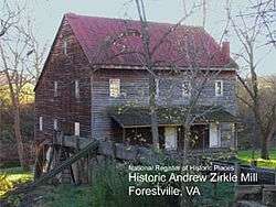
Zirkle Mill |
|
February 10, 1983
(#83003316) |
West of Quicksburg on State Route 42
38°42′50″N 78°43′20″W / 38.713889°N 78.722222°W / 38.713889; -78.722222 (Zirkle Mill) |
Quicksburg |
|
.jpg)