| [3] |
Name on the Register[4] |
Image |
Date listed[5] |
Location |
Description |
|---|
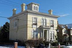
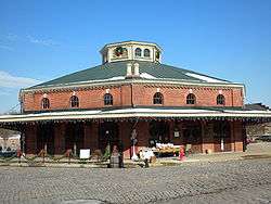
| 1 |
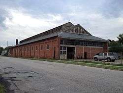
Appomattox Iron Works |
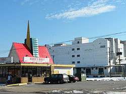
|
August 11, 1976
(#76002226) |
20-28 Old St.
37°13′58″N 77°24′22″W / 37.232778°N 77.406111°W / 37.232778; -77.406111 (Appomattox Iron Works) |
|
| 2 |
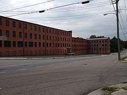
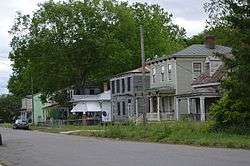
Atlantic Coast Line Railroad Commercial and Industrial Historic District |
|
August 27, 2009
(#09000665) |
200-300 W. Washington, 4-42 S. Market, 100-100 Perry, the 200-300 blocks of W. Wythe, and the 200 block of Brown Sts.
37°13′28″N 77°24′29″W / 37.224444°N 77.408056°W / 37.224444; -77.408056 (Atlantic Coast Line Railroad Commercial and Industrial Historic District) |
|
| 3 |
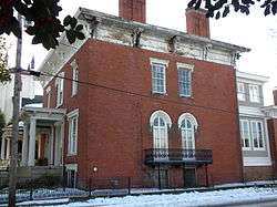
Battersea |
|
November 12, 1969
(#69000344) |
1289 Upper Appomattox St.
37°13′32″N 77°25′42″W / 37.225556°N 77.428333°W / 37.225556; -77.428333 (Battersea) |
|
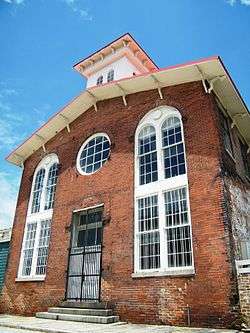
| 4 |
Blandford Cemetery |
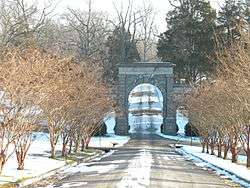
|
October 15, 1992
(#92001371) |
319 S. Crater Rd.
37°13′33″N 77°22′50″W / 37.225833°N 77.380556°W / 37.225833; -77.380556 (Blandford Cemetery) |
Burial ground for 30,000 Confederates killed in the Siege of Petersburg (1864-1865); one of several sites claiming to have celebrated the first Memorial Day ceremony, in 1866, in the United States |
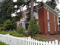
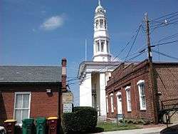
| 5 |
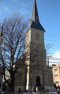
Blandford Church |
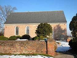
|
May 31, 1972
(#72001513) |
319 S. Crater Rd.
37°13′34″N 77°23′15″W / 37.226111°N 77.387500°W / 37.226111; -77.387500 (Blandford Church) |
|
| 6 |
Anna P. Bolling Junior High School |
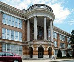
|
October 30, 1998
(#98001316) |
35 W. Fillmore St.
37°13′19″N 77°24′09″W / 37.221944°N 77.402500°W / 37.221944; -77.402500 (Anna P. Bolling Junior High School) |
|
| 7 |
Centre Hill |
|
December 27, 1972
(#72001514) |
Center Hill Lane
37°13′50″N 77°24′05″W / 37.230556°N 77.401389°W / 37.230556; -77.401389 (Centre Hill) |
|
| 8 |
Centre Hill Historic District |
|
June 13, 1986
(#86001277) |
Henry, N. Adams, N. Jefferson, Franklin, and E. Washington Sts., Centre Hill Ct., and Centre Hill Ave.
37°13′46″N 77°24′00″W / 37.229444°N 77.400000°W / 37.229444; -77.400000 (Centre Hill Historic District) |
|
| 9 |
City Market |
|
June 11, 1969
(#69000345) |
Rock, W. Old and River Sts., and Cockade Alley
37°14′00″N 77°24′15″W / 37.233333°N 77.404167°W / 37.233333; -77.404167 (City Market) |
|
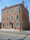
| 10 |
Cohen House |
|
November 1, 2007
(#07001141) |
32 S. Adams St.
37°13′37″N 77°24′06″W / 37.226806°N 77.401667°W / 37.226806; -77.401667 (Cohen House) |
|
| 11 |
Commerce Street Industrial Historic District |
|
September 12, 2008
(#08000870) |
Commerce, Upper Appomattox, West, Dunlop, and South Sts.
37°13′32″N 77°25′12″W / 37.225556°N 77.420000°W / 37.225556; -77.420000 (Commerce Street Industrial Historic District) |
|
| 12 |
Exchange Building |
|
June 11, 1969
(#69000322) |
15-19 W. Bank St.
37°13′55″N 77°24′20″W / 37.231944°N 77.405556°W / 37.231944; -77.405556 (Exchange Building) |
|
| 13 |
Farmers' Bank |
|
April 13, 1972
(#72001515) |
Northwestern corner of Bollingbrook St. and Cockade Alley
37°13′58″N 77°24′15″W / 37.232778°N 77.404167°W / 37.232778; -77.404167 (Farmers' Bank) |
|
| 14 |
Folly Castle Historic District |
|
July 16, 1980
(#80004313) |
Perry and W. Washington Sts.; also 235-618 Washington, 235-580 Hinton, 15-37 Guarantee, 18-115 Lafayette, and 18-42 Perry Sts.; also roughly along South St. from Commerce St. to Farmer St.
37°13′37″N 77°24′34″W / 37.226944°N 77.409444°W / 37.226944; -77.409444 (Folly Castle Historic District) |
Second and third sets of boundaries represent boundary increases of April 14, 1992 and January 10, 2000 |
| 15 |
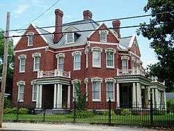
Nathaniel Friend House |
|
August 11, 1976
(#76002227) |
27-29 Bollingbrook St.
37°13′58″N 77°24′14″W / 37.232778°N 77.403889°W / 37.232778; -77.403889 (Nathaniel Friend House) |
|
| 16 |
Lee Memorial Park |
|
August 14, 2000
(#00000896) |
1832 Johnson Rd.
37°11′57″N 77°24′24″W / 37.199167°N 77.406667°W / 37.199167; -77.406667 (Lee Memorial Park) |
|
| 17 |
McIlwaine House |
|
July 16, 1973
(#73002217) |
Market Square at corner of Pelham and Cockade Alleys
37°14′00″N 77°24′14″W / 37.233333°N 77.403889°W / 37.233333; -77.403889 (McIlwaine House) |
|
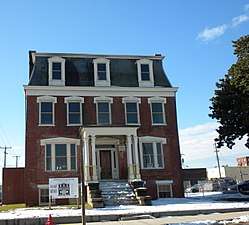
| 18 |
William McKenney House |
|
December 6, 1990
(#90001830) |
250 S. Sycamore St.
37°13′24″N 77°24′07″W / 37.223333°N 77.401944°W / 37.223333; -77.401944 (William McKenney House) |
|
| 19 |
North Battersea-Pride's Field Historic District |
|
May 26, 2005
(#05000475) |
Roughly along the Appomattox River bank, McKenzie, W. High., Upper Appomattox Sts., from 1250 W. High to Fleet Sts.
37°13′36″N 77°25′21″W / 37.226667°N 77.422500°W / 37.226667; -77.422500 (North Battersea-Pride's Field Historic District) |
|
| 20 |
Peabody Building of the Peabody-Williams School |
|
August 2, 2000
(#00000891) |
Jones St.
37°13′04″N 77°24′41″W / 37.217778°N 77.411389°W / 37.217778; -77.411389 (Peabody Building of the Peabody-Williams School) |
|
| 21 |
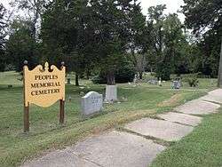
People's Memorial Cemetery |
|
March 28, 2008
(#08000245) |
334 S. Crater Rd.
37°13′30″N 77°23′20″W / 37.225000°N 77.388889°W / 37.225000; -77.388889 (People's Memorial Cemetery) |
|
| 22 |
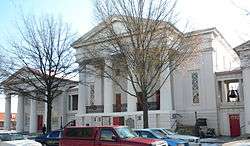
Petersburg City Hall |
|
November 16, 1978
(#78003185) |
129-141 N. Union St.
37°13′47″N 77°24′19″W / 37.229722°N 77.405278°W / 37.229722; -77.405278 (Petersburg City Hall) |
|
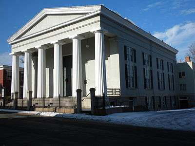
| 23 |
Petersburg Courthouse |
|
May 14, 1973
(#73002218) |
Court House Sq.
37°13′51″N 77°24′13″W / 37.230833°N 77.403611°W / 37.230833; -77.403611 (Petersburg Courthouse) |
|
| 24 |
Petersburg Courthouse Historic District |
|
December 21, 1990
(#90001572) |
Roughly bounded by W. Bank, N. Adams, W. Washington, and N. Market Sts.
37°13′49″N 77°24′18″W / 37.230278°N 77.405000°W / 37.230278; -77.405000 (Petersburg Courthouse Historic District) |
|
| 25 |
Petersburg Old Town Historic District |
|
July 4, 1980
(#80004314) |
U.S. Route 1 and State Route 36; also 241 4th St., 223-225 Henry St., and 230 and 316 E. Bank St.
37°13′55″N 77°24′37″W / 37.231944°N 77.410278°W / 37.231944; -77.410278 (Petersburg Old Town Historic District) |
Second set of boundaries represents a boundary increase of September 12, 2008 |
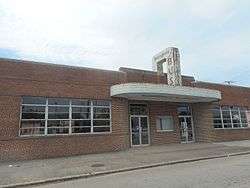
| 26 |
Petersburg Trailways Bus Station |
|
September 29, 2015
(#15000680) |
108 E. Washington St.
37°13′41″N 77°24′05″W / 37.227917°N 77.401389°W / 37.227917; -77.401389 (Petersburg Trailways Bus Station) |
|
| 27 |
Pocahontas Island Historic District |
|
November 3, 2006
(#06000977) |
Pocahontas, Witten, Rolfe, Logan, and Sapony Sts.
37°14′12″N 77°23′57″W / 37.236667°N 77.399167°W / 37.236667; -77.399167 (Pocahontas Island Historic District) |
|
| 28 |
Poplar Lawn Historic District |
|
May 23, 1980
(#80004315) |
Roughly bounded by Surrey Lane and St. Jefferson, Mars, and Harrison Sts.; also the junction of E. Wythe and S. Jefferson, from the southeastern section of the original historic district to Lieutenant Run, and along both sides of Harrison St. at its southwestern corner
37°13′27″N 77°24′05″W / 37.224167°N 77.401389°W / 37.224167; -77.401389 (Poplar Lawn Historic District) |
Second set of boundaries represents a boundary increase of February 10, 2006 |
| 29 |
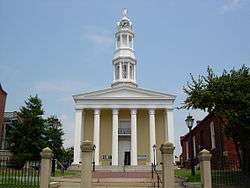
Saint Paul's Church |
|
May 30, 1986
(#86001191) |
102 N. Union St.
37°13′44″N 77°24′20″W / 37.228889°N 77.405556°W / 37.228889; -77.405556 (Saint Paul's Church) |
|
| 30 |
Second Presbyterian Church |
|
January 14, 1991
(#90002114) |
419 W. Washington St.
37°13′37″N 77°24′37″W / 37.226944°N 77.410278°W / 37.226944; -77.410278 (Second Presbyterian Church) |
|
| 31 |
South Chappell Street Car Barn |
|
February 25, 2009
(#09000066) |
124 South Chappell St.
37°13′12″N 77°25′28″W / 37.220000°N 77.424444°W / 37.220000; -77.424444 (South Chappell Street Car Barn) |
|
| 32 |
South Market Street Historic District |
|
April 22, 1992
(#92000345) |
S. Market St. from Washington St. to Halifax St.
37°13′30″N 77°24′21″W / 37.225000°N 77.405833°W / 37.225000; -77.405833 (South Market Street Historic District) |
|
| 33 |
Stewart-Hinton House |
|
January 14, 2004
(#03001437) |
416 High St.
37°13′46″N 77°24′41″W / 37.229306°N 77.411389°W / 37.229306; -77.411389 (Stewart-Hinton House) |
|
| 34 |
Strawberry Hill |
|
December 23, 1974
(#74002239) |
231-235-237 Hinton St.
37°13′43″N 77°24′31″W / 37.228611°N 77.408611°W / 37.228611; -77.408611 (Strawberry Hill) |
|
| 35 |
Sutherland House |
|
November 22, 2011
(#11000837) |
606 Harding St.
37°13′04″N 77°24′19″W / 37.217778°N 77.405278°W / 37.217778; -77.405278 (Sutherland House) |
|
| 36 |
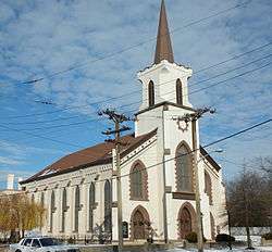
Tabb Street Presbyterian Church |
|
May 31, 1979
(#79003288) |
21 W. Tabb St.
37°13′49″N 77°24′19″W / 37.230278°N 77.405278°W / 37.230278; -77.405278 (Tabb Street Presbyterian Church) |
|
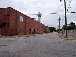
| 37 |
Virginia Trunk & Bag Company |
|
December 23, 2009
(#09001157) |
600 W. Wythe St.
37°13′28″N 77°24′38″W / 37.224444°N 77.410556°W / 37.224444; -77.410556 (Virginia Trunk & Bag Company) |
|
| 38 |
Thomas Wallace House |
|
May 2, 1975
(#75002116) |
Southwestern corner of Brown and S. Market Sts.
37°13′27″N 77°24′22″W / 37.224167°N 77.406111°W / 37.224167; -77.406111 (Thomas Wallace House) |
|
| 39 |
Washington Street Methodist Church |
|
November 24, 1980
(#80004209) |
14-24 E. Washington St.
37°13′40″N 77°24′09″W / 37.227778°N 77.402500°W / 37.227778; -77.402500 (Washington Street Methodist Church) |
|
.jpg)
.jpg)
.jpg)

.jpg)
.jpg)

.jpg)