| [3] |
Name on the Register[4] |
Image |
Date listed[5] |
Location |
City or town |
Description |
|---|
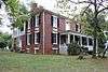
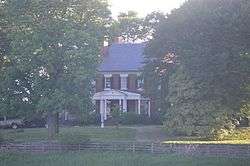
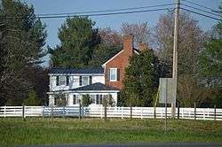
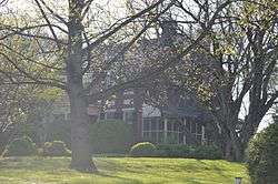
| 1 |
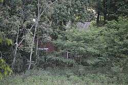
Avenel |
|
January 30, 1992
(#92000003) |
413 Avenel Ave.
37°20′17″N 79°31′28″W / 37.337917°N 79.524444°W / 37.337917; -79.524444 (Avenel) |
Bedford |
|
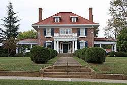
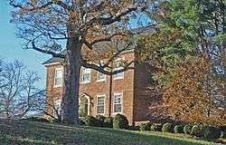
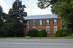
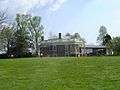
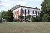
| 2 |
John D. Ballard House |
|
December 12, 1997
(#97001505) |
525 Longwood Ave.
37°20′22″N 79°31′12″W / 37.339444°N 79.520000°W / 37.339444; -79.520000 (John D. Ballard House) |
Bedford |
|
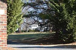
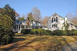
| 3 |
Bedford Historic District |
|
October 4, 1984
(#84000031) |
Roughly bounded by Longwood, Bedford, and Mountain Aves. and Peaks, Oak, Grove, and Washington Sts.
37°20′04″N 79°31′25″W / 37.334444°N 79.523611°W / 37.334444; -79.523611 (Bedford Historic District) |
Bedford |
|
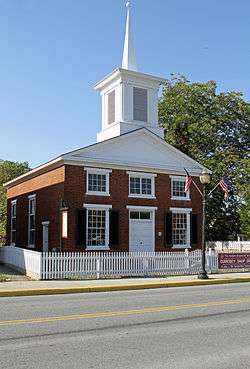
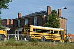
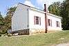
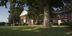
| 4 |
Bedford Historic Meetinghouse |
|
January 31, 1978
(#78003182) |
153 W. Main St.
37°20′05″N 79°31′32″W / 37.334861°N 79.525556°W / 37.334861; -79.525556 (Bedford Historic Meetinghouse) |
Bedford |
|
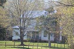
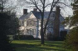
| 5 |
Bellevue |
|
December 19, 1990
(#89001917) |
Bellevue Rd., 1 mile (1.6 km) east of Goode
37°21′52″N 79°22′02″W / 37.364444°N 79.367222°W / 37.364444; -79.367222 (Bellevue) |
Goode |
|
| 6 |
Bellevue Rural Historic District |
|
November 30, 2005
(#05001345) |
Bellevue Rd.
37°22′21″N 79°22′52″W / 37.372500°N 79.381111°W / 37.372500; -79.381111 (Bellevue Rural Historic District) |
Forest |
|
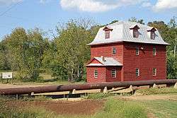
| 7 |
Big Otter Mill |
|
October 30, 1998
(#98001314) |
State Route 122
37°23′27″N 79°30′13″W / 37.390833°N 79.503750°W / 37.390833; -79.503750 (Big Otter Mill) |
Bedford |
|
| 8 |
Brook Hill Farm |
|
June 6, 1997
(#97000489) |
0.75 miles (1.21 km) south of the junction of U.S. Route 221 and Bellevue Rd.
37°22′05″N 79°22′29″W / 37.368056°N 79.374722°W / 37.368056; -79.374722 (Brook Hill Farm) |
Forest |
|
| 9 |
Burks-Guy-Hagen House |
|
December 19, 1985
(#85003201) |
520 Peaks St.
37°20′22″N 79°31′23″W / 37.339444°N 79.523056°W / 37.339444; -79.523056 (Burks-Guy-Hagen House) |
Bedford |
|
| 10 |
Cifax Rural Historic District |
|
February 20, 1992
(#92000052) |
Junction of Otterville and Old Cifax Rds., and the surrounding valley area
37°24′39″N 79°24′28″W / 37.410833°N 79.407778°W / 37.410833; -79.407778 (Cifax Rural Historic District) |
Cifax |
|
| 11 |
Bowling Eldridge House |
|
August 12, 1993
(#93000824) |
1651 Fox Hill Rd.
37°28′22″N 79°12′07″W / 37.472778°N 79.201944°W / 37.472778; -79.201944 (Bowling Eldridge House) |
Lynchburg |
|
| 12 |
Elk Hill |
|
April 2, 1973
(#73001996) |
Northwest of Forest on Perrowville Rd.
37°24′33″N 79°20′36″W / 37.409028°N 79.343472°W / 37.409028; -79.343472 (Elk Hill) |
Forest |
|
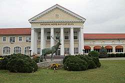
| 13 |
Elks National Home |
|
May 29, 2008
(#08000479) |
931 Ashland Ave.
37°20′36″N 79°32′06″W / 37.343333°N 79.535000°W / 37.343333; -79.535000 (Elks National Home) |
Bedford |
|
| 14 |
Fancy Farm |
|
January 7, 1972
(#72001384) |
On State Route 43, north of its junction with Kelso Mill Rd.
37°23′54″N 79°33′23″W / 37.398333°N 79.556389°W / 37.398333; -79.556389 (Fancy Farm) |
Bedford |
|
| 15 |
Hope Dawn |
|
October 9, 1974
(#74002106) |
Northwest of Lynchburg off Abert Rd.
37°29′55″N 79°13′59″W / 37.498611°N 79.233194°W / 37.498611; -79.233194 (Hope Dawn) |
Lynchburg |
|
| 16 |
Liberty Hall |
|
August 12, 2009
(#09000613) |
12000 E. U.S. Route 460
37°18′23″N 79°18′48″W / 37.306389°N 79.313333°W / 37.306389; -79.313333 (Liberty Hall) |
Forest |
|
| 17 |
Locust Level |
|
December 21, 1990
(#90001841) |
U.S. Route 460, west of its junction with Goose Creek Valley Rd.
37°23′11″N 79°44′14″W / 37.386389°N 79.737222°W / 37.386389; -79.737222 (Locust Level) |
Montvale |
|
| 18 |
Mount Airy |
|
December 19, 1990
(#90001823) |
Junction of Chellis Ford and Mt. Airy Rds.
37°06′19″N 79°25′03″W / 37.105278°N 79.417500°W / 37.105278; -79.417500 (Mount Airy) |
Leesville |
|
| 19 |
New London Academy |
|
April 13, 1972
(#72001385) |
Near the junction of U.S. Route 460 and New London Rd.
37°18′24″N 79°18′19″W / 37.306528°N 79.305278°W / 37.306528; -79.305278 (New London Academy) |
Forest |
|
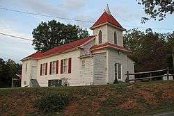
| 20 |
New Prospect Church |
|
March 31, 2000
(#00000312) |
4445 Sheep Creek Rd.
37°25′39″N 79°38′09″W / 37.427500°N 79.635833°W / 37.427500; -79.635833 (New Prospect Church) |
Bedford |
|
| 21 |
Old Rectory |
|
July 24, 1973
(#73001998) |
South of Perrowville on Perrowville Rd.
37°24′10″N 79°20′18″W / 37.402778°N 79.338333°W / 37.402778; -79.338333 (Old Rectory) |
Perrowville |
|
| 22 |
Olive Branch Missionary Baptist Church |
|
May 4, 2007
(#07000392) |
5982 Joppa Mill Rd.
37°14′55″N 79°37′33″W / 37.248611°N 79.625833°W / 37.248611; -79.625833 (Olive Branch Missionary Baptist Church) |
Moneta |
|
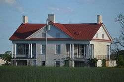
| 23 |
Otterburn |
|
February 16, 2001
(#01000146) |
Big Island Rd.
37°22′04″N 79°29′48″W / 37.367639°N 79.496528°W / 37.367639; -79.496528 (Otterburn) |
Bedford |
|
| 24 |
Pleasant View |
|
November 15, 2006
(#06001043) |
5050 Bellevue Rd.
37°20′48″N 79°21′42″W / 37.346667°N 79.361667°W / 37.346667; -79.361667 (Pleasant View) |
Forest |
|
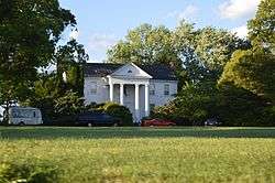
| 25 |
Poplar Forest |
|
November 12, 1969
(#69000223) |
1542 Bateman Bridge Rd.
37°20′53″N 79°15′52″W / 37.348056°N 79.264444°W / 37.348056; -79.264444 (Poplar Forest) |
Lynchburg |
|
| 26 |
Rothsay |
|
October 30, 1992
(#92001387) |
Northern side of U.S. Route 221, 2,000 feet (610 m) east of its junction with Thomas Jefferson Rd.
37°22′01″N 79°17′01″W / 37.367083°N 79.283611°W / 37.367083; -79.283611 (Rothsay) |
Forest |
|
| 27 |
Saint Stephen's Episcopal Church |
|
November 7, 1985
(#85002766) |
Perrowville Rd.
37°22′41″N 79°18′29″W / 37.378194°N 79.308056°W / 37.378194; -79.308056 (Saint Stephen's Episcopal Church) |
Forest |
|
| 28 |
Thomas Methodist Episcopal Chapel |
|
August 11, 2004
(#04000844) |
Penicks Mill Rd.
37°22′43″N 79°37′37″W / 37.378611°N 79.626944°W / 37.378611; -79.626944 (Thomas Methodist Episcopal Chapel) |
Thaxton |
|
| 29 |
Three Otters |
|
September 15, 1970
(#70000785) |
West of the junction of State Route 43 and Three Otters Rd.
37°21′27″N 79°32′43″W / 37.357500°N 79.545278°W / 37.357500; -79.545278 (Three Otters) |
Bedford |
|
| 30 |
Twin Oaks Farm |
|
July 5, 2001
(#01000704) |
Sheep Creek Rd.
37°25′37″N 79°37′57″W / 37.426944°N 79.632500°W / 37.426944; -79.632500 (Twin Oaks Farm) |
Peaks of Otter |
|
| 31 |
Woodbourne |
|
July 2, 1973
(#73001997) |
Northeast of Forest off Gumtree Rd.
37°22′11″N 79°16′44″W / 37.369722°N 79.278889°W / 37.369722; -79.278889 (Woodbourne) |
Forest |
|