| [3] |
Name on the Register |
Image |
Date listed[4] |
Location |
City or town |
Description |
|---|
| 1 |
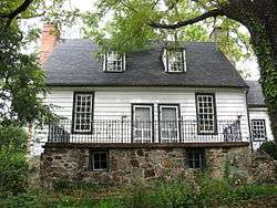
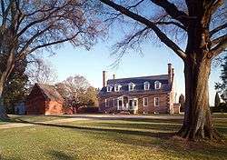
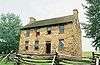
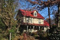
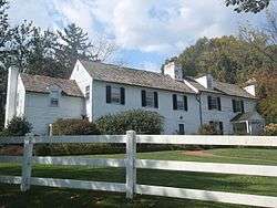
"A" Fort and Battery Hill Redoubt-Camp Early |
|
October 30, 1998
(#98001315) |
Balmoral Greens Ave., 1 mile (1.6 km) south of the junction with Compton Rd.
38°47′22″N 77°25′40″W / 38.789444°N 77.427778°W / 38.789444; -77.427778 ("A" Fort and Battery Hill Redoubt-Camp Early) |
Manassas Park |
|
| 2 |
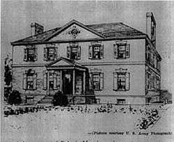
Belvoir Mansion Ruins and the Fairfax Grave |
|
June 4, 1973
(#73002337) |
Southeast of the junction of 23rd St. and Belvoir Rd.
38°40′50″N 77°07′42″W / 38.680694°N 77.128333°W / 38.680694; -77.128333 (Belvoir Mansion Ruins and the Fairfax Grave) |
Fort Belvoir |
|
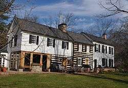
| 3 |
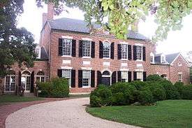
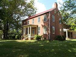
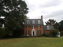
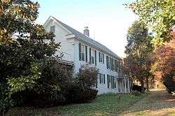
Bloomfield |
|
February 5, 2013
(#12001266) |
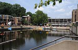
12000 Leesburg Pike
39°00′37″N 77°21′34″W / 39.010278°N 77.359444°W / 39.010278; -77.359444 (Bloomfield) |
Herndon |
|
| 4 |
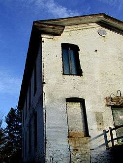
A. Smith Bowman Distillery |
|
December 9, 1999
(#99001503) |
1875 Old Reston Ave.
38°57′24″N 77°21′05″W / 38.956667°N 77.351389°W / 38.956667; -77.351389 (A. Smith Bowman Distillery) |
Reston |
|
| 5 |
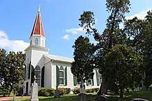
Clifton Historic District |
|
August 15, 1985
(#85001786) |
Roughly bounded by Popes Head Creek, Water St., Dell Ave., and Chestnut and Chapel Rds.
38°46′46″N 77°23′11″W / 38.779444°N 77.386389°W / 38.779444; -77.386389 (Clifton Historic District) |
Clifton |
|
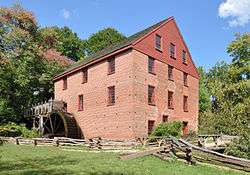
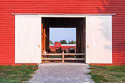
| 6 |
Colvin Run Mill |
|
August 16, 1977
(#77001487) |
South of Great Falls at 10017 Colvin Run Rd.
38°58′07″N 77°17′35″W / 38.968611°N 77.293056°W / 38.968611; -77.293056 (Colvin Run Mill) |
Great Falls |
|
| 7 |
Cornwell Farm |
|
April 13, 1977
(#77001488) |
Southeast of Great Falls, 9414 Georgetown Pike
38°59′30″N 77°16′17″W / 38.991528°N 77.271389°W / 38.991528; -77.271389 (Cornwell Farm) |
Great Falls |
|
| 8 |
D.C. Workhouse and Reformatory Historic District |
|
February 16, 2006
(#06000052) |
Between Silverbrook Rd., Lorton Rd., Ox Rd., and Furnace Rd.
38°41′53″N 77°15′16″W / 38.698056°N 77.254444°W / 38.698056; -77.254444 (D.C. Workhouse and Reformatory Historic District) |
Lorton |
|
| 9 |
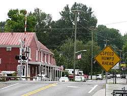
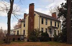
Dranesville Tavern |
|
November 9, 1972
(#72001393) |
11919 Leesburg Pike
39°00′29″N 77°21′37″W / 39.008056°N 77.360278°W / 39.008056; -77.360278 (Dranesville Tavern) |
Dranesville |
|
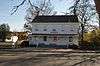
| 10 |
Fairfax Arms |
|
May 21, 1979
(#79003037) |
10712 Old Colchester Rd.
38°40′06″N 77°14′08″W / 38.668333°N 77.235556°W / 38.668333; -77.235556 (Fairfax Arms) |
Colchester |
|
| 11 |
Floris Historic District |
|
August 12, 2010
(#10000543) |
Bounded by Centreville Rd., W. Ox Rd., Monroe St., and Frying Pan Branch
38°56′11″N 77°24′35″W / 38.936389°N 77.409722°W / 38.936389; -77.409722 (Floris Historic District) |
Herndon |
|
| 12 |
Fort Hunt |
|
March 26, 1980
(#80000353) |
George Washington Memorial Parkway
38°42′54″N 77°03′07″W / 38.715000°N 77.051944°W / 38.715000; -77.051944 (Fort Hunt) |
Alexandria |
|
| 13 |
Four Stairs |
|
August 11, 2004
(#04000842) |
840 Leigh Mill Rd.
38°59′04″N 77°16′36″W / 38.984444°N 77.276667°W / 38.984444; -77.276667 (Four Stairs) |
Great Falls |
|
| 14 |
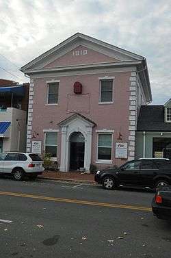
Freeman Store |
|
May 16, 2012
(#11000834) |
131 Church St., NE.
38°54′12″N 77°15′54″W / 38.903333°N 77.265000°W / 38.903333; -77.265000 (Freeman Store) |
Vienna |
|
| 15 |
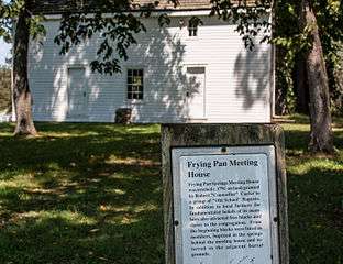
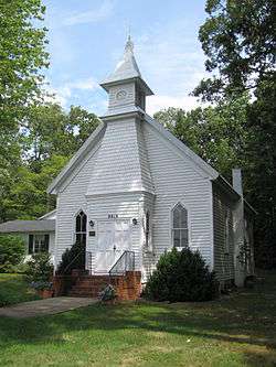
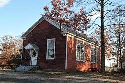
Frying Pan Meetinghouse |
|
February 5, 1991
(#91000016) |
2615 Centreville Rd.
38°56′24″N 77°24′47″W / 38.940000°N 77.413056°W / 38.940000; -77.413056 (Frying Pan Meetinghouse) |
Floris |
|
| 16 |
George Washington Memorial Parkway |
|
June 2, 1995
(#95000605) |
Roughly the southern side of the Potomac River from the American Legion to the Memorial Bridge and the north side from Brickyard Rd. to the Chain Bridge
38°57′38″N 77°08′54″W / 38.960556°N 77.148333°W / 38.960556; -77.148333 (George Washington Memorial Parkway) |
Langley |
|
| 17 |
Georgetown Pike |
|
August 22, 2012
(#12000537) |
From the District of Columbia boundary at the Chain Bridge to the junction with Leesburg Pike at Seneca Rd.
38°57′14″N 77°11′31″W / 38.953889°N 77.191944°W / 38.953889; -77.191944 (Georgetown Pike) |
McLean |
Extends into Arlington County |
| 18 |
Great Falls Grange Hall and Forestville School |
|
August 11, 2004
(#04000861) |
9812 and 9818 Georgetown Pike
38°59′52″N 77°17′08″W / 38.997778°N 77.285556°W / 38.997778; -77.285556 (Great Falls Grange Hall and Forestville School) |
Great Falls |
|
| 19 |
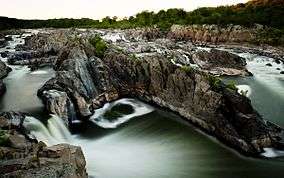
Great Falls Park Historic District |
|
December 22, 2014
(#14001079) |
Bounded by the Potomac River, Georgetown Pike, and River Bend Rd.
38°59′30″N 77°15′02″W / 38.991667°N 77.250556°W / 38.991667; -77.250556 (Great Falls Park Historic District) |
Great Falls |
|
| 20 |
Green Spring |
|
October 22, 2003
(#03001089) |
4601 Green Spring Rd.
38°49′28″N 77°09′26″W / 38.824444°N 77.157222°W / 38.824444; -77.157222 (Green Spring) |
Alexandria |
|
| 21 |
John Gunnell House |
|
November 27, 2006
(#06001100) |
489 Arnon Meadow Rd.
39°00′48″N 77°17′23″W / 39.013333°N 77.289722°W / 39.013333; -77.289722 (John Gunnell House) |
Great Falls |
|
| 22 |
William Gunnell House |
|
May 22, 2003
(#03000447) |
600 Insbruck Ave.
39°00′13″N 77°17′05″W / 39.003611°N 77.284722°W / 39.003611; -77.284722 (William Gunnell House) |
Great Falls |
|
| 23 |
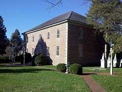
Gunston Hall |
|
October 15, 1966
(#66000832) |
10709 Gunston Rd.
38°39′51″N 77°09′37″W / 38.664167°N 77.160278°W / 38.664167; -77.160278 (Gunston Hall) |
Mason Neck |
|
| 24 |
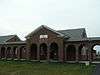
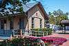
Herndon Depot |
|
June 18, 1979
(#79003039) |
Elden St.
38°58′13″N 77°23′12″W / 38.970278°N 77.386583°W / 38.970278; -77.386583 (Herndon Depot) |
Herndon |
|
| 25 |
Herndon Historic District |
|
January 11, 1991
(#90002121) |
Roughly bounded by Locust, Spring, Pearl, Monroe, Station, and Vine Sts.
38°58′06″N 77°23′05″W / 38.968333°N 77.384722°W / 38.968333; -77.384722 (Herndon Historic District) |
Herndon |
|
| 26 |
Hollin Hills Historic District |
|
September 30, 2013
(#13000807) |
Roughly Beechwood, Elba, Glasgow, Martha's, Paul Springs, Range, and Stafford Rds., and Mason Hill, Rebecca, and Whiteoaks Drs.
38°45′24″N 77°04′02″W / 38.756667°N 77.067222°W / 38.756667; -77.067222 (Hollin Hills Historic District) |
Alexandria |
|
| 27 |
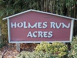
Holmes Run Acres Historic District |
|
March 22, 2007
(#07000230) |
Generally bounded by Gallows Rd., Surrey Ln, and Holmes Run Dr.
38°51′09″N 77°12′38″W / 38.852500°N 77.210556°W / 38.852500; -77.210556 (Holmes Run Acres Historic District) |
Falls Church |
|
| 28 |
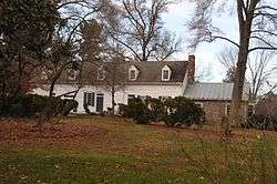
Hope Park Mill and Miller's House |
|
August 15, 1977
(#77001486) |
12124 Pope's Head Rd.
38°48′55″N 77°21′56″W / 38.815139°N 77.365694°W / 38.815139; -77.365694 (Hope Park Mill and Miller's House) |
Fairfax |
|
| 29 |
Huntley |
|
November 3, 1972
(#72001392) |
6918 Harrison Lane
38°45′56″N 77°05′41″W / 38.765694°N 77.094722°W / 38.765694; -77.094722 (Huntley) |
Alexandria |
|
| 30 |
Langley Fork Historic District |
|
October 19, 1982
(#82001818) |
Junction of Georgetown Pike and Old Chain Bridge Rd.
38°56′46″N 77°09′36″W / 38.946111°N 77.16°W / 38.946111; -77.16 (Langley Fork Historic District) |
Langley |
|
| 31 |
Lake Anne Village Center Historic District |
|
June 5, 2017
(#100001041) |
North Shore Dr. and Washington Plaza W. and N.
38°58′08″N 77°20′27″W / 38.968889°N 77.340833°W / 38.968889; -77.340833 (Lake Anne Village Center Historic District) |
Reston |
|
| 32 |
Lexington |
|
May 28, 2013
(#13000336) |
7301 High Point Rd.
38°39′37″N 77°10′28″W / 38.660278°N 77.174444°W / 38.660278; -77.174444 (Lexington) |
Lorton |
|
| 33 |
Manassas National Battlefield Park |
|
October 15, 1966
(#66000039) |
Northwest of Manassas off State Route 215
38°49′28″N 77°30′12″W / 38.824444°N 77.503333°W / 38.824444; -77.503333 (Manassas National Battlefield Park) |
Manassas |
Boundaries increased on January 18, 2006, but no location details specified |
| 34 |
Merrybrook |
|
April 26, 2007
(#07000362) |
2346 Centreville Rd.
38°57′14″N 77°24′30″W / 38.953889°N 77.408333°W / 38.953889; -77.408333 (Merrybrook) |
Herndon |
|
| 35 |
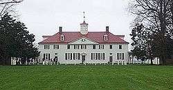
Mount Vernon |
|
October 15, 1966
(#66000833) |
7 miles (11 km) south of Alexandria on the George Washington Memorial Parkway
38°42′29″N 77°05′10″W / 38.708056°N 77.086111°W / 38.708056; -77.086111 (Mount Vernon) |
Alexandria |
|
| 36 |
Mount Vernon High School |
|
May 11, 2018
(#100002439) |
8333 Richmond Hwy.
38°43′53″N 77°06′06″W / 38.7314°N 77.1017°W / 38.7314; -77.1017 (Mount Vernon High School) |
Alexandria vicinity |
The 1939 building, not the current school. |
| 37 |
Mount Vernon Memorial Highway |
|
May 18, 1981
(#81000079) |
Washington St. and the George Washington Memorial Parkway
38°46′30″N 77°03′07″W / 38.775000°N 77.051944°W / 38.775000; -77.051944 (Mount Vernon Memorial Highway) |
McLean |
|
| 38 |
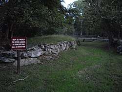
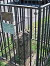
Northwest No. 3 Boundary Marker of the Original District of Columbia |
|
February 1, 1991
(#91000005) |
4013 N. Tazewell St.
38°55′28″N 77°07′55″W / 38.924583°N 77.132083°W / 38.924583; -77.132083 (Northwest No. 3 Boundary Marker of the Original District of Columbia) |
McLean |
|
| 39 |
Oak Hill |
|
May 19, 2004
(#04000478) |
4716 Wakefield Chapel Rd.
38°49′15″N 77°14′24″W / 38.820972°N 77.240000°W / 38.820972; -77.240000 (Oak Hill) |
Annandale |
|
| 40 |
Oakton Trolley Station |
|
February 8, 1995
(#95000026) |
2923 Gray St.
38°52′46″N 77°17′49″W / 38.879444°N 77.296944°W / 38.879444; -77.296944 (Oakton Trolley Station) |
Oakton |
|
| 41 |
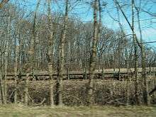
Orange and Alexandria Railroad Bridge Piers |
|
August 8, 1989
(#89001061) |
Both sides of Bull Run just east of Manassas Park[5]
38°46′35″N 77°25′17″W / 38.776389°N 77.421389°W / 38.776389; -77.421389 (Orange and Alexandria Railroad Bridge Piers) |
Manassas Park |
Extends into Prince William County |
| 42 |
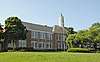
Pohick Church |
|
October 16, 1969
(#69000239) |
9201 U.S. Route 1
38°42′33″N 77°11′38″W / 38.709028°N 77.193889°W / 38.709028; -77.193889 (Pohick Church) |
Lorton |
|
| 43 |
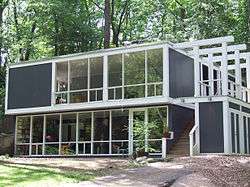
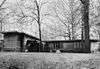
Pope-Leighey House |
|
December 18, 1970
(#70000791) |
East of Accotink off U.S. Route 1
38°43′10″N 77°08′10″W / 38.719444°N 77.136111°W / 38.719444; -77.136111 (Pope-Leighey House) |
Accotink |
|
| 44 |
Potomac Canal Historic District |
|
October 18, 1979
(#79003038) |
East of Great Falls
38°59′44″N 77°15′14″W / 38.995556°N 77.253889°W / 38.995556; -77.253889 (Potomac Canal Historic District) |
Great Falls |
|
| 45 |
St. Mary's Church |
|
July 1, 1976
(#76002104) |
5605 Vogue Rd.
38°48′10″N 77°19′36″W / 38.802778°N 77.326667°W / 38.802778; -77.326667 (St. Mary's Church) |
Fairfax Station |
|
| 46 |
Salona |
|
July 24, 1973
(#73002011) |
1214 Buchanan St.
38°56′17″N 77°10′15″W / 38.937917°N 77.170833°W / 38.937917; -77.170833 (Salona) |
McLean |
|
| 47 |
Silverbrook Methodist Church |
|
January 16, 2004
(#03001438) |
8616 Silverbrook Rd.
38°43′33″N 77°14′35″W / 38.725833°N 77.242917°W / 38.725833; -77.242917 (Silverbrook Methodist Church) |
Lorton |
|
| 48 |
Southwest No. 6 Boundary Marker of the Original District of Columbia |
|
February 1, 1991
(#91000011) |
S. Jefferson St. south of the junction with Columbia Pike, in the median strip
38°51′07″N 77°07′09″W / 38.851889°N 77.119250°W / 38.851889; -77.119250 (Southwest No. 6 Boundary Marker of the Original District of Columbia) |
Bailey's Crossroads |
|
| 49 |
Southwest No. 7 Boundary Marker of the Original District of Columbia |
|
February 1, 1991
(#91000012) |
Behind 3101 S. Manchester St.
38°51′45″N 77°07′58″W / 38.862500°N 77.132778°W / 38.862500; -77.132778 (Southwest No. 7 Boundary Marker of the Original District of Columbia) |
Seven Corners |
|
| 50 |
Southwest No. 8 Boundary Marker of the Original District of Columbia |
|
February 1, 1991
(#91000013) |
Junction of Wilson Boulevard and John Marshall Dr., behind an apartment building
38°52′22″N 77°08′45″W / 38.872639°N 77.145833°W / 38.872639; -77.145833 (Southwest No. 8 Boundary Marker of the Original District of Columbia) |
Seven Corners |
Extends into Arlington County |
| 51 |
Spring Hill Farm |
|
November 22, 2002
(#02000446) |
1121 Spring Hill Rd.
38°56′53″N 77°13′32″W / 38.948056°N 77.225556°W / 38.948056; -77.225556 (Spring Hill Farm) |
McLean |
|
| 52 |
Sully |
|
December 18, 1970
(#70000793) |
North of the junction of U.S. Route 50 and State Route 28
38°54′28″N 77°25′51″W / 38.907778°N 77.430833°W / 38.907778; -77.430833 (Sully) |
Chantilly |
|
| 53 |
Sydenstricker School |
|
August 22, 2012
(#12000539) |
8511 Hooes Rd.
38°45′20″N 77°14′21″W / 38.755694°N 77.239167°W / 38.755694; -77.239167 (Sydenstricker School) |
Springfield |
|
| 54 |
Taft Archeological Site#029-5411 |
|
August 11, 2004
(#04000859) |
Address Restricted
38°38′55″N 77°11′40″W / 38.648611°N 77.194444°W / 38.648611; -77.194444 (Taft Archeological Site#029-5411) |
Lorton |
|
| 55 |
Tauxemont Historic District |
|
February 9, 2006
(#06000033) |
Between Fort Hunt Rd. and Accotink Place, including Shenandoah, Tauxemont, Namassin, Westmoreland and Gahant Rds., and Bolling
38°44′42″N 77°03′20″W / 38.745000°N 77.055556°W / 38.745000; -77.055556 (Tauxemont Historic District) |
Alexandria |
|
| 56 |
Tower House |
|
May 2, 2006
(#06000341) |
9066 Tower House Place
38°42′41″N 77°04′01″W / 38.711389°N 77.066944°W / 38.711389; -77.066944 (Tower House) |
Alexandria |
|
| 57 |
Vale School-Community House |
|
June 8, 2011
(#11000349) |
3124 Fox Mill Rd.
38°53′30″N 77°20′56″W / 38.891667°N 77.348889°W / 38.891667; -77.348889 (Vale School-Community House) |
Oakton |
|
| 58 |
George Washington's Gristmill |
|
August 8, 2003
(#03000739) |
5512 George Washington Memorial Parkway
38°42′47″N 77°07′48″W / 38.713056°N 77.130000°W / 38.713056; -77.130000 (George Washington's Gristmill) |
Lorton |
|
| 59 |
West Cornerstone |
|
February 1, 1991
(#91000014) |
West side of Meridian St., south of the junction with Williamsburg Boulevard
38°53′36″N 77°10′20″W / 38.893333°N 77.172222°W / 38.893333; -77.172222 (West Cornerstone) |
Falls Church |
|
| 60 |
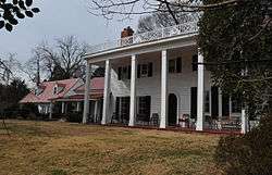
Woodlawn Plantation |
|
February 26, 1970
(#70000792) |
West of the junction of U.S. Route 1 and State Route 235; also 9000 U.S. Route 1
38°43′03″N 77°08′14″W / 38.717500°N 77.137222°W / 38.717500; -77.137222 (Woodlawn Plantation) |
Alexandria |
9000 Richmond represents a boundary increase of November 18, 2011 |
| 61 |
Woodlawn Quaker Meetinghouse |
|
May 21, 2009
(#09000335) |
8990 Woodlawn Rd.
38°42′51″N 77°08′32″W / 38.714167°N 77.142222°W / 38.714167; -77.142222 (Woodlawn Quaker Meetinghouse) |
Fort Belvoir |
|
_%2C_11919_Leesburg_Pike_(moved_from_orig._location)%2C_Herndon_vicinity_(Fairfax%2C_Virginia).jpg)
_NW_3.jpg)
.jpg)
_SW_6_-2.jpg)
_SW_7.jpg)
_West_Stone.jpg)