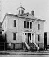
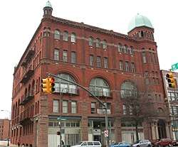
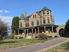
| [3] |
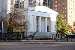
Name on the Register[4] |
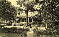
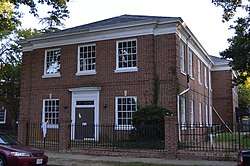
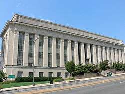
Image |
Date listed[5] |
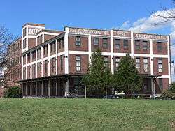
Location |
Description |
|---|
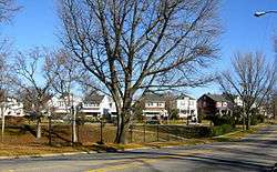
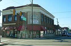
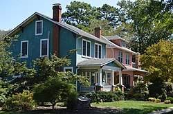
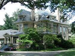
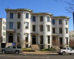
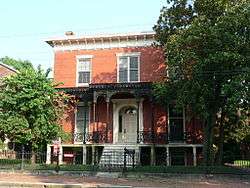
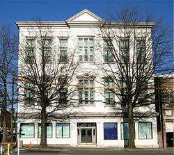
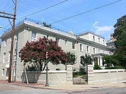
| 1 |
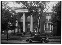
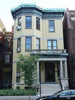
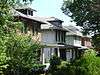
2900 Block Grove Avenue Historic District |
|
February 20, 1973
(#73002223) |
2901, 2905, 2911, and 2915 Grove Ave.
37°33′20″N 77°28′36″W / 37.555556°N 77.476667°W / 37.555556; -77.476667 (2900 Block Grove Avenue Historic District) |
|
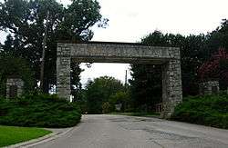
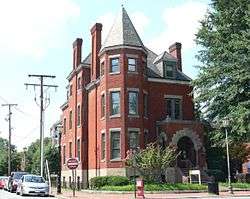
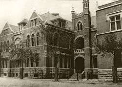
| 2 |
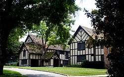
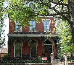
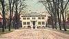
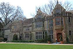
Agecroft |
|
December 13, 1978
(#78003186) |
4305 Sulgrave Rd.
37°33′11″N 77°30′18″W / 37.553056°N 77.505000°W / 37.553056; -77.505000 (Agecroft) |
|
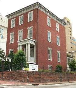
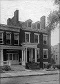
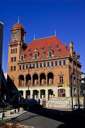
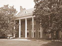
| 3 |
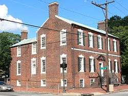
The Almshouse |
|
October 29, 1981
(#81000647) |
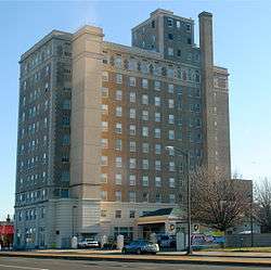
210 Hospital St.
37°33′11″N 77°25′50″W / 37.553056°N 77.430556°W / 37.553056; -77.430556 (The Almshouse) |
|
| 4 |
American Tobacco Company, South Richmond Complex Historic District |
|
August 15, 2016
(#16000536) |
400-800 Jefferson Davis Highway
37°30′31″N 77°26′52″W / 37.508611°N 77.447778°W / 37.508611; -77.447778 (American Tobacco Company, South Richmond Complex Historic District) |
|
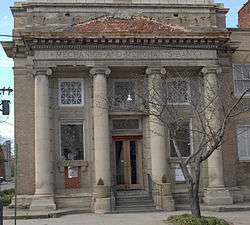
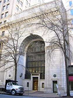
| 5 |
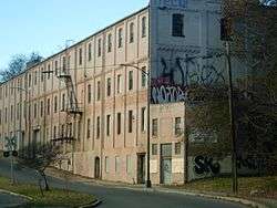
Armitage Manufacturing Company |
|
August 22, 2012
(#12000545) |
3200 Williamsburg Ave.
37°31′29″N 77°24′54″W / 37.524722°N 77.415000°W / 37.524722; -77.415000 (Armitage Manufacturing Company) |
|
| 6 |
Atlantic Motor Company |
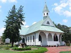
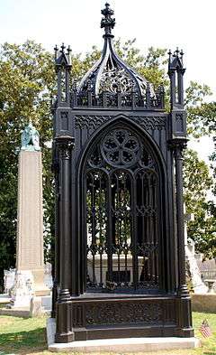
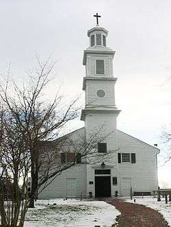
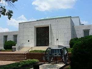
|
November 16, 2005
(#05001271) |
1840 W. Broad St.
37°33′24″N 77°27′36″W / 37.556667°N 77.460000°W / 37.556667; -77.460000 (Atlantic Motor Company) |
|
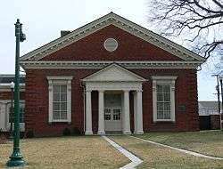
| 7 |
Nathaniel Bacon School |
|
August 24, 1992
(#92001031) |
815 N. 35th St.
37°31′51″N 77°24′17″W / 37.530833°N 77.404722°W / 37.530833; -77.404722 (Nathaniel Bacon School) |
|
| 8 |
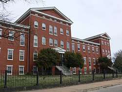
Baker Public School |
|
August 15, 2016
(#16000537) |
100 W. Baker St.
37°33′07″N 77°26′18″W / 37.551944°N 77.438333°W / 37.551944; -77.438333 (Baker Public School) |
|
| 9 |
Barret House |
|
February 23, 1972
(#72001517) |
15 S. 5th St.
37°32′22″N 77°26′26″W / 37.539583°N 77.440417°W / 37.539583; -77.440417 (Barret House) |
|
| 10 |
Barton Heights Cemeteries |
|
April 10, 2002
(#02000364) |
1600 Lamb Ave.
37°33′29″N 77°25′58″W / 37.558056°N 77.432778°W / 37.558056; -77.432778 (Barton Heights Cemeteries) |
|
| 11 |
Battery Court Historic District |
|
October 9, 2003
(#02000594) |
Roughly Dupont, Edgewood, Fendall, Greenwood, Griffin, Montrose, Moss Side, Noble, North, Edgehill, and Graham
37°34′02″N 77°26′23″W / 37.567222°N 77.439722°W / 37.567222; -77.439722 (Battery Court Historic District) |
|
| 12 |
William Beers House |
|
April 16, 1969
(#69000346) |
1228 E. Broad St.
37°32′19″N 77°25′47″W / 37.538611°N 77.429722°W / 37.538611; -77.429722 (William Beers House) |
|
| 13 |
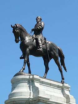
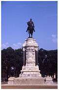
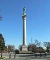
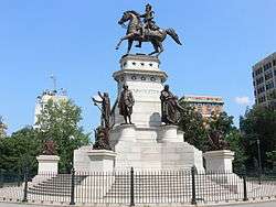
Belgian Building |
|
February 26, 1970
(#01000439) |
Lombardy St. at its junction with Brook Rd.
37°33′44″N 77°27′00″W / 37.562222°N 77.450000°W / 37.562222; -77.450000 (Belgian Building) |
|
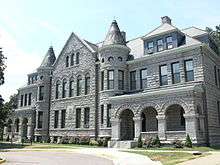
| 14 |
Bell Tower |
|
June 11, 1969
(#69000347) |
Capitol Sq.
37°32′20″N 77°26′07″W / 37.538944°N 77.435278°W / 37.538944; -77.435278 (Bell Tower) |
|
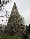
| 15 |
Belle Isle |
|
March 17, 1995
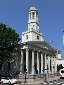
(#95000246) |
James River at U.S. Routes 1/301
37°31′45″N 77°27′13″W / 37.529167°N 77.453611°W / 37.529167; -77.453611 (Belle Isle) |
|
| 16 |
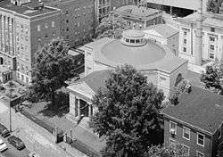
Blair Tobacco Storage Warehouse Complex Historic District |
|
August 15, 2016
(#16000538) |
2601 Maury St.
37°30′36″N 77°27′20″W / 37.510000°N 77.455556°W / 37.510000; -77.455556 (Blair Tobacco Storage Warehouse Complex Historic District) |
|
| 17 |
Block 0-100 East Franklin Street Historic District |
|
February 27, 1980
(#80004216) |
Roughly bounded by 1st, Main, Foushee, and Grace Sts.
37°32′35″N 77°26′37″W / 37.543056°N 77.443611°W / 37.543056; -77.443611 (Block 0-100 East Franklin Street Historic District) |
|
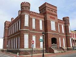
| 18 |
Blues Armory |
|
May 17, 1976
(#76002229) |
6th and Marshall Sts.
37°32′36″N 77°26′07″W / 37.543333°N 77.435278°W / 37.543333; -77.435278 (Blues Armory) |
|
| 19 |
Boulevard Historic District |
|
September 18, 1986
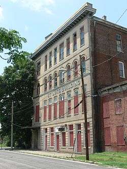
(#86002887) |
10-300 S. Boulevard and 10-800 N. Boulevard
37°33′23″N 77°28′29″W / 37.556389°N 77.474722°W / 37.556389; -77.474722 (Boulevard Historic District) |
|
| 20 |
Branch Building |
|
April 17, 1970
(#70000878) |
1015 E. Main St.
37°32′13″N 77°26′06″W / 37.537083°N 77.435000°W / 37.537083; -77.435000 (Branch Building) |
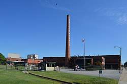
|
| 21 |
Branch House |
|
February 23, 1984
(#84003569) |
2501 Monument Ave.
37°33′30″N 77°28′06″W / 37.558333°N 77.468333°W / 37.558333; -77.468333 (Branch House) |
|
| 22 |
Broad Street Commercial Historic District |
|
April 9, 1987
(#87000611) |
Along Broad St., an area roughly bounded by Belvidere, Marshall, 4th, and Grace; also 709-916 W. Broad St., 308-310 N. Laurel St., and 301-306 Gilmer St.; also the southern side of the 100 block of E. Marshall St., and the 300 blocks of 1st and 2nd Sts., between Broad and Marshall Sts.
37°32′48″N 77°26′37″W / 37.546667°N 77.443611°W / 37.546667; -77.443611 (Broad Street Commercial Historic District) |
Second and third sets of boundaries represent boundary increases of August 11, 2004 and March 27, 2007 |
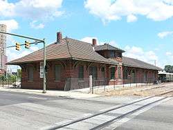
| 23 |
Broad Street Station |
|
February 23, 1972
(#72001518) |
Broad and Robinson Sts.
37°33′40″N 77°27′57″W / 37.561111°N 77.465833°W / 37.561111; -77.465833 (Broad Street Station) |
|
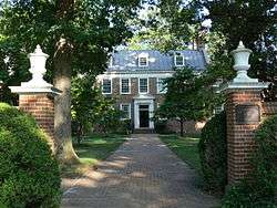
| 24 |
Brookland Park Historic District |
|
August 6, 2003
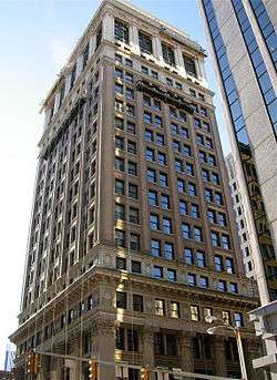
(#02000591) |
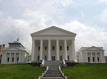
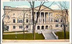
Roughly Griffin, Fendall, Hanes, Garland, North, Barton, Lamb, and Cliff Aves., and Norwood, Hooper, Essex, and Brookland Park
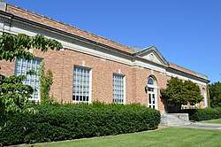
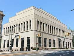
37°34′20″N 77°25′57″W / 37.572222°N 77.432500°W / 37.572222; -77.432500 (Brookland Park Historic District) |
|
| 25 |
Joseph Bryan Park |
|
November 21, 2002
(#02001369) |
4308 Hermitage Rd.
37°35′37″N 77°28′26″W / 37.593611°N 77.473889°W / 37.593611; -77.473889 (Joseph Bryan Park) |
|
| 26 |
Byrd Park Court Historic District |
|
February 2, 2016
(#15001043) |
701, 703, and 735 Lake Rd. and 705-733 Byrd Park Ct.
37°32′37″N 77°28′16″W / 37.543611°N 77.471111°W / 37.543611; -77.471111 (Byrd Park Court Historic District) |
|
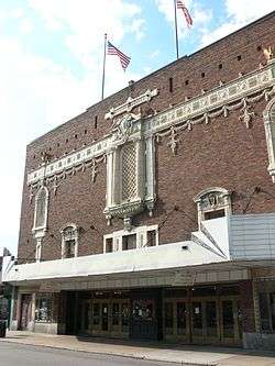
| 27 |
Byrd Theatre |
|
September 24, 1979
(#79003289) |
2908 W. Cary St.
37°33′09″N 77°28′40″W / 37.552500°N 77.477778°W / 37.552500; -77.477778 (Byrd Theatre) |
|
| 28 |
William Byrd Hotel |
|
December 16, 1996
(#96001454) |
2501 W. Broad St.
37°33′36″N 77°27′59″W / 37.560000°N 77.466389°W / 37.560000; -77.466389 (William Byrd Hotel) |
|
| 29 |
William Byrd Park |
|
February 2, 2016
(#15001044) |
600 S. Boulevard
37°32′40″N 77°28′40″W / 37.544444°N 77.477778°W / 37.544444; -77.477778 (William Byrd Park) |
|
| 30 |
Henry Coalter Cabell House |
|
December 27, 1972
(#72001519) |
116 S. 3rd St.
37°32′24″N 77°26′37″W / 37.540000°N 77.443611°W / 37.540000; -77.443611 (Henry Coalter Cabell House) |
|
| 31 |
Henry Mansfield Cannon Memorial Chapel |
|
May 7, 2013
(#13000259) |
36 Westhampton Way
37°34′28″N 77°32′20″W / 37.574444°N 77.538889°W / 37.574444; -77.538889 (Henry Mansfield Cannon Memorial Chapel) |
|
| 32 |
Carillon Neighborhood Historic District |
|
February 2, 2016
(#15001045) |
Belmont, Blanton, Maplewood, Rendale, and Sunset Aves., and Carrolton, Condie, French, Garrett, Rueger, and Sheppard Sts.
37°32′40″N 77°29′06″W / 37.544444°N 77.485000°W / 37.544444; -77.485000 (Carillon Neighborhood Historic District) |
|
| 33 |
Carver Industrial Historic District |
|
May 26, 2000
(#00000559) |
Marshall, Lombardy, Clay, and Harrison Sts.
37°33′16″N 77°27′14″W / 37.554444°N 77.453889°W / 37.554444; -77.453889 (Carver Industrial Historic District) |
|
| 34 |
Carver Residential Historic District |
|
April 12, 2002
(#02000365) |
700-1500 blocks of W. Leigh, the 700-1400 blocks of W. Catherine, and Clay and Marshall; also 909-1011 W. Marshall St.
37°33′10″N 77°26′58″W / 37.552778°N 77.449444°W / 37.552778; -77.449444 (Carver Residential Historic District) |
W. Marshall represents a boundary increase of November 1, 2006 |
| 35 |
Cary Street Park and Shop Center |
|
July 5, 2001
(#01000701) |
3120-3158 W. Cary St.
37°33′14″N 77°28′53″W / 37.553889°N 77.481389°W / 37.553889; -77.481389 (Cary Street Park and Shop Center) |
|
| 36 |
John B. Cary School |
|
August 24, 1992
(#92001030) |
2100 Idlewood Ave.
37°32′48″N 77°28′09″W / 37.546667°N 77.469167°W / 37.546667; -77.469167 (John B. Cary School) |
|
| 37 |
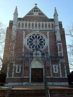
Cathedral of the Sacred Heart |
|
July 8, 1982
(#82004584) |
Floyd Ave. and Laurel St.
37°32′51″N 77°27′08″W / 37.547500°N 77.452222°W / 37.547500; -77.452222 (Cathedral of the Sacred Heart) |
|
| 38 |
Centenary Church |
|
December 28, 1979
(#79003077) |
411 E. Grace St.
37°32′31″N 77°26′20″W / 37.541944°N 77.438889°W / 37.541944; -77.438889 (Centenary Church) |
|
| 39 |
Central National Bank |
|
September 20, 1979
(#79003290) |
3rd and Broad Sts.
37°32′37″N 77°26′24″W / 37.543611°N 77.44°W / 37.543611; -77.44 (Central National Bank) |
|
| 40 |
Chamberlayne Gardens |
|
May 2, 2007
(#07000390) |
4301-4313 and 4315-4327 Chamberlayne Ave. and 4800-4818 Old Brook Rd.
37°35′43″N 77°26′55″W / 37.595278°N 77.448611°W / 37.595278; -77.448611 (Chamberlayne Gardens) |
|
| 41 |
The Chesapeake Warehouses |
|
April 11, 2014
(#13000891) |
1100 Dinwiddie Ave.
37°30′50″N 77°26′14″W / 37.513889°N 77.437222°W / 37.513889; -77.437222 (The Chesapeake Warehouses) |
|
| 42 |
Chestnut Hill-Plateau Historic District |
|
April 12, 2002
(#02000366) |
1st, 2nd, 3rd, 4th, and 5th Aves. from Brooklyn Park Boulevard to Trigg St.
37°33′47″N 77°25′14″W / 37.563056°N 77.420556°W / 37.563056; -77.420556 (Chestnut Hill-Plateau Historic District) |
|
| 43 |
Church Hill North Historic District |
|
September 5, 1997
(#97000958) |
Along Marshall, Clay, Leigh, and M. Sts., bounded by 21st and 30th Sts.; also roughly bounded by 25th St., T St., 32nd St., and M St.
37°31′58″N 77°24′57″W / 37.532778°N 77.415833°W / 37.532778; -77.415833 (Church Hill North Historic District) |
Second set of boundaries represents a boundary increase of August 16, 2000 |
| 44 |
Church of the Sacred Heart |
|
November 20, 2002
(#02001368) |
1401 Perry St.
37°31′21″N 77°26′55″W / 37.522500°N 77.448611°W / 37.522500; -77.448611 (Church of the Sacred Heart) |
|
| 45 |
City Hall |
|
October 1, 1969
(#69000327) |
Bounded by 10th, Broad, 11th, and Capitol Sts.
37°32′23″N 77°25′58″W / 37.539722°N 77.432778°W / 37.539722; -77.432778 (City Hall) |
|
| 46 |
The Coliseum-Duplex Envelope Company Building |
|
January 27, 1999
(#99000077) |
1339-1363 W. Broad St.
37°33′12″N 77°27′20″W / 37.553333°N 77.455556°W / 37.553333; -77.455556 (The Coliseum-Duplex Envelope Company Building) |
|
| 47 |
Columbia |
|
September 16, 1982
(#82004585) |
1142 W. Grace St.
37°33′12″N 77°27′23″W / 37.553333°N 77.456389°W / 37.553333; -77.456389 (Columbia) |
|
| 48 |
Commonwealth Club Historic District |
|
April 7, 1983
(#83003301) |
319-415 and 400-500 W. Franklin St.
37°32′46″N 77°26′52″W / 37.546111°N 77.447778°W / 37.546111; -77.447778 (Commonwealth Club Historic District) |
|
| 49 |
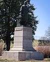
Confederate Memorial Chapel |
|
February 23, 1972
(#72001520) |
2900 Grove Ave.
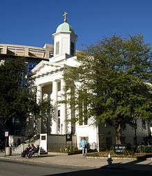
37°33′21″N 77°28′34″W / 37.555833°N 77.476111°W / 37.555833; -77.476111 (Confederate Memorial Chapel) |
|
| 50 |
Crenshaw House |
|
August 30, 2010
(#10000585) |
919 W. Franklin St.
37°32′59″N 77°27′14″W / 37.549722°N 77.453889°W / 37.549722; -77.453889 (Crenshaw House) |
|
| 51 |
Crozet House |
|
February 23, 1972
(#72001521) |
100 E. Main St.
37°32′33″N 77°26′35″W / 37.542500°N 77.443194°W / 37.542500; -77.443194 (Crozet House) |
|
| 52 |
Decatur O. Davis House |
|
May 11, 2000
(#00000490) |
1001 E. Clay St.
37°32′30″N 77°25′53″W / 37.541667°N 77.431389°W / 37.541667; -77.431389 (Decatur O. Davis House) |
|
| 53 |
Department of Public Utilities Howard (Overbrook) Road Facility |
|
July 24, 2007
(#07000767) |
1307, 1311, 1315, 1317, and 1319 Overbrook Rd.
37°33′54″N 77°27′11″W / 37.565000°N 77.453056°W / 37.565000; -77.453056 (Department of Public Utilities Howard (Overbrook) Road Facility) |
|
| 54 |
Donnan-Asher Iron-Front Building |
|
February 26, 1970
(#70000879) |
1207-1211 E. Main St.
37°32′11″N 77°26′00″W / 37.536389°N 77.433472°W / 37.536389; -77.433472 (Donnan-Asher Iron-Front Building) |
|
| 55 |
Egyptian Building |
|
April 16, 1969
(#69000321) |
Southwestern corner of the junction of E. Marshall and College Sts.
37°32′21″N 77°25′46″W / 37.539167°N 77.429444°W / 37.539167; -77.429444 (Egyptian Building) |
|
| 56 |
English Village |
|
September 29, 1983
(#83003302) |
3418-3450 Grove Ave.
37°33′31″N 77°29′02″W / 37.558611°N 77.483889°W / 37.558611; -77.483889 (English Village) |
|
| 57 |
Fairmount Historic District |
|
February 19, 2008
(#08000075) |
Roughly bounded by 24th, Y, 20th, T, R, Q, and P Sts., Fairfield and Carrington Aves., and the Mechanicsville Turnpike
37°32′31″N 77°24′48″W / 37.541944°N 77.413333°W / 37.541944; -77.413333 (Fairmount Historic District) |
|
| 58 |
Fairmount School |
|
November 9, 2005
(#05001227) |
1501 N. 21st St.
37°32′37″N 77°24′45″W / 37.543611°N 77.412500°W / 37.543611; -77.412500 (Fairmount School) |
|
| 59 |
Fan Area Historic District |
|
September 12, 1985
(#85002243) |
Roughly bounded by N. Harrison, W. Main, W. Grace, and N. Mullberry Sts.; also roughly bounded by W. Main St., S. Harrison St., the Richmond Metropolitan Expressway, and S. Boulevard
37°32′56″N 77°28′08″W / 37.548889°N 77.468889°W / 37.548889; -77.468889 (Fan Area Historic District) |
Second set of boundaries represents a boundary increase of May 30, 1986 |
| 60 |
Fifth and Main Downtown Historic District |
|
August 30, 2006
(#06000750) |
400-500 blocks of E. Franklin St., the 400-600 blocks of E. Main St., the 00 blocks of N. 4th, 5th, and 6th Sts. and S. 5th St.; also the 00 blocks of N. 3rd, N. 4th, and S. 6th, and the 300 and 400 blocks of E. Main Sts.
37°32′26″N 77°26′24″W / 37.540556°N 77.440000°W / 37.540556; -77.440000 (Fifth and Main Downtown Historic District) |
Second set of boundaries represents a boundary increase of November 28, 2012 |
| 61 |
First African Baptist Church |
|
April 16, 1969
(#69000348) |
Northeastern corner of the junction of College and E. Broad Sts.
37°32′19″N 77°25′46″W / 37.538611°N 77.429444°W / 37.538611; -77.429444 (First African Baptist Church) |
|
| 62 |
First Baptist Church |
|
April 16, 1969
(#69000349) |
Northwestern corner of the junction of 12th and E. Broad Sts.
37°32′23″N 77°25′53″W / 37.539722°N 77.431389°W / 37.539722; -77.431389 (First Baptist Church) |
|
| 63 |
First Battalion Virginia Volunteers Armory |
|
December 23, 2009
(#09001158) |
122 W. Leigh St.
37°33′00″N 77°26′29″W / 37.550000°N 77.441389°W / 37.550000; -77.441389 (First Battalion Virginia Volunteers Armory) |
|
| 64 |
First National Bank Building |
|
April 12, 1982
(#82004586) |
825-27 E. Main St.
37°32′17″N 77°26′12″W / 37.538056°N 77.436667°W / 37.538056; -77.436667 (First National Bank Building) |
|
| 65 |
Forest Hill Historic District |
|
October 3, 2012
(#12000851) |
Roughly bounded by Riverside Dr., Forest Hill Park, Reedy Creek, Bassett Ave., Southcliff Rd., and Cedar Ln.
37°31′08″N 77°28′48″W / 37.518889°N 77.480000°W / 37.518889; -77.480000 (Forest Hill Historic District) |
|
| 66 |
Forest Hill Park |
|
November 22, 2002
(#02001446) |
Between Riverside Dr., Forest Hill Ave., 42nd St., and 34th St.
37°31′10″N 77°28′24″W / 37.519444°N 77.473333°W / 37.519444; -77.473333 (Forest Hill Park) |
|
| 67 |
Fourth Baptist Church |
|
September 7, 1979
(#79003291) |
2800 P St.
37°32′10″N 77°24′36″W / 37.536111°N 77.410000°W / 37.536111; -77.410000 (Fourth Baptist Church) |
|
| 68 |
Fraternal Order of Eagles Building |
|
May 3, 2006
(#06000346) |
220 E. Marshall St.
37°32′43″N 77°26′18″W / 37.545278°N 77.438333°W / 37.545278; -77.438333 (Fraternal Order of Eagles Building) |
|
| 69 |
Robert Fulton School |
|
September 18, 2017
(#100001643) |
1000-1012 Carlisle Ave.
37°31′02″N 77°24′16″W / 37.517222°N 77.404444°W / 37.517222; -77.404444 (Robert Fulton School) |
|
| 70 |
Ginter Park Historic District |
|
September 22, 1986
(#86002688) |
Roughly bounded by North Ave., Moss Side, and Hawthorne and Chamberlayne Aves., Brookland Park Boulevard, and Brook Rd.; also parts of Brook Rd. and Seminary, Chamberlayne, Montrose, Moss Side, and Noble Aves.
37°34′54″N 77°26′48″W / 37.581667°N 77.446667°W / 37.581667; -77.446667 (Ginter Park Historic District) |
Second set of addresses represents a boundary increase of June 5, 2017 |
| 71 |
Ginter Park Terrace Historic District |
|
December 4, 2004
(#04001292) |
3000 blocks of Hawthorne, Noble, Moss Side, Montrose, and Edgewood Aves.
37°34′24″N 77°26′27″W / 37.573333°N 77.440833°W / 37.573333; -77.440833 (Ginter Park Terrace Historic District) |
|
| 72 |
Ellen Glasgow House |
|
November 11, 1971
(#71001041) |
1 W. Main St.
37°32′35″N 77°26′41″W / 37.543056°N 77.444722°W / 37.543056; -77.444722 (Ellen Glasgow House) |
|
| 73 |
Gordon-Baughan-Warren House |
|
February 1, 2006
(#05001621) |
6303 Towana Rd.
37°34′38″N 77°31′40″W / 37.577222°N 77.527778°W / 37.577222; -77.527778 (Gordon-Baughan-Warren House) |
|
| 74 |
Governor's Mansion |
|
June 4, 1969
(#69000360) |
Capitol Sq.
37°32′18″N 77°25′56″W / 37.538333°N 77.432222°W / 37.538333; -77.432222 (Governor's Mansion) |
|
| 75 |
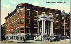
Grace Hospital |
|
August 11, 2004
(#04000856) |
401 W. Grace St.
37°32′49″N 77°26′48″W / 37.546944°N 77.446667°W / 37.546944; -77.446667 (Grace Hospital) |
|
| 76 |
Grace Street Commercial Historic District |
|
July 13, 1998
(#98000739) |
Roughly bounded by Adams, Broad, 8th, and Franklin Sts.; also 626 and 700 E. Broad St., 12-118 N. 8th St., 707-715 E. Franklin St., and 2-18 and 13 W. Franklin St.
37°32′32″N 77°26′19″W / 37.542222°N 77.438611°W / 37.542222; -77.438611 (Grace Street Commercial Historic District) |
Second set of boundaries represents a boundary increase of November 12, 2009 |
| 77 |
William H. Grant House |
|
April 16, 1969
(#69000356) |
1008 E. Clay St.
37°32′31″N 77°25′51″W / 37.541944°N 77.430833°W / 37.541944; -77.430833 (William H. Grant House) |
|
| 78 |
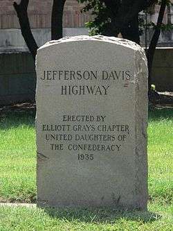
Elliott Grays Marker-Jefferson Davis Highway |
|
August 31, 2006
(#06000748) |
Junction of Harwood St., Ingram Ave., and the Jefferson Davis Highway
37°30′12″N 77°26′48″W / 37.503361°N 77.446639°W / 37.503361; -77.446639 (Elliott Grays Marker-Jefferson Davis Highway) |
|
| 79 |
Green's Farm (Huntley) |
|
November 9, 2005
(#05001228) |
6510 Three Chopt Rd.
37°34′57″N 77°31′46″W / 37.582500°N 77.529444°W / 37.582500; -77.529444 (Green's Farm (Huntley)) |
|
| 80 |
Hancock-Wirt-Caskie House |
|
April 17, 1970
(#70000881) |
2 N. 5th St.
37°32′26″N 77°26′24″W / 37.540556°N 77.440000°W / 37.540556; -77.440000 (Hancock-Wirt-Caskie House) |
|
| 81 |
Hasker and Marcuse Factory |
|
August 11, 1983
(#83003303) |
2401-2413 Venable St.
37°32′18″N 77°24′51″W / 37.538333°N 77.414167°W / 37.538333; -77.414167 (Hasker and Marcuse Factory) |
|
| 82 |
Bolling Haxall House |
|
March 16, 1972
(#72001522) |
211 E. Franklin St.
37°32′32″N 77°26′29″W / 37.542222°N 77.441389°W / 37.542222; -77.441389 (Bolling Haxall House) |
|
| 83 |
Hebrew Cemetery |
|
May 5, 2006
(#06000348) |
400 Hospital St.
37°33′09″N 77°25′47″W / 37.552500°N 77.429722°W / 37.552500; -77.429722 (Hebrew Cemetery) |
|
| 84 |
Hermitage Road Historic District |
|
February 9, 2006
(#06000031) |
3800-4200 blocks of Hermitage Rd.
37°35′20″N 77°27′50″W / 37.588889°N 77.463889°W / 37.588889; -77.463889 (Hermitage Road Historic District) |
|
| 85 |
Hermitage Road Warehouse Historic District |
|
June 9, 2014
(#14000302) |
Bounded by Hermitage and Overbrook Rds., Sherwood Ave., and Interstate 95
37°34′07″N 77°27′32″W / 37.568611°N 77.458889°W / 37.568611; -77.458889 (Hermitage Road Warehouse Historic District) |
|
| 86 |
Higgins Doctors Office Building |
|
May 8, 2017
(#100000987) |
3540 Floyd Ave.
37°33′30″N 77°29′14″W / 37.558472°N 77.487222°W / 37.558472; -77.487222 (Higgins Doctors Office Building) |
|
| 87 |
Highland Park Plaza Historic District |
|
December 4, 2004
(#04001294) |
Roughly bounded by Meadowbridge Rd., Missouri Ave., the city limits, and Detroit Ave.
37°34′29″N 77°24′58″W / 37.574722°N 77.416111°W / 37.574722; -77.416111 (Highland Park Plaza Historic District) |
|
| 88 |
Highland Park Public School |
|
October 22, 1991
(#91001683) |
2928 2nd Ave.
37°34′10″N 77°25′09″W / 37.569444°N 77.419167°W / 37.569444; -77.419167 (Highland Park Public School) |
|
| 89 |
Holly Lawn |
|
August 26, 1982
(#82004587) |
4015 Hermitage Rd.
37°35′22″N 77°27′48″W / 37.589306°N 77.463333°W / 37.589306; -77.463333 (Holly Lawn) |
|
| 90 |
Hollywood Cemetery |
|
November 12, 1969
(#69000350) |
412 S. Cherry St.
37°32′10″N 77°27′30″W / 37.536111°N 77.458333°W / 37.536111; -77.458333 (Hollywood Cemetery) |
|
| 91 |
Home For Confederate Women |
|
November 7, 1985
(#85002767) |
301 N. Sheppard St.
37°33′25″N 77°28′34″W / 37.556944°N 77.476111°W / 37.556944; -77.476111 (Home For Confederate Women) |
|
| 92 |
Hunt-Sitterding House |
|
September 12, 2008
(#08000877) |
901 Floyd Ave.
37°32′49″N 77°27′11″W / 37.546944°N 77.453056°W / 37.546944; -77.453056 (Hunt-Sitterding House) |
|
| 93 |
Jackson Ward Historic District |
|
July 30, 1976
(#76002187) |
Roughly bounded by 5th, Marshall, and Gilmer Sts., and the Richmond-Petersburg Turnpike; also ½-17 E. Marshall St. and 0-24 W. Marshall St.; also the 400 blocks of 1st, 2nd, and 3rd Sts., 106-108 E. Marshall, and 411-413 N. Adams St.
37°32′52″N 77°26′28″W / 37.547778°N 77.441111°W / 37.547778; -77.441111 (Jackson Ward Historic District) |
Second and third sets of boundaries represent boundary increases of September 26, 2005 and May 16, 2008 |
| 94 |
James River and Kanawha Canal Historic District |
|
August 26, 1971
(#71000982) |
Extends from Ship Locks to Bosher's Dam
37°32′06″N 77°26′36″W / 37.535000°N 77.443333°W / 37.535000; -77.443333 (James River and Kanawha Canal Historic District) |
|
| 95 |
Jefferson Hotel |
|
June 4, 1969
(#69000351) |
104 W. Main St.
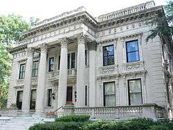
37°32′39″N 77°26′44″W / 37.544167°N 77.445556°W / 37.544167; -77.445556 (Jefferson Hotel) |
|
| 96 |
Jerman House |
|
February 2, 2016
(#15001046) |
24 Hampton Hills Ln.
37°33′53″N 77°31′36″W / 37.564722°N 77.526667°W / 37.564722; -77.526667 (Jerman House) |
|
| 97 |
John Rolfe Apartments |
|
September 9, 2010
(#10000736) |
101 Tempsford Ln.
37°33′59″N 77°31′11″W / 37.566389°N 77.519722°W / 37.566389; -77.519722 (John Rolfe Apartments) |
|
| 98 |
Kent Road Village |
|
August 18, 2011
(#11000549) |
920-924 N. Hamilton St. and 905-935 Kent Rd.
37°33′59″N 77°29′03″W / 37.566389°N 77.484167°W / 37.566389; -77.484167 (Kent Road Village) |
|
| 99 |
Kent-Valentine House |
|
December 18, 1970
(#70000882) |
12 E. Franklin St.
37°32′38″N 77°26′34″W / 37.543889°N 77.442778°W / 37.543889; -77.442778 (Kent-Valentine House) |
|
| 100 |
Kenwyn |
|
June 1, 2018
(#100002530) |
6 Ampthill Rd
37°33′59″N 77°30′50″W / 37.5664°N 77.5139°W / 37.5664; -77.5139 (Kenwyn) |
|
| 101 |
Laburnum Park Historic District |
|
February 5, 2002
(#01001573) |
Westwood, Palmyra, Confederate, Wilmington, and W. Laburnum Aves., and Chatham, Gloucester, and Lamont Sts.
37°34′52″N 77°27′23″W / 37.581111°N 77.456389°W / 37.581111; -77.456389 (Laburnum Park Historic District) |
|
| 102 |
Laurel Meadow |
|
February 5, 2014
(#13001165) |
1640 Bramwell Rd.
37°29′08″N 77°30′27″W / 37.485556°N 77.507500°W / 37.485556; -77.507500 (Laurel Meadow) |
|
| 103 |
Lee Medical Building |
|
April 17, 2018
(#100002356) |
1805 Monument Ave.
37°33′14″N 77°27′39″W / 37.553975°N 77.460742°W / 37.553975; -77.460742 (Lee Medical Building) |
|
| 104 |
Robert E. Lee Monument |
|
January 5, 2007
(#06001213) |
1700 Monument Ave. at the junction of Monument and Allen Aves.
37°33′14″N 77°27′36″W / 37.553889°N 77.460000°W / 37.553889; -77.460000 (Robert E. Lee Monument) |
|
| 105 |
Leigh Street Baptist Church |
|
March 16, 1972
(#72001523) |
517 N. 25th St.
37°32′02″N 77°24′58″W / 37.533889°N 77.416111°W / 37.533889; -77.416111 (Leigh Street Baptist Church) |
|
| 106 |
Benjamin Watkins Leigh House |
|
April 16, 1969
(#69000352) |
1000 E. Clay St.
37°32′31″N 77°25′52″W / 37.542083°N 77.431111°W / 37.542083; -77.431111 (Benjamin Watkins Leigh House) |
|
| 107 |
Linden Row |
|
November 23, 1971
(#71001061) |
100-114 E. Franklin St.
37°32′36″N 77°26′32″W / 37.543333°N 77.442222°W / 37.543333; -77.442222 (Linden Row) |
|
| 108 |
Loews Theatre |
|
November 20, 1979
(#79003292) |
6th and Grace Sts.
37°32′30″N 77°26′13″W / 37.541667°N 77.436944°W / 37.541667; -77.436944 (Loews Theatre) |
|
| 109 |
Main Street Banking Historic District |
|
June 1, 2005
(#05000527) |
E. Main St. between 7th and Governors Sts.; also 700, 703, 705-711, 801, and 830-838 Main St., E., 7 7th St., S., and 28 6th St., S.
37°32′18″N 77°26′10″W / 37.538333°N 77.436111°W / 37.538333; -77.436111 (Main Street Banking Historic District) |
Second set of boundaries represents a boundary increase of August 27, 2013 |
| 110 |
Main Street Station and Trainshed |
|
October 15, 1970
(#70000867) |
1020 E. Main St.
37°32′05″N 77°25′45″W / 37.534722°N 77.429167°W / 37.534722; -77.429167 (Main Street Station and Trainshed) |
|
| 111 |
Manchester Courthouse |
|
May 8, 1998
(#98000450) |
920 Hull St.
37°31′19″N 77°26′31″W / 37.521944°N 77.441944°W / 37.521944; -77.441944 (Manchester Courthouse) |
|
| 112 |
Manchester Industrial Historic District |
|
August 2, 2000
(#00000886) |
Roughly bounded by Perry St., the James River, Mayo's Bridge, Maury St., and 10th St.; also the 700 block of Stockton St.; also parts of Decatur, Everett, Hull, Maury, and Stockton Sts., 700 Semmes Ave., 300 E. 2nd St., and the 300 blocks of E. 5th and 6th Sts.
37°31′33″N 77°26′13″W / 37.525833°N 77.436944°W / 37.525833; -77.436944 (Manchester Industrial Historic District) |
Second and third sets of boundaries represent boundary increases of September 22, 2004 and August 1, 2012 |
| 113 |
Manchester Residential and Commercial Historic District |
|
May 16, 2002
(#02000521) |
Roughly bounded by 9th St., McDonough St., Cowardin Ave., and Stockton St.; also 1211-1217, 1301-1305, and 1418 McDonough St., 310-312 W. 12th St., 309 W. 13th St., and 314 and 400 W. 14th St.
37°31′21″N 77°26′42″W / 37.522500°N 77.445000°W / 37.522500; -77.445000 (Manchester Residential and Commercial Historic District) |
Second set of boundaries represents a boundary increase of November 1, 2006 |
| 114 |
John Marshall House |
|
October 15, 1966
(#66000916) |
9th and Marshall Sts.
37°32′31″N 77°25′59″W / 37.541944°N 77.433056°W / 37.541944; -77.433056 (John Marshall House) |
|
| 115 |
Mason's Hall |
|
July 2, 1973
(#73002220) |
1807 E. Franklin St.
37°32′00″N 77°25′36″W / 37.533472°N 77.426667°W / 37.533472; -77.426667 (Mason's Hall) |
|
| 116 |
Masonic Temple |
|
February 10, 1983
(#83003305) |
101-107 W. Broad St.
37°32′46″N 77°26′36″W / 37.546111°N 77.443333°W / 37.546111; -77.443333 (Masonic Temple) |
|
| 117 |
Maury Street Marker, Jefferson Davis Highway |
|
June 2, 2004
(#04000572) |
Junction of Maury St. and the Jefferson Davis Highway
37°30′45″N 77°26′53″W / 37.512583°N 77.448111°W / 37.512583; -77.448111 (Maury Street Marker, Jefferson Davis Highway) |
|
| 118 |
Maymont |
|
December 16, 1971
(#71001062) |
Hampton St. (Spottswood Rd.)
37°32′04″N 77°28′42″W / 37.534444°N 77.478333°W / 37.534444; -77.478333 (Maymont) |
|
| 119 |
Monroe Park Historic District |
|
July 5, 1984
(#84003572) |
Roughly bounded by Belvidere, Main, Cherry, Park, Laurel, and Franklin Sts.
37°32′48″N 77°27′01″W / 37.546667°N 77.450278°W / 37.546667; -77.450278 (Monroe Park Historic District) |
|
| 120 |
Monroe Ward |
|
January 27, 2000
(#99001717) |
Roughly Main and Cary St., and 3rd to Jefferson Sts.
37°32′34″N 77°26′38″W / 37.542778°N 77.443889°W / 37.542778; -77.443889 (Monroe Ward) |
|
| 121 |
James Monroe Tomb |
|
November 11, 1971
(#71001044) |
Hollywood Cemetery, 412 S. Cherry St.
37°32′02″N 77°27′24″W / 37.533778°N 77.456556°W / 37.533778; -77.456556 (James Monroe Tomb) |
|
| 122 |
Monument Avenue Historic District |
|
February 16, 1970
(#70000883) |
Bounded by Grace and Birch Sts., Park Ave., and Roseneath Rd.; also roughly Franklin St. from Roseneath Rd. to Cleveland St.
37°33′30″N 77°28′04″W / 37.558333°N 77.467778°W / 37.558333; -77.467778 (Monument Avenue Historic District) |
Franklin Street represents a boundary increase of January 17, 1991 |
| 123 |
Monumental Church |
|
April 16, 1969
(#69000326) |
1224 E. Broad St.
37°32′20″N 77°25′47″W / 37.538889°N 77.429722°W / 37.538889; -77.429722 (Monumental Church) |
|
| 124 |
Moore's Auto Body and Paint Shop |
|
October 14, 1993
(#93001123) |
401 W. Broad St.
37°32′51″N 77°26′45″W / 37.547500°N 77.445833°W / 37.547500; -77.445833 (Moore's Auto Body and Paint Shop) |
|
| 125 |
Philip Morris Blended Leaf Complex Historic District |
|
June 5, 2017
(#100001049) |
2301 Maury St.
37°30′46″N 77°27′00″W / 37.512778°N 77.450000°W / 37.512778; -77.450000 (Philip Morris Blended Leaf Complex Historic District) |
|
| 126 |
Morson's Row |
|
June 11, 1969
(#69000354) |
219-223 Governor St.
37°32′19″N 77°25′54″W / 37.538611°N 77.431667°W / 37.538611; -77.431667 (Morson's Row) |
|
| 127 |
National Theater |
|
April 2, 2003
(#03000188) |
700-710 E. Broad St.
37°32′31″N 77°26′07″W / 37.541944°N 77.435278°W / 37.541944; -77.435278 (National Theater) |
|
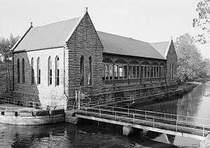
| 128 |
New Pump-House |
|
November 21, 2002
(#02001366) |
1708 Pump House Dr.
37°32′12″N 77°29′10″W / 37.536667°N 77.486111°W / 37.536667; -77.486111 (New Pump-House) |
|
| 129 |
Ninth Street Office Building |
|
September 16, 2009
(#09000730) |
202 N. 9th St.
37°32′25″N 77°26′05″W / 37.540278°N 77.434722°W / 37.540278; -77.434722 (Ninth Street Office Building) |
|
| 130 |
North Court |
|
May 7, 2013
(#13000260) |
40 Westhampton Way
37°34′33″N 77°32′36″W / 37.57586°N 77.54342°W / 37.57586; -77.54342 (North Court) |
|
| 131 |
North Thompson Street Historic District |
|
September 18, 2017
(#100001644) |
N. Thompson St. between Broad St. and Monument Ave.
37°34′03″N 77°28′46″W / 37.567500°N 77.479444°W / 37.567500; -77.479444 (North Thompson Street Historic District) |
|
| 132 |
Oakwood-Chimborazo Historic District |
|
March 18, 2005
(#04001372) |
Roughly N. 30th-N. 39th St. on Chimborazo, Meldon, Oakwood, E. Broad, Briel, E. Clay, E. Leigh, M, E. Marshall, N, O, and P Sts.
37°31′48″N 77°24′27″W / 37.530000°N 77.407500°W / 37.530000; -77.407500 (Oakwood-Chimborazo Historic District) |
|
| 133 |
Old Stone House |
|
November 14, 1973
(#73002222) |
1914 E. Main St.
37°31′56″N 77°25′34″W / 37.532111°N 77.426111°W / 37.532111; -77.426111 (Old Stone House) |
|
| 134 |
Oliver Chilled Plow Works Branch House |
|
June 4, 2018
(#100002531) |
908 Oliver Way
37°32′30″N 77°25′29″W / 37.541693°N 77.4246°W / 37.541693; -77.4246 (Oliver Chilled Plow Works Branch House) |
|
| 135 |
Oregon Hill Historic District |
|
February 5, 1991
(#91000022) |
Roughly bounded by W. Cary St., Belvidere St., Oregon Hill Park, S. Cherry St. and S. Linden St.
37°32′24″N 77°27′07″W / 37.540000°N 77.451944°W / 37.540000; -77.451944 (Oregon Hill Historic District) |
|
| 136 |
Pace-King House |
|
July 30, 1976
(#76002230) |
205 N. 19th St.
37°32′04″N 77°25′28″W / 37.534306°N 77.424444°W / 37.534306; -77.424444 (Pace-King House) |
|
| 137 |
Pine Camp Tuberculosis Hospital |
|
April 4, 2003
(#03000190) |
4901 Old Brook Rd.
37°36′00″N 77°26′46″W / 37.600000°N 77.446111°W / 37.600000; -77.446111 (Pine Camp Tuberculosis Hospital) |
|
| 138 |
Planters National Bank |
|
February 10, 1983
(#83003306) |
12th and E. Main Sts.
37°32′13″N 77°26′00″W / 37.536944°N 77.433333°W / 37.536944; -77.433333 (Planters National Bank) |
|
| 139 |
Putney Houses |
|
June 11, 1969
(#69000355) |
1010-1012 E. Marshall St.
37°32′27″N 77°25′53″W / 37.540833°N 77.431389°W / 37.540833; -77.431389 (Putney Houses) |
|
| 140 |
Randolph School |
|
October 4, 1984
(#84000050) |
300 S. Randolph St.
37°32′37″N 77°27′36″W / 37.543611°N 77.460000°W / 37.543611; -77.460000 (Randolph School) |
|
| 141 |
Reveille |
|
February 1, 1979
(#79003293) |
4200 Cary St. Rd.
37°33′38″N 77°29′45″W / 37.560694°N 77.495833°W / 37.560694; -77.495833 (Reveille) |
|
| 142 |
Rice House |
|
March 30, 1999
(#99000369) |
1000 Old Locke Lane
37°33′21″N 77°31′02″W / 37.555833°N 77.517222°W / 37.555833; -77.517222 (Rice House) |
|
| 143 |
Richmond Academy of Medicine |
|
August 16, 1984
(#84003574) |
1200 E. Clay St.
37°32′28″N 77°25′46″W / 37.541111°N 77.429306°W / 37.541111; -77.429306 (Richmond Academy of Medicine) |
|
| 144 |
Richmond and Chesapeake Bay Railway Car Barn |
|
May 4, 2006
(#06000349) |
1620 Brook Rd.
37°33′30″N 77°26′48″W / 37.558333°N 77.446667°W / 37.558333; -77.446667 (Richmond and Chesapeake Bay Railway Car Barn) |
|
| 145 |
Richmond Locomotive and Machine Works |
|
April 27, 2007
(#07000363) |
1331 N. Boulevard
37°34′02″N 77°28′02″W / 37.567222°N 77.467222°W / 37.567222; -77.467222 (Richmond Locomotive and Machine Works) |
|
| 146 |
Robinson House |
|
December 24, 2013
(#13000993) |
200 N. Boulevard
37°33′26″N 77°28′28″W / 37.557111°N 77.474472°W / 37.557111; -77.474472 (Robinson House) |
|
| 147 |
Rockfalls |
|
February 21, 2017
(#100000678) |
7441 Rockfalls Dr.
37°33′00″N 77°31′31″W / 37.550000°N 77.525278°W / 37.550000; -77.525278 (Rockfalls) |
|
| 148 |
Ryland Hall |
|
May 7, 2013
(#13000261) |
2 Ryland Circle
37°34′39″N 77°32′14″W / 37.577500°N 77.537222°W / 37.577500; -77.537222 (Ryland Hall) |
|
| 149 |
St. Alban's Hall |
|
September 9, 1982
(#82004588) |
300-302 E. Main St.
37°32′29″N 77°26′29″W / 37.541389°N 77.441389°W / 37.541389; -77.441389 (St. Alban's Hall) |
|
| 150 |
St. Andrew's Church |
|
June 22, 1979
(#79003294) |
223, 224, and 227 S. Cherry St.
37°32′31″N 77°27′07″W / 37.541944°N 77.451944°W / 37.541944; -77.451944 (St. Andrew's Church) |
|
| 151 |
St. Catherine's School |
|
May 4, 2007
(#07000400) |
6001 Grove Ave.
37°34′20″N 77°31′16″W / 37.572222°N 77.521111°W / 37.572222; -77.521111 (St. Catherine's School) |
|
| 152 |
St. Christopher's School |
|
March 13, 2002
(#02000183) |
711 St. Christopher's Rd.
37°34′46″N 77°31′18″W / 37.579444°N 77.521667°W / 37.579444; -77.521667 (St. Christopher's School) |
|
| 153 |
St. John's Church Historic District |
|
September 15, 1970
(#70000884) |
Bounded roughly by 22nd, Marshall, 32nd, Main, and Franklin Sts. and Williamsburg Ave.; also roughly bounded by 21st, E. Marshall, 22nd and E. Franklin Sts.
37°31′48″N 77°25′06″W / 37.530000°N 77.418333°W / 37.530000; -77.418333 (St. John's Church Historic District) |
Second set of boundaries represents a boundary increase of January 17, 1991 |
| 154 |
St. John's Episcopal Church |
|
October 15, 1966
(#66000920) |
E. Broad St. between 24th and 25th Sts.
37°31′53″N 77°25′11″W / 37.531389°N 77.419722°W / 37.531389; -77.419722 (St. John's Episcopal Church) |
|
| 155 |
St. Luke Building |
|
September 16, 1982
(#82004589) |
900 St. James St.
37°33′04″N 77°26′13″W / 37.551111°N 77.436944°W / 37.551111; -77.436944 (St. Luke Building) |
|
| 156 |
St. Paul's Church |
|
June 4, 1969
(#69000357) |
815 E. Grace St.
37°32′23″N 77°26′07″W / 37.539722°N 77.435278°W / 37.539722; -77.435278 (St. Paul's Church) |
|
| 157 |
St. Peter's Church |
|
June 23, 1969
(#69000358) |
800 E. Grace St.
37°32′26″N 77°26′07″W / 37.540556°N 77.435306°W / 37.540556; -77.435306 (St. Peter's Church) |
|
| 158 |
St. Sophia Home of the Little Sisters of the Poor |
|
May 7, 1980
(#80004217) |
16 N. Harvie St.
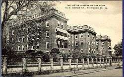
37°32′50″N 77°27′31″W / 37.547222°N 77.458611°W / 37.547222; -77.458611 (St. Sophia Home of the Little Sisters of the Poor) |
|
| 159 |
Scott House |
|
November 26, 2007
(#05001545) |
909 W. Franklin St.
37°32′58″N 77°27′12″W / 37.549444°N 77.453333°W / 37.549444; -77.453333 (Scott House) |
|
| 160 |
Scott's Addition Historic District |
|
August 12, 2005
(#05000896) |
Roughly bounded by Cutshaw Ave., Boulevard, and the former Richmond, Fredericksburg and Potomac railroad line
37°34′06″N 77°28′21″W / 37.568333°N 77.4725°W / 37.568333; -77.4725 (Scott's Addition Historic District) |
|
| 161 |
Second Presbyterian Church |
|
March 29, 1972
(#72001525) |
9 N. 5th St.
37°32′26″N 77°26′22″W / 37.540556°N 77.439444°W / 37.540556; -77.439444 (Second Presbyterian Church) |
|
| 162 |
Shockoe Hill Cemetery |
|
July 7, 1995
(#95000818) |
Junction of Hospital and 2nd Sts.
37°33′05″N 77°25′56″W / 37.551389°N 77.432222°W / 37.551389; -77.432222 (Shockoe Hill Cemetery) |
|
| 163 |
Shockoe Slip Historic District |
|
March 29, 1972
(#72001526) |
Roughly along E. Carey St. between S. 14th and S. 12th Sts.; also roughly bounded by the former Seaboard Coast Line railroad tracks, the Downtown Expressway, Main, Dock, and 12th Sts.; also 11-15 and 101 S. 15th St., and 1433 E. Main St.; also the 300 block of S. 11th, 1200 and 1300 E. Byrd Sts., 1201 Haxall Pt., and the Thirteenth Street Bridge
37°32′07″N 77°26′02″W / 37.535278°N 77.433889°W / 37.535278; -77.433889 (Shockoe Slip Historic District) |
Second, third, and fourth sets of boundaries represent boundary increases of April 20, 1983, August 24, 2005, and August 14, 2012 |
| 164 |
Shockoe Valley and Tobacco Row Historic District |
|
February 24, 1983
(#83003308) |
Roughly bounded by Dock, 15th, Clay, Franklin, and Peach Sts.
37°31′56″N 77°25′35″W / 37.532222°N 77.426389°W / 37.532222; -77.426389 (Shockoe Valley and Tobacco Row Historic District) |
|
| 165 |
Sixth Mount Zion Baptist Church |
|
December 16, 1996
(#96001445) |
14 W. Duval St.
37°33′02″N 77°26′18″W / 37.550556°N 77.438333°W / 37.550556; -77.438333 (Sixth Mount Zion Baptist Church) |
|
| 166 |
Southern Biscuit Company |
|
August 22, 2012
(#12000546) |
900 Terminal Pl.
37°33′47″N 77°28′04″W / 37.563056°N 77.467778°W / 37.563056; -77.467778 (Southern Biscuit Company) |
|
| 167 |
Southern Stove Works |
|
May 26, 2005
(#05000480) |
1215 Hermitage Rd.
37°33′41″N 77°27′34″W / 37.561389°N 77.459444°W / 37.561389; -77.459444 (Southern Stove Works) |
|
| 168 |
Southern Stove Works, Manchester |
|
February 21, 2008
(#08000076) |
516-520 Dinwiddie Ave.
37°31′04″N 77°25′57″W / 37.517778°N 77.4325°W / 37.517778; -77.4325 (Southern Stove Works, Manchester) |
|
| 169 |
Springfield School |
|
August 24, 1992
(#92001032) |
608 N. 26th St.
37°32′03″N 77°24′55″W / 37.534167°N 77.415278°W / 37.534167; -77.415278 (Springfield School) |
|
| 170 |
Springhill Historic District |
|
February 10, 2014
(#13001173) |
W. 19th, W. 20th, W. 21st, and W. 22nd Sts., Riverside Dr., and Stonewall Ave.
37°31′24″N 77°27′16″W / 37.523333°N 77.454500°W / 37.523333; -77.454500 (Springhill Historic District) |
|
| 171 |
Steamer Company Number 5 |
|
February 8, 1995
(#95000027) |
200 W. Marshall St.
37°32′52″N 77°26′34″W / 37.547778°N 77.442778°W / 37.547778; -77.442778 (Steamer Company Number 5) |
|
| 172 |
Stearns Iron-Front Building |
|
February 26, 1970
(#70000885) |
1007-1013 E. Main St.
37°32′14″N 77°26′06″W / 37.537222°N 77.435000°W / 37.537222; -77.435000 (Stearns Iron-Front Building) |
|
| 173 |
Stewart-Lee House |
|
May 5, 1972
(#72001527) |
707 E. Franklin St.
37°32′23″N 77°26′13″W / 37.539722°N 77.437083°W / 37.539722; -77.437083 (Stewart-Lee House) |
|
| 174 |
Stonewall Jackson School |
|
May 3, 1984
(#84003576) |
1520 W. Main St.
37°32′51″N 77°27′38″W / 37.547500°N 77.460556°W / 37.547500; -77.460556 (Stonewall Jackson School) |
|
| 175 |
Taylor Farm |
|
January 24, 1991
(#90002158) |
4012 Walmsley Boulevard
37°28′10″N 77°28′10″W / 37.469583°N 77.469444°W / 37.469583; -77.469444 (Taylor Farm) |
|
| 176 |
Taylor-Mayo House |
|
April 2, 1973
(#73002221) |
110 W. Franklin St.
37°32′42″N 77°26′42″W / 37.545000°N 77.445000°W / 37.545000; -77.445000 (Taylor-Mayo House) |
|
| 177 |
Third Street Bethel A.M.E. Church |
|
June 5, 1975
(#75002117) |
616 N. 3rd St.
37°32′52″N 77°26′10″W / 37.547778°N 77.436111°W / 37.547778; -77.436111 (Third Street Bethel A.M.E. Church) |
|
| 178 |
Thomas Jefferson High School |
|
December 23, 1993
(#93001441) |
4100 W. Grace St.
37°34′17″N 77°29′11″W / 37.571389°N 77.486389°W / 37.571389; -77.486389 (Thomas Jefferson High School) |
|
| 179 |
Three Chopt Road Historic District |
|
August 14, 2012
(#12000520) |
Three Chopt Rd. from Cary St. to Bandy Rd.
37°34′43″N 77°31′36″W / 37.578611°N 77.526667°W / 37.578611; -77.526667 (Three Chopt Road Historic District) |
|
| 180 |
E. M. Todd Company |
|
September 14, 2002
(#02000997) |
1128 Hermitage Rd.
37°33′44″N 77°27′38″W / 37.562222°N 77.460556°W / 37.562222; -77.460556 (E. M. Todd Company) |
|
| 181 |
Tower Building |
|
November 24, 2017
(#100001854) |
3212 Cutshaw Ave.
37°33′57″N 77°28′32″W / 37.565833°N 77.475556°W / 37.565833; -77.475556 (Tower Building) |
|
| 182 |
Town of Barton Heights Historic District |
|
August 6, 2003
(#02000592) |
Roughly Barton, Fendall, Greenwood, Lamb, Miller, Monterio, North, Rose, Dove, Home, Minor, Poe, Wellford, and Wickham
37°33′37″N 77°25′57″W / 37.560278°N 77.4325°W / 37.560278; -77.4325 (Town of Barton Heights Historic District) |
|
| 183 |
Tredegar Iron Works |
|
July 2, 1971
(#71001048) |
500 Tredegar St.
37°32′08″N 77°26′43″W / 37.535556°N 77.445278°W / 37.535556; -77.445278 (Tredegar Iron Works) |
|
| 184 |
Trinity Methodist Church |
|
April 16, 1987
(#87000625) |
2000 E. Broad St.
37°32′04″N 77°25′23″W / 37.534444°N 77.423056°W / 37.534444; -77.423056 (Trinity Methodist Church) |
|
| 185 |
Tuckahoe Apartments |
|
February 2, 2001
(#01000065) |
5621 Cary St. Rd.
37°34′07″N 77°31′22″W / 37.568611°N 77.522778°W / 37.568611; -77.522778 (Tuckahoe Apartments) |
|
| 186 |
Two Hundred Block West Franklin Street Historic District |
|
November 17, 1977
(#77001536) |
200 block of W. Franklin St.; also 212-220 W. Main St.
37°32′43″N 77°26′45″W / 37.545278°N 77.445833°W / 37.545278; -77.445833 (Two Hundred Block West Franklin Street Historic District) |
Main Street represents a boundary increase of October 21, 1994 |
| 187 |
U.S. Post Office and Customhouse |
|
June 4, 1969
(#69000359) |
1000 E. Main St.
37°32′16″N 77°26′05″W / 37.537778°N 77.434722°W / 37.537778; -77.434722 (U.S. Post Office and Customhouse) |
|
| 188 |
Union Hill Historic District |
|
December 31, 2002
(#02001670) |
Roughly 20th, 21st, 22nd, 23rd, 24th 25th, Jessamine, Pink, Burton, Carrington, Cedar, Clay, Jefferson, Leigh, M, and O Sts.
37°32′14″N 77°25′05″W / 37.537222°N 77.418056°W / 37.537222; -77.418056 (Union Hill Historic District) |
|
| 189 |
Union Seminary |
|
April 14, 1983
(#83003309) |
3401 Brook Rd.
37°34′44″N 77°26′50″W / 37.578889°N 77.447222°W / 37.578889; -77.447222 (Union Seminary) |
|
| 190 |
United Daughters of the Confederacy Memorial Building |
|
April 24, 2008
(#08000341) |
328 N. Boulevard
37°33′25″N 77°28′26″W / 37.556944°N 77.473889°W / 37.556944; -77.473889 (United Daughters of the Confederacy Memorial Building) |
|
| 191 |
Valentine Museum |
|
June 11, 1969
(#69000329) |
1005-1015 E. Clay St.
37°32′29″N 77°25′51″W / 37.541389°N 77.430833°W / 37.541389; -77.430833 (Valentine Museum) |
|
| 192 |
Virginia Commission for the Blind |
|
November 22, 2016
(#16000800) |
3003 Parkwood Ave.
37°33′06″N 77°28′47″W / 37.551667°N 77.479722°W / 37.551667; -77.479722 (Virginia Commission for the Blind) |
|
| 193 |
Virginia Department of Highways Building |
|
April 5, 2004
(#04000270) |
1401 E. Broad St.
37°32′17″N 77°25′51″W / 37.538056°N 77.430833°W / 37.538056; -77.430833 (Virginia Department of Highways Building) |
|
| 194 |
Virginia House |
|
June 13, 1990
(#89001933) |
4301 Sulgrave Rd.
37°33′13″N 77°30′11″W / 37.553611°N 77.503056°W / 37.553611; -77.503056 (Virginia House) |
|
| 195 |
Virginia Mutual Building |
|
November 7, 1977
(#77001537) |
821 E. Main St.
37°32′18″N 77°26′13″W / 37.538333°N 77.436944°W / 37.538333; -77.436944 (Virginia Mutual Building) |
|
| 196 |
Virginia State Capitol |
|
October 15, 1966
(#66000911) |
Capitol Sq.
37°32′19″N 77°26′01″W / 37.538611°N 77.433611°W / 37.538611; -77.433611 (Virginia State Capitol) |
|
| 197 |
Virginia State Library |
|
August 9, 2005
(#05000867) |
1111 E. Broad St.
37°32′21″N 77°25′55″W / 37.539167°N 77.431944°W / 37.539167; -77.431944 (Virginia State Library) |
Once home to the Virginia Supreme Court; now an executive office building, the Patrick Henry Building |
| 198 |
Virginia State Library-Oliver Hill Building |
|
June 20, 2008
(#08000542) |
102 Governor St.
37°32′10″N 77°25′59″W / 37.536056°N 77.433056°W / 37.536056; -77.433056 (Virginia State Library-Oliver Hill Building) |
|
| 199 |
Virginia Union University |
|
July 26, 1982
(#82004590) |
1500 N. Lombardy St.
37°33′39″N 77°27′07″W / 37.560833°N 77.451944°W / 37.560833; -77.451944 (Virginia Union University) |
|
| 200 |
Virginia War Memorial Carillon |
|
October 4, 1984
(#84000053) |
1300 Blanton Ave.
37°32′27″N 77°29′00″W / 37.540833°N 77.483333°W / 37.540833; -77.483333 (Virginia War Memorial Carillon) |
|
| 201 |
Virginia Washington Monument |
|
January 15, 2004
(#03001421) |
Capitol Square
37°32′22″N 77°26′02″W / 37.539444°N 77.434017°W / 37.539444; -77.434017 (Virginia Washington Monument) |
|
| 202 |
The Virginia |
|
February 10, 1983
(#83003310) |
1 N. 5th St.
37°32′25″N 77°26′22″W / 37.540278°N 77.439444°W / 37.540278; -77.439444 (The Virginia) |
|
| 203 |
Maggie L. Walker High School |
|
September 9, 1998
(#98001160) |
1000 N. Lombardy St.
37°33′28″N 77°27′14″W / 37.557778°N 77.453889°W / 37.557778; -77.453889 (Maggie L. Walker High School) |
|
| 204 |
Maggie Lena Walker House |
|
May 12, 1975
(#75002100) |
110A E. Leigh St.
37°32′52″N 77°26′16″W / 37.547778°N 77.437778°W / 37.547778; -77.437778 (Maggie Lena Walker House) |
|
| 205 |
George Washington Building |
|
May 18, 2011
(#11000297) |
1100 Bank St.
37°32′15″N 77°26′00″W / 37.5375°N 77.433333°W / 37.5375; -77.433333 (George Washington Building) |
|
| 206 |
Weisiger-Carroll House |
|
May 19, 1994
(#94000454) |
2408 Bainbridge St.
37°31′00″N 77°27′20″W / 37.516528°N 77.455417°W / 37.516528; -77.455417 (Weisiger-Carroll House) |
|
| 207 |
West Broad Street Commercial Historic District |
|
January 16, 2001
(#00001667) |
1300-1600 W. Broad St.
37°33′10″N 77°27′16″W / 37.552778°N 77.454444°W / 37.552778; -77.454444 (West Broad Street Commercial Historic District) |
|
| 208 |
West Broad Street Industrial and Commercial Historic District |
|
August 18, 2011
(#11000550) |
1800-2100 blocks of Broad and Marshall Sts., bounded by Allison and Allen Sts.
37°33′26″N 77°27′37″W / 37.557222°N 77.460278°W / 37.557222; -77.460278 (West Broad Street Industrial and Commercial Historic District) |
|
| 209 |
West Franklin Street Historic District |
|
September 14, 1972
(#72001528) |
W. Franklin St. between Laurel and Ryland Sts.; also the 900 block of W. Grace St., the 4000 block of N. Harrison St., and the 300 block of Shafer St.
37°33′00″N 77°27′13″W / 37.550000°N 77.453611°W / 37.550000; -77.453611 (West Franklin Street Historic District) |
Second set of boundaries represents a boundary increase of September 16, 2009 |
| 210 |
West of Boulevard Historic District |
|
March 7, 1994
(#94000153) |
Roughly bounded by Colonial Ave., W. Grace St., Cutshaw Ave., Thompson St., and Ellwood Ave.
37°33′35″N 77°28′46″W / 37.559722°N 77.479444°W / 37.559722; -77.479444 (West of Boulevard Historic District) |
|
| 211 |
Westbourne |
|
January 27, 2000
(#99001721) |
330 Oak Ln.
37°34′24″N 77°30′26″W / 37.573333°N 77.507222°W / 37.573333; -77.507222 (Westbourne) |
|
| 212 |
White House of the Confederacy |
|
October 15, 1966
(#66000924) |
Clay and 12th Sts.
37°32′27″N 77°25′46″W / 37.540833°N 77.429583°W / 37.540833; -77.429583 (White House of the Confederacy) |
|
| 213 |
John Whitworth House |
|
February 5, 1999
(#99000143) |
2221 Grove Ave.
37°33′08″N 77°28′05″W / 37.552361°N 77.468056°W / 37.552361; -77.468056 (John Whitworth House) |
|
| 214 |
Wicker Apartments |
|
January 9, 2016
(#15000962) |
3905-4213 Chamberlain Ave. and 4210-4232 Old Brook Rd.
37°35′38″N 77°26′54″W / 37.593889°N 77.448333°W / 37.593889; -77.448333 (Wicker Apartments) |
|
| 215 |
Charlotte Williams Memorial Hospital |
|
April 9, 2004
(#04000269) |
1201 E. Broad St.
37°32′20″N 77°25′53″W / 37.538889°N 77.431389°W / 37.538889; -77.431389 (Charlotte Williams Memorial Hospital) |
|
| 216 |
Wilton |
|
April 30, 1976
(#76002231) |
South of Richmond on the northern bank of the James River
37°33′45″N 77°31′11″W / 37.562500°N 77.519722°W / 37.562500; -77.519722 (Wilton) |
|
| 217 |
Joseph P. Winston House |
|
June 11, 1979
(#79003295) |
101-103 E. Grace St.
37°32′38″N 77°26′31″W / 37.543889°N 77.441944°W / 37.543889; -77.441944 (Joseph P. Winston House) |
|
| 218 |
Woodland Heights Historic District |
|
September 30, 2009
(#09000796) |
Bounded by the James River, W. 24th St., Bainbridge St., and Forest Hill Ave., and W. 32nd and 34th Sts.
37°31′16″N 77°27′47″W / 37.521111°N 77.463056°W / 37.521111; -77.463056 (Woodland Heights Historic District) |
|
| 219 |
Woodward House |
|
June 19, 1974
(#74002243) |
3017 Williamsburg Ave.
37°31′29″N 77°25′00″W / 37.524722°N 77.416667°W / 37.524722; -77.416667 (Woodward House) |
|
| 220 |
Young Women's Christian Association |
|
May 3, 1984
(#84003578) |
6 N. 5th St.
37°32′27″N 77°26′23″W / 37.540833°N 77.439722°W / 37.540833; -77.439722 (Young Women's Christian Association) |
|
.jpg)
.jpg)
.jpg)
.jpg)
.jpg)
.jpg)
%2C_Richmond%2C_Virginia%2C_2011.JPG)
_v1.JPG)

.jpg)
.jpg)

.jpg)


%2C_Richmond_vicinity%2C_(Henrico_County%2C_Virginia).jpg)
.jpg)