| [3] |
Name on the Register[4] |
Image |
Date listed[5] |
Location |
Description |
|---|
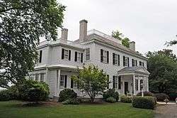
| 1 |
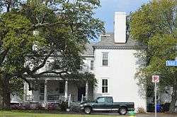
Allmand-Archer House |
|
September 22, 1971
(#71001056) |
327 Duke St.
36°51′06″N 76°17′34″W / 36.851528°N 76.292778°W / 36.851528; -76.292778 (Allmand-Archer House) |
|
| 2 |
American Cigar Company |
|
September 3, 2009
(#09000690) |
1148 E. Princess Anne Rd.
36°51′21″N 76°16′14″W / 36.855833°N 76.270556°W / 36.855833; -76.270556 (American Cigar Company) |
|
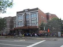
| 3 |
Attucks Theatre |
|
September 16, 1982
(#82004575) |
1008-1012 Church St.
36°51′24″N 76°16′44″W / 36.856667°N 76.278889°W / 36.856667; -76.278889 (Attucks Theatre) |
|
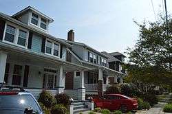
| 4 |
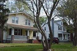
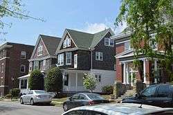
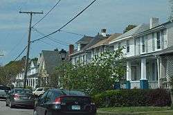
Ballentine Place Historic District |
|
May 22, 2003
(#03000459) |
Roughly bounded by Cromwell Ave., Cape Henry Ave., McKann Ave., and Lafayette Boulevard
36°52′01″N 76°15′11″W / 36.866944°N 76.253056°W / 36.866944; -76.253056 (Ballentine Place Historic District) |
|
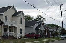
| 5 |
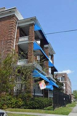
Berkley North Historic District |
|
November 22, 2000
(#00001440) |
Roughly bounded by Bellamy Ave., Pescara Creek, Berkley Ave., and Interstate 464
36°50′05″N 76°16′55″W / 36.834722°N 76.281944°W / 36.834722; -76.281944 (Berkley North Historic District) |
|
| 6 |
Boush-Tazewell House |
|
July 18, 1974
(#74002238) |
6225 Powhatan Ave.
36°54′01″N 76°18′50″W / 36.900278°N 76.313889°W / 36.900278; -76.313889 (Boush-Tazewell House) |
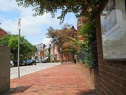
|
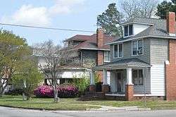
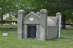
| 7 |
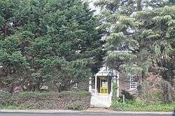
Chesterfield Heights Historic District |
|
June 10, 2003
(#03000443) |
Roughly bounded by the East Branch Elizabeth River, Ballentine Boulevard, Sedgewick St., and Interstate 264
36°50′34″N 76°15′28″W / 36.842778°N 76.257778°W / 36.842778; -76.257778 (Chesterfield Heights Historic District) |
|
| 8 |
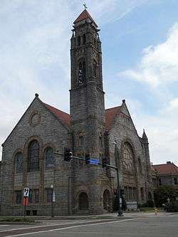
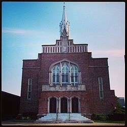
Christ and St. Luke's Church |
|
June 18, 1979
(#79003286) |
560 W. Olney Rd.
36°51′36″N 76°17′52″W / 36.860000°N 76.297778°W / 36.860000; -76.297778 (Christ and St. Luke's Church) |
|
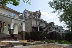
| 9 |
Colonial Place |
|
May 22, 2002
(#02000532) |
Roughly bounded by the Lafayette River, Knitting Mill Creek, East Haven Creek, and 38th St.
36°53′05″N 76°17′20″W / 36.884722°N 76.288889°W / 36.884722; -76.288889 (Colonial Place) |
|
| 10 |
Downtown Norfolk Historic District |
|
March 20, 1987
(#87000475) |
Granby, Main, and Plume Sts., City Hall Ave., and Bank St.; also Granby, Freemason, Charlotte, Bute, and York Sts., College Pl., and Monticello Ave.
36°50′58″N 76°17′28″W / 36.849444°N 76.291111°W / 36.849444; -76.291111 (Downtown Norfolk Historic District) |
Second set of boundaries represents a boundary increase of May 30, 2001 |
| 11 |
Elmwood Cemetery |
|
August 27, 2013
(#13000643) |
238 E. Princess Anne Rd.
36°51′42″N 76°16′57″W / 36.861648°N 76.282497°W / 36.861648; -76.282497 (Elmwood Cemetery) |
|
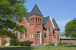
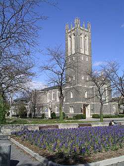
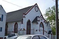
| 12 |
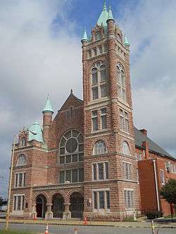
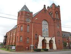
Epworth United Methodist Church |
|
August 21, 1997
(#97000955) |
124 W. Freemason St.
36°51′06″N 76°17′27″W / 36.851667°N 76.290833°W / 36.851667; -76.290833 (Epworth United Methodist Church) |
|
| 13 |
First Baptist Church |
|
July 21, 1983
(#83003297) |
418 E. Bute St.
36°51′10″N 76°17′03″W / 36.852778°N 76.284167°W / 36.852778; -76.284167 (First Baptist Church) |
|
| 14 |
First Calvary Baptist Church |
|
October 15, 1987
(#87001853) |
1036-1040 Wide St.
36°51′24″N 76°16′39″W / 36.856667°N 76.277500°W / 36.856667; -76.277500 (First Calvary Baptist Church) |
|
| 15 |
Fort Norfolk |
|
October 29, 1976
(#76002225) |
803 Front St.
36°51′25″N 76°18′22″W / 36.856944°N 76.306111°W / 36.856944; -76.306111 (Fort Norfolk) |
|
| 16 |
Freemason Street Baptist Church |
|
September 22, 1971
(#71001057) |
Northeastern corner of Freemason and Bank Sts.
36°51′02″N 76°17′13″W / 36.850556°N 76.286944°W / 36.850556; -76.286944 (Freemason Street Baptist Church) |
|
| 17 |
Ghent Historic District |
|
July 4, 1980
(#80004455) |
Roughly bounded by Olney Rd., Virginia Beach Boulevard, Smith's Creek, and Brambleton Ave.
36°51′24″N 76°17′50″W / 36.856667°N 76.297222°W / 36.856667; -76.297222 (Ghent Historic District) |
|
| 18 |
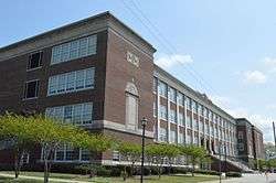
James Blair Junior High School |
|
February 4, 2000
(#00000068) |
730 Spotswood Ave.
36°52′07″N 76°17′47″W / 36.868611°N 76.296389°W / 36.868611; -76.296389 (James Blair Junior High School) |
|
| 19 |
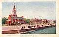
Jamestown Exposition Site Buildings |
|
October 20, 1975
(#75002114) |
Bounded by Bacon, Powhatan, Farragut, Gilbert, Bainbridge, and the harbor
36°57′02″N 76°18′49″W / 36.950556°N 76.313611°W / 36.950556; -76.313611 (Jamestown Exposition Site Buildings) |
|
| 20 |
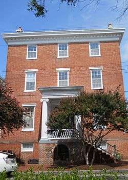
Kenmure |
|
June 1, 1988
(#88000601) |
420 W. Bute St.
36°51′10″N 76°17′49″W / 36.852778°N 76.296944°W / 36.852778; -76.296944 (Kenmure) |
|
| 21 |
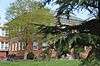
Lafayette Grammar and High School |
|
February 10, 1983
(#83003298) |
3109 Tidewater Dr.
36°52′37″N 76°15′52″W / 36.876944°N 76.264444°W / 36.876944; -76.264444 (Lafayette Grammar and High School) |
|
| 22 |
Lafayette Residence Park |
|
January 27, 1999
(#99000071) |
Roughly bounded by Tidewater Dr., Dupont Creek, Fontainbleau Crescent, La Salle Ave., Orleans Creek, and the Lafayette River
36°52′37″N 76°16′00″W / 36.876944°N 76.266667°W / 36.876944; -76.266667 (Lafayette Residence Park) |
|
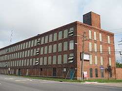
| 23 |
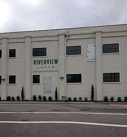
Lambert's Point Knitting Mill (122-0934) |
|
February 1, 2006
(#05001585) |
808 W. 44th St.
36°53′05″N 76°17′44″W / 36.884722°N 76.295556°W / 36.884722; -76.295556 (Lambert's Point Knitting Mill (122-0934)) |
|
| 24 |
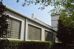
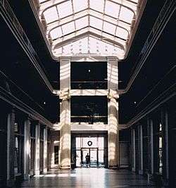
Monticello Arcade |
|
May 21, 1975
(#75002115) |
In the 200 block of E. City Hall Ave., between City Hall Ave. and Plume St.
36°50′50″N 76°17′27″W / 36.847222°N 76.290833°W / 36.847222; -76.290833 (Monticello Arcade) |
|
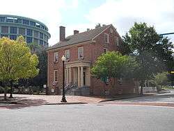
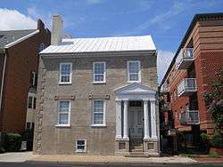
| 25 |
Moses Myers House |
|
February 16, 1970
(#70000874) |
Southwestern corner of E. Freemason and N. Bank Sts.
36°51′01″N 76°17′15″W / 36.850278°N 76.287500°W / 36.850278; -76.287500 (Moses Myers House) |
|
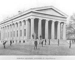
| 26 |
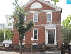
Norfolk Academy |
|
November 12, 1969
(#69000343) |
420 Bank St.
36°51′04″N 76°17′09″W / 36.851111°N 76.285833°W / 36.851111; -76.285833 (Norfolk Academy) |
|
| 27 |
Norfolk and Western Railroad Historic District |
|
May 18, 2015
(#15000253) |
Parts of 21st through 27th Sts., Bowden's Ferry Rd., and Colley, Colonial, Debree, Llewellyn, Monticello Aves.
36°52′19″N 76°17′32″W / 36.871944°N 76.292222°W / 36.871944; -76.292222 (Norfolk and Western Railroad Historic District) |
|
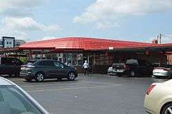
| 28 |
Norfolk Auto Row Historic District |
|
August 25, 2014
(#14000529) |
Roughly bounded by E. 14th, Boush, and Granby Sts., and Monticello and W. Brambleton Aves.
36°51′22″N 76°17′18″W / 36.856111°N 76.288333°W / 36.856111; -76.288333 (Norfolk Auto Row Historic District) |
|
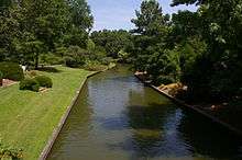
| 29 |
Norfolk Botanical Garden |
|
August 17, 2005
(#05000895) |
6700 Azalea Garden Rd.
36°54′12″N 76°12′12″W / 36.903333°N 76.203333°W / 36.903333; -76.203333 (Norfolk Botanical Garden) |
|
| 30 |
Norfolk City Hall |
|
March 16, 1972
(#72001511) |
421 E. City Hall Ave.
36°50′51″N 76°17′19″W / 36.847500°N 76.288611°W / 36.847500; -76.288611 (Norfolk City Hall) |
Current home of the General Douglas MacArthur Memorial |
| 31 |
North Ghent |
|
July 11, 2001
(#01000693) |
Bounded by Princess Anne Rd., Olney Rd., Colonial Ave., and Colley Ave.
36°51′45″N 76°17′53″W / 36.862500°N 76.298056°W / 36.862500; -76.298056 (North Ghent) |
|
| 32 |
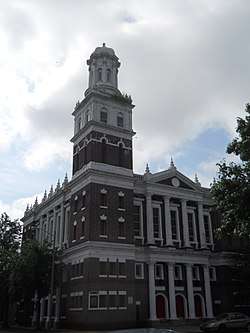
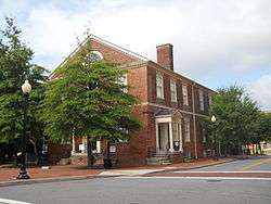
Old Norfolk City Hall |
|
October 29, 1981
(#81000674) |
235 E. Plume St.
36°50′48″N 76°17′25″W / 36.846667°N 76.290278°W / 36.846667; -76.290278 (Old Norfolk City Hall) |
Also known as the Seaboard building and a former U.S. Post Office. Today this is part of the Slover branch of the Norfolk Public Library. A glass atrium was built to adjoin it to the neighboring Selden Arcade.[6] |
| 33 |
Park Place Historic District |
|
February 10, 2006
(#06000029) |
Roughly bounded by Hampton Boulevard, 23rd St., Granby St., and 38th St.
36°52′29″N 76°17′28″W / 36.874722°N 76.291111°W / 36.874722; -76.291111 (Park Place Historic District) |
Boundary increase approved June 5, 2017 |
| 34 |
Poplar Hall |
|
November 7, 1997
(#97001402) |
400 Stuart Cir.
36°50′45″N 76°13′19″W / 36.845833°N 76.221944°W / 36.845833; -76.221944 (Poplar Hall) |
|
| 35 |
Queen Street Baptist Church |
|
March 15, 2006
(#06000141) |
413 Brambleton Ave.
36°51′12″N 76°17′02″W / 36.853333°N 76.283889°W / 36.853333; -76.283889 (Queen Street Baptist Church) |
|
| 36 |
Riverview |
|
September 24, 1999
(#99001198) |
Roughly bounded by LaVallette Ave., Beach Ave. on the Lafayette River, and Columbus Ave.
36°52′58″N 76°16′45″W / 36.882778°N 76.279167°W / 36.882778; -76.279167 (Riverview) |
|
| 37 |
St. John's African Methodist Episcopal Church |
|
December 4, 1986
(#86003441) |
539-545 E. Bute St.
36°51′08″N 76°16′56″W / 36.852222°N 76.282222°W / 36.852222; -76.282222 (St. John's African Methodist Episcopal Church) |
|
| 38 |
Saint Mary's Catholic Cemetery |
|
July 13, 2001
(#01000694) |
3000 Church St.
36°52′28″N 76°16′49″W / 36.874444°N 76.280278°W / 36.874444; -76.280278 (Saint Mary's Catholic Cemetery) |
|
| 39 |
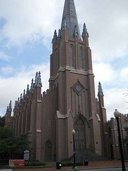
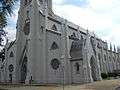
St. Mary's Church |
|
May 25, 1979
(#79003287) |
232 Chapel St.
36°50′50″N 76°16′57″W / 36.847222°N 76.282611°W / 36.847222; -76.282611 (St. Mary's Church) |
|
| 40 |
St. Paul's Church |
|
July 2, 1971
(#71001058) |
201 St. Paul's Boulevard
36°50′52″N 76°17′07″W / 36.847639°N 76.285278°W / 36.847639; -76.285278 (St. Paul's Church) |
|
| 41 |
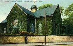
St. Peter's Episcopal Church |
|
July 8, 2010
(#10000445) |
1625 Brown Ave.
36°50′37″N 76°16′24″W / 36.843611°N 76.273333°W / 36.843611; -76.273333 (St. Peter's Episcopal Church) |
|
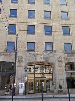
| 42 |
Seaboard Air Line Railway Building |
|
February 5, 2013
(#12001271) |
221-229 W. Bute St.
36°51′10″N 76°17′30″W / 36.852778°N 76.291667°W / 36.852778; -76.291667 (Seaboard Air Line Railway Building) |
Also known as the Wainwright Building or Wainwright Downtown, a luxury apartment building.[7] |
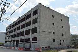
| 43 |
Security Storage and Safe Deposit Company Warehouse |
|
November 19, 2014
(#14000948) |
517-523 Front St.
36°51′15″N 76°18′01″W / 36.854167°N 76.300278°W / 36.854167; -76.300278 (Security Storage and Safe Deposit Company Warehouse) |
|
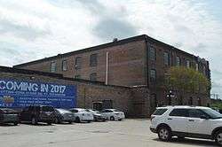
| 44 |
Southern Bagging Company |
|
August 8, 2007
(#07000804) |
1900 Monticello Ave.
36°51′56″N 76°17′01″W / 36.865556°N 76.283611°W / 36.865556; -76.283611 (Southern Bagging Company) |
|
| 45 |
Talbot Hall |
|
February 2, 2016
(#15001041) |
600 Talbot Hall Rd., 6601 Caroline St., and 6651 Talbot Hall Ct.
36°54′12″N 76°17′14″W / 36.903333°N 76.287222°W / 36.903333; -76.287222 (Talbot Hall) |
|
| 46 |
Taylor-Whittle House |
|
September 22, 1971
(#71001059) |
225 W. Freemason St.
36°51′07″N 76°17′32″W / 36.851806°N 76.292222°W / 36.851806; -76.292222 (Taylor-Whittle House) |
|
| 47 |
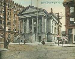
U.S. Customhouse |
|
April 17, 1970
(#70000901) |
101 E. Main St.
36°50′46″N 76°17′32″W / 36.846111°N 76.292222°W / 36.846111; -76.292222 (U.S. Customhouse) |
|
| 48 |
US Post Office and Courthouse |
|
October 10, 1984
(#84000098) |
600 Granby St.
36°51′13″N 76°17′18″W / 36.853611°N 76.288333°W / 36.853611; -76.288333 (US Post Office and Courthouse) |
|
| 49 |
USS WISCONSIN (BB-64) battleship |
|
March 28, 2012
(#12000178) |
1 Waterside Dr.
36°50′54″N 76°17′44″W / 36.848333°N 76.295556°W / 36.848333; -76.295556 (USS WISCONSIN (BB-64) battleship) |
|
| 50 |
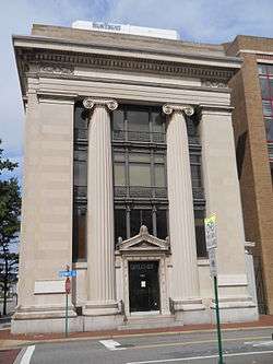
Virginia Bank and Trust Building |
|
February 23, 1984
(#84003553) |
101 Granby St.
36°50′48″N 76°17′33″W / 36.846528°N 76.292500°W / 36.846528; -76.292500 (Virginia Bank and Trust Building) |
|
| 51 |
Virginia Ice & Freezing Corporation Cold Storage Warehouse |
|
November 13, 2009
(#09000922) |
835 Southampton Ave.
36°51′30″N 76°18′23″W / 36.858333°N 76.306389°W / 36.858333; -76.306389 (Virginia Ice & Freezing Corporation Cold Storage Warehouse) |
|
| 52 |
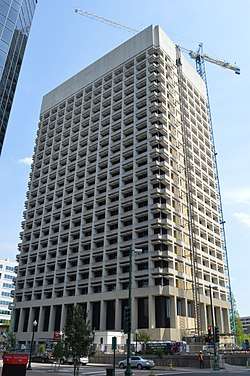
Virginia National Bank Headquarters Historic District |
|
August 15, 2016
(#16000535) |
Bounded by Commercial Place, Waterside Dr., and E. Plume and Atlantic Sts.
36°50′44″N 76°17′23″W / 36.845556°N 76.289722°W / 36.845556; -76.289722 (Virginia National Bank Headquarters Historic District) |
Also known as Bank of America Center (Norfolk, Virgina) and as of 2017, Icon Norfolk (luxury apartments)[8] |
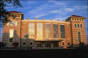
| 53 |
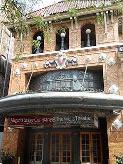
Wells Theatre |
|
May 19, 1980
(#80004312) |
Tazewell St. and Monticello Ave.
36°50′57″N 76°17′25″W / 36.849167°N 76.290278°W / 36.849167; -76.290278 (Wells Theatre) |
|
| 54 |
West Freemason Street Area Historic District |
|
November 7, 1972
(#72001512) |
Both sides of Bute and Freemason Sts. between the Elizabeth River and York and Duke Sts.
36°51′08″N 76°17′40″W / 36.852222°N 76.294444°W / 36.852222; -76.294444 (West Freemason Street Area Historic District) |
|
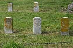
| 55 |
West Point Cemetery |
|
May 3, 2007
(#07000393) |
238 E. Princess Anne Rd.
36°51′40″N 76°17′06″W / 36.861111°N 76.285000°W / 36.861111; -76.285000 (West Point Cemetery) |
|
| 56 |
Williamston-Woodland Historic District |
|
August 25, 2014
(#14000530) |
Roughly bounded by the Norfolk Southern railroad line and Church, 18th, and Omohundro Sts.
36°51′58″N 76°16′59″W / 36.866111°N 76.283056°W / 36.866111; -76.283056 (Williamston-Woodland Historic District) |
|
| 57 |
Willoughby-Baylor House |
|
September 22, 1971
(#71001060) |
601 Freemason St.
36°50′59″N 76°17′08″W / 36.849722°N 76.285556°W / 36.849722; -76.285556 (Willoughby-Baylor House) |
|
| 58 |
Winona |
|
July 5, 2001
(#01000702) |
Roughly bounded by Ashland Circle, Ashland Ave., Elmere Place, Huntington Crescent, Holland Ave., and the Lafayette River
36°52′51″N 76°16′10″W / 36.880833°N 76.269444°W / 36.880833; -76.269444 (Winona) |
|
| 59 |
Zion Methodist Church |
|
April 4, 2007
(#07000274) |
2729 Bowden's Ferry Rd.
36°52′42″N 76°18′14″W / 36.878333°N 76.303889°W / 36.878333; -76.303889 (Zion Methodist Church) |
|
.jpg)
.jpg)
.jpg)
.jpg)
.jpg)
_4.jpg)
%2C_Norfolk_city%2C_Virginia.jpg)
_underway_at_sea%2C_circa_1988-1991_(NH_97206-KN).jpg)