| [3] |
Name on the Register[4] |
Image |
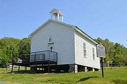
Date listed[5] |
Location |
City or town |
Description |
|---|
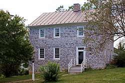
| 1 |
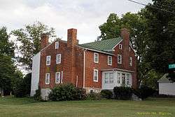
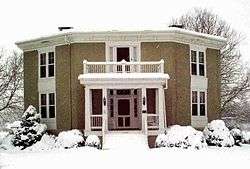
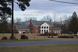
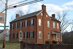
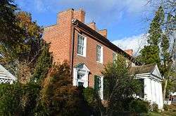
Baxter House |
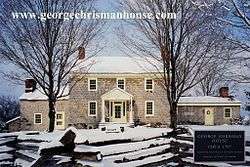
|
October 3, 1973
(#73002057) |
North of Harrisonburg on State Route 42
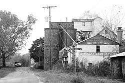
38°33′21″N 78°50′08″W / 38.555833°N 78.835694°W / 38.555833; -78.835694 (Baxter House) |
Edom |
|
| 2 |
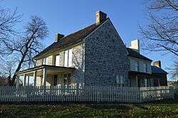
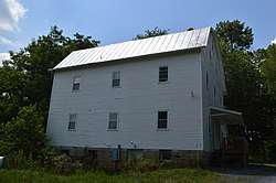
John K. Beery Farm |
|
September 19, 1973
(#73002058) |
North of Harrisonburg off State Route 42
38°31′08″N 78°51′31″W / 38.518889°N 78.858611°W / 38.518889; -78.858611 (John K. Beery Farm) |
Edom |
|
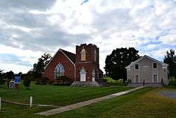
| 3 |
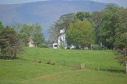
Bethlehem Church |
|
June 27, 1985
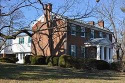
(#85001414) |
Tenth Legion Rd.
38°34′40″N 78°43′56″W / 38.577639°N 78.732222°W / 38.577639; -78.732222 (Bethlehem Church) |
Broadway |
|
| 4 |
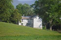
Big Run Quarry Site |
|
December 13, 1985
(#85003177) |
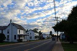
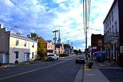
Address Restricted
|
Luray |
|
| 5 |
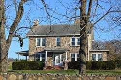
Bogota |
|
March 25, 2009
(#09000162) |
5375 Lynnwood Rd.
38°19′03″N 78°46′27″W / 38.317500°N 78.774167°W / 38.317500; -78.774167 (Bogota) |
Port Republic |
|
| 6 |
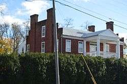
Bon Air |
|
May 2, 2007
(#07000399) |
2477 Bear Lithia Rd.
38°26′10″N 78°37′08″W / 38.436111°N 78.618889°W / 38.436111; -78.618889 (Bon Air) |
Elkton |
|
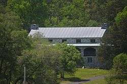
| 7 |
Breneman-Turner Mill |
|
April 20, 2006
(#06000325) |
5036 Turners Mill Ln.
38°31′30″N 78°52′30″W / 38.525000°N 78.875000°W / 38.525000; -78.875000 (Breneman-Turner Mill) |
Harrisonburg |
|
| 8 |
Bridgewater Historic District |
|
November 1, 1984
(#84000477) |
Roughly Main St. from the North River to Crawford Ave., and E. College, Gravel Lane, and Bank St.
38°22′56″N 78°58′36″W / 38.382222°N 78.976667°W / 38.382222; -78.976667 (Bridgewater Historic District) |
Bridgewater |
|
| 9 |
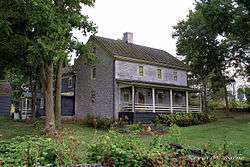
Cave Hill Farm |
|
November 18, 2011
(#11000839) |
9780 Cave Hill Rd.
38°21′34″N 78°43′18″W / 38.359444°N 78.721667°W / 38.359444; -78.721667 (Cave Hill Farm) |
McGaheysville |
|
| 10 |
George Chrisman House |
|
December 1, 2006
(#06001099) |
5341 Shaver Mill Rd.
38°32′42″N 78°52′04″W / 38.545000°N 78.867778°W / 38.545000; -78.867778 (George Chrisman House) |
Linville |
|
| 11 |
Contentment |
|
May 19, 2004
(#04000481) |
253 Contentment Ln.
38°20′31″N 78°56′06″W / 38.342083°N 78.935000°W / 38.342083; -78.935000 (Contentment) |
Mount Crawford |
|
| 12 |
Dayton Historic District |
|
August 16, 1984
(#84003590) |
Roughly bounded by Main, Mason, Walnut, Summit, and Bowman Sts.
38°24′58″N 78°56′27″W / 38.416111°N 78.940833°W / 38.416111; -78.940833 (Dayton Historic District) |
Dayton |
|
| 13 |
David and Catherine Driver Farm |
|
May 8, 2007
(#07000415) |
3796 Long Meadow Dr.
38°37′20″N 78°45′19″W / 38.622222°N 78.755139°W / 38.622222; -78.755139 (David and Catherine Driver Farm) |
Timberville |
|
| 14 |
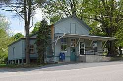
Edom Store and Post Office |
|
July 24, 2007
(#07000768) |
5375 Jesse Bennett Way
38°31′32″N 78°51′36″W / 38.525417°N 78.860000°W / 38.525417; -78.860000 (Edom Store and Post Office) |
Edom |
|
| 15 |
Joseph Funk House |
|
February 24, 1975
(#75002036) |
Singers Glen Rd.
38°33′04″N 78°55′03″W / 38.551111°N 78.917500°W / 38.551111; -78.917500 (Joseph Funk House) |
Singers Glen |
|
| 16 |
Harnsberger Farm |
|
January 22, 1992
(#91001974) |
Junction of Point and Rinacas Corner Rds.
38°28′36″N 78°38′08″W / 38.476528°N 78.635556°W / 38.476528; -78.635556 (Harnsberger Farm) |
Shenandoah |
|
| 17 |
Stephen Harnsberger House |
|
July 8, 1982
(#82004593) |
Holly Ave.
38°16′31″N 78°49′48″W / 38.275222°N 78.830000°W / 38.275222; -78.830000 (Stephen Harnsberger House) |
Grottoes |
|
| 18 |
Daniel Harrison House |
|
July 24, 1973
(#73002056) |
Northeast of Dayton on State Route 42
38°25′05″N 78°56′09″W / 38.418056°N 78.935833°W / 38.418056; -78.935833 (Daniel Harrison House) |
Dayton |
|
| 19 |
Haugh House |
|
August 18, 2011
(#11000552) |
6529 State Route 253
38°21′05″N 78°49′27″W / 38.351389°N 78.824167°W / 38.351389; -78.824167 (Haugh House) |
Port Republic |
|
| 20 |
Inglewood |
|
May 30, 1985
(#85001172) |
Kratzler Rd.
38°28′51″N 78°50′43″W / 38.480833°N 78.845278°W / 38.480833; -78.845278 (Inglewood) |
Harrisonburg |
|
| 21 |
Kite Mansion |
|
February 13, 2007
(#07000049) |
17271 U.S. Route 33
38°24′12″N 78°36′15″W / 38.403333°N 78.604167°W / 38.403333; -78.604167 (Kite Mansion) |
Elkton |
|
| 22 |
Kyle's Mill House |
|
March 6, 2001
(#01000142) |
1764 Cross Keys Rd.
38°22′20″N 78°49′37″W / 38.372361°N 78.827083°W / 38.372361; -78.827083 (Kyle's Mill House) |
Harrisonburg |
|
| 23 |
Lincoln Homestead and Cemetery |
|
December 5, 1972
(#72001414) |
South of the junction of State Route 42 and Klines Mill Rd.
38°33′32″N 78°50′04″W / 38.558889°N 78.834444°W / 38.558889; -78.834444 (Lincoln Homestead and Cemetery) |
Broadway |
|
| 24 |
Linville Creek Bridge |
|
April 15, 1978
(#78003042) |
South of Broadway on Springbrook Rd.
38°36′23″N 78°48′11″W / 38.606250°N 78.803056°W / 38.606250; -78.803056 (Linville Creek Bridge) |
Broadway |
|
| 25 |
Long Meadow |
|
June 1, 2005
(#05000528) |
2525 Fridleys Gap Rd.
38°30′55″N 78°44′34″W / 38.515139°N 78.742639°W / 38.515139; -78.742639 (Long Meadow) |
Harrisonburg |
|
| 26 |
Longs Chapel |
|
November 15, 2006
(#06001042) |
1334B Fridleys Gap Rd.
38°30′46″N 78°45′46″W / 38.512639°N 78.762639°W / 38.512639; -78.762639 (Longs Chapel) |
Harrisonburg |
|
| 27 |
Mannheim (082-0005) |
|
May 27, 2004
(#04000553) |
4713 Wengers Mill Rd.
38°32′53″N 78°50′50″W / 38.547917°N 78.847222°W / 38.547917; -78.847222 (Mannheim (082-0005)) |
Linville |
|
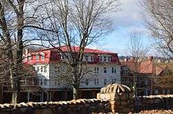
| 28 |
Massanetta Springs Historic District |
|
May 26, 2005
(#05000477) |
712 Massanetta Springs Rd.
38°24′03″N 78°50′10″W / 38.400833°N 78.836111°W / 38.400833; -78.836111 (Massanetta Springs Historic District) |
Harrisonburg |
|
| 29 |
Melrose Caverns and Harrison Farmstead |
|
May 14, 2014
(#14000237) |
6639 N. U.S. Route 11
38°31′02″N 78°47′25″W / 38.517222°N 78.790278°W / 38.517222; -78.790278 (Melrose Caverns and Harrison Farmstead) |
Harrisonburg |
|
| 30 |
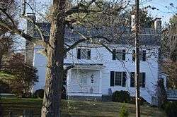
Miller-Kite House |
|
February 1, 1979
(#79003083) |
302 Rockingham St.
38°24′32″N 78°36′57″W / 38.408889°N 78.615972°W / 38.408889; -78.615972 (Miller-Kite House) |
Elkton |
Headquarters of Confederate General Stonewall Jackson during the Shenandoah Valley Campaign of the American Civil War |
| 31 |
Paul's Ottobine Mill |
|
June 12, 2017
(#100001083) |
8061 Judge Paul Rd.
38°25′44″N 79°02′15″W / 38.428889°N 79.037500°W / 38.428889; -79.037500 (Paul's Ottobine Mill) |
Dayton |
|
| 32 |
Peter Paul House |
|
December 28, 1979
(#79003082) |
North of Dayton on Silver Lake Rd.
38°25′48″N 78°56′19″W / 38.430000°N 78.938611°W / 38.430000; -78.938611 (Peter Paul House) |
Dayton |
|
| 33 |
Jonathan Peale House |
|
November 1, 2007
(#07001144) |
67 Cross Keys Rd.
38°23′31″N 78°48′39″W / 38.391944°N 78.810833°W / 38.391944; -78.810833 (Jonathan Peale House) |
Harrisonburg |
|
| 34 |
Plains Mill |
|
May 19, 2014
(#14000238) |
14767 Plains Mill Rd.
38°38′49″N 78°43′14″W / 38.646944°N 78.720556°W / 38.646944; -78.720556 (Plains Mill) |
Timberville |
|
| 35 |
Port Republic Historic District |
|
September 8, 1980
(#80004224) |
State Route 253 and Main St.
38°17′39″N 78°48′56″W / 38.294167°N 78.815556°W / 38.294167; -78.815556 (Port Republic Historic District) |
Port Republic |
|
| 36 |
Singers Glen Historic District |
|
January 20, 1978
(#78003043) |
Junction of Green Hill and Singers Glen Rds.
38°33′09″N 78°54′50″W / 38.552500°N 78.913889°W / 38.552500; -78.913889 (Singers Glen Historic District) |
Singers Glen |
|
| 37 |
Sites House |
|
April 3, 1979
(#79003081) |
Southwest of Broadway off Sunset Dr.
38°35′40″N 78°49′40″W / 38.594444°N 78.827778°W / 38.594444; -78.827778 (Sites House) |
Broadway |
|
| 38 |
Skyline Drive Historic District |
|
April 28, 1997
(#97001112) |
Shenandoah National Park, from the northern entrance station at Front Royal to the southern entrance station at the Rockfish Gap
38°22′03″N 78°32′12″W / 38.367500°N 78.536667°W / 38.367500; -78.536667 (Skyline Drive Historic District) |
Luray |
|
| 39 |
Taylor Springs |
|
June 6, 2002
(#02000621) |
3712 Taylor Spring Ln.
38°23′40″N 78°50′18″W / 38.394306°N 78.838472°W / 38.394306; -78.838472 (Taylor Springs) |
Harrisonburg |
|
| 40 |
Timberville Historic District |
|
January 2, 2013
(#12001137) |
Bounded by Main, Bellevue, Montevideo, High, Church, and S. C Sts., and Maple Ave.
38°38′20″N 78°46′24″W / 38.638889°N 78.773333°W / 38.638889; -78.773333 (Timberville Historic District) |
Timberville |
|
| 41 |
Tunker House |
|
July 2, 1971
(#71000989) |
South of central Broadway on Lindsay Ave.
38°36′16″N 78°47′54″W / 38.604306°N 78.798333°W / 38.604306; -78.798333 (Tunker House) |
Broadway |
|

.jpg)
_at_Rockingham_Street_in_Timberville%2C_Rockingham_County%2C_Virginia.jpg)