| [3] |
Name on the Register[4] |
Image |
Date listed[5] |
Location |
Description |
|---|
| 1 |
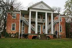
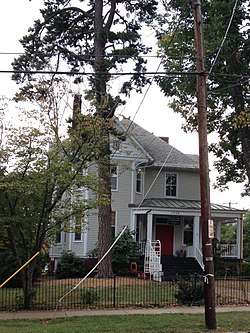
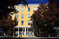
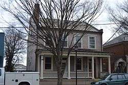
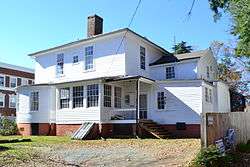
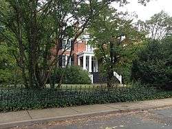
Abell-Gleason House |
|
February 16, 2001
(#01000151) |
521 N. 1st St.
38°02′07″N 78°28′47″W / 38.035278°N 78.479722°W / 38.035278; -78.479722 (Abell-Gleason House) |
|
| 2 |
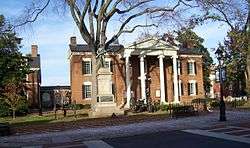
Albemarle County Courthouse Historic District |
|
June 30, 1972
(#72001503) |
Courthouse Sq. and surrounding properties
38°01′54″N 78°28′39″W / 38.031667°N 78.477500°W / 38.031667; -78.477500 (Albemarle County Courthouse Historic District) |
|
| 3 |
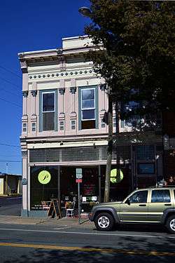
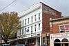
Anderson Brothers Building |
|
October 21, 1982
(#82001797) |
1417-1427 University Ave.
38°02′04″N 78°30′01″W / 38.034583°N 78.500139°W / 38.034583; -78.500139 (Anderson Brothers Building) |
|
| 4 |
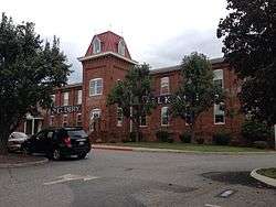
Armstrong Knitting Factory |
|
October 21, 1982
(#82001798) |
700 Harris St.
38°02′09″N 78°29′03″W / 38.035833°N 78.484167°W / 38.035833; -78.484167 (Armstrong Knitting Factory) |
|
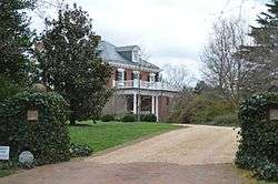
| 5 |
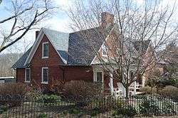
Barringer Mansion |
|
October 21, 1982
(#82001799) |
1404 Jefferson Park Ave.
38°01′54″N 78°30′08″W / 38.031667°N 78.502222°W / 38.031667; -78.502222 (Barringer Mansion) |
|
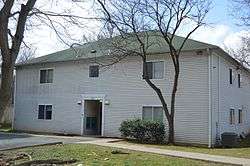
| 6 |
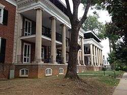
Belmont |
|
October 21, 1982
(#82001800) |
759 Belmont Ave.
38°01′29″N 78°28′38″W / 38.024722°N 78.477222°W / 38.024722; -78.477222 (Belmont) |
|
| 7 |
Carter-Gilmer House |
|
October 21, 1982
(#82001801) |
802 E. Jefferson St.
38°01′51″N 78°28′32″W / 38.030833°N 78.475417°W / 38.030833; -78.475417 (Carter-Gilmer House) |
|
| 8 |
Charlottesville and Albemarle County Courthouse Historic District |
|
July 28, 1982
(#82004904) |
Roughly bounded by Park, Water, Saxton, and Main Sts.
38°01′53″N 78°28′42″W / 38.031389°N 78.478333°W / 38.031389; -78.478333 (Charlottesville and Albemarle County Courthouse Historic District) |
|
| 9 |
Charlottesville Coca-Cola Bottling Works |
|
February 27, 2013
(#13000045) |
722 Preston Ave.
38°02′10″N 78°29′17″W / 38.036111°N 78.488056°W / 38.036111; -78.488056 (Charlottesville Coca-Cola Bottling Works) |
|
| 10 |
Dabney-Thompson House |
|
January 10, 1984
(#84003498) |
1602 Gordon Ave.
38°02′23″N 78°29′57″W / 38.039861°N 78.499167°W / 38.039861; -78.499167 (Dabney-Thompson House) |
|
| 11 |
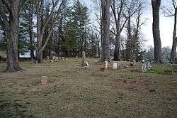
Daughters of Zion Cemetery |
|
June 24, 2010
(#10000382) |
Corner of 1st and Oak Sts.
38°01′36″N 78°29′04″W / 38.026667°N 78.484444°W / 38.026667; -78.484444 (Daughters of Zion Cemetery) |
|
| 12 |
Delevan Baptist Church |
|
October 21, 1982
(#82001802) |
632 W. Main St.
38°01′52″N 78°29′23″W / 38.031111°N 78.489722°W / 38.031111; -78.489722 (Delevan Baptist Church) |
|
| 13 |
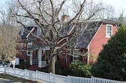
Enderly |
|
October 21, 1982
(#82001803) |
603 Watson Ave.
38°02′27″N 78°28′14″W / 38.040833°N 78.470556°W / 38.040833; -78.470556 (Enderly) |
|
| 14 |
Ficklin-Crawford Cottage |
|
October 21, 1982
(#82001804) |
1200 Carlton Ave.
38°01′24″N 78°28′18″W / 38.023333°N 78.471667°W / 38.023333; -78.471667 (Ficklin-Crawford Cottage) |
|
| 15 |
Fifeville and Tonsler Neighborhoods Historic District |
|
June 18, 2009
(#09000452) |
Bounded by Cherry Ave to the south, the railway to the north, 4th St., SW, to the east, and Spring St. to the west
38°01′45″N 78°29′21″W / 38.029167°N 78.489167°W / 38.029167; -78.489167 (Fifeville and Tonsler Neighborhoods Historic District) |
|
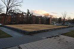
| 16 |
The Foster Site |
|
May 16, 2016
(#16000259) |
1540 Jefferson Park Ave.
38°01′54″N 78°30′16″W / 38.031667°N 78.504444°W / 38.031667; -78.504444 (The Foster Site) |
|
| 17 |
Four Acres |
|
October 21, 1982
(#82001805) |
1314 Rugby Rd.
38°02′58″N 78°29′25″W / 38.049444°N 78.490278°W / 38.049444; -78.490278 (Four Acres) |
|
| 18 |
Fry's Spring Historic District |
|
November 19, 2014
(#14000944) |
Roughly Highland, Jefferson Park, Monte Vista, Stribling, Raymond, Robertson, Sunset, and Todd Aves., and Hill St.
38°01′08″N 78°30′48″W / 38.018889°N 78.513333°W / 38.018889; -78.513333 (Fry's Spring Historic District) |
|
| 19 |
Gardner-Mays Cottage |
|
October 21, 1982
(#82001806) |
1022 Grove St.
38°01′45″N 78°29′56″W / 38.029167°N 78.498750°W / 38.029167; -78.498750 (Gardner-Mays Cottage) |
|
| 20 |
Hard Bargain |
|
January 10, 1984
(#84003521) |
1105 Park St.
38°02′35″N 78°28′16″W / 38.043056°N 78.471111°W / 38.043056; -78.471111 (Hard Bargain) |
|
| 21 |
Charles B. Holt House |
|
April 14, 2006
(#06000320) |
1010 Preston Ave.
38°02′22″N 78°29′31″W / 38.039444°N 78.491944°W / 38.039444; -78.491944 (Charles B. Holt House) |
|
| 22 |
Hotel Gleason/Albemarle Hotel, Imperial Cafe |
|
August 10, 1983
(#83003267) |
617-619 W. Main St.
38°01′53″N 78°29′20″W / 38.031389°N 78.488889°W / 38.031389; -78.488889 (Hotel Gleason/Albemarle Hotel, Imperial Cafe) |
|
| 23 |
House at Pireus |
|
August 10, 1983
(#83003268) |
302 Riverside Ave.
38°01′19″N 78°27′21″W / 38.021944°N 78.455972°W / 38.021944; -78.455972 (House at Pireus) |
|
| 24 |
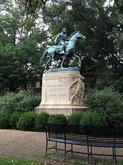
Thomas Jonathan Jackson Sculpture |
|
May 16, 1997
(#97000446) |
Jackson Park, bounded by High, Jefferson, and 4th Sts., and the Albemarle County Courthouse
38°01′55″N 78°28′41″W / 38.031944°N 78.478056°W / 38.031944; -78.478056 (Thomas Jonathan Jackson Sculpture) |
|
| 25 |
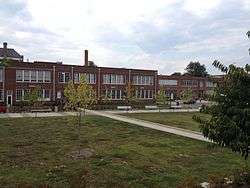
Jefferson School, Carver Recreation Center, and School Site |
|
February 15, 2006
(#06000050) |
233 4th St., NW.
38°01′56″N 78°29′13″W / 38.032222°N 78.486944°W / 38.032222; -78.486944 (Jefferson School, Carver Recreation Center, and School Site) |
|
| 26 |
Martha Jefferson Historic District |
|
February 21, 2008
(#08000066) |
Includes parts of Lexington, Locust, and Grove Aves., and E. High, Maple, Sycamore, Poplar, and Hazel Sts.
38°01′59″N 78°28′13″W / 38.033056°N 78.470278°W / 38.033056; -78.470278 (Martha Jefferson Historic District) |
|
| 27 |
King Lumber Company Warehouse |
|
August 10, 1983
(#83003269) |
608 Preston Ave.
38°02′06″N 78°29′10″W / 38.035000°N 78.486111°W / 38.035000; -78.486111 (King Lumber Company Warehouse) |
|
| 28 |
King-Runkle House |
|
August 10, 1983
(#83003270) |
201 14th St., NW.
38°02′05″N 78°29′58″W / 38.034861°N 78.499306°W / 38.034861; -78.499306 (King-Runkle House) |
|
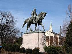
| 29 |
Robert Edward Lee Sculpture |
|
May 16, 1997
(#97000447) |
Lee Park, bounded by Market, Jefferson, 1st, and 2nd Sts., NE.
38°01′55″N 78°28′50″W / 38.031861°N 78.480556°W / 38.031861; -78.480556 (Robert Edward Lee Sculpture) |
|
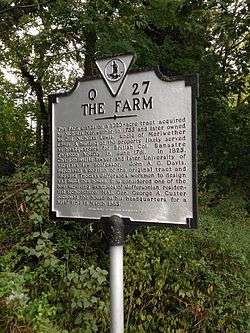
| 30 |
Lewis Farm |
|
October 21, 1982
(#82001807) |
1201 Jefferson St.
38°01′44″N 78°28′08″W / 38.028889°N 78.468750°W / 38.028889; -78.468750 (Lewis Farm) |
|
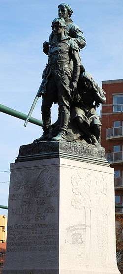
| 31 |
Meriwether Lewis and William Clark Sculpture |
|
May 16, 1997
(#97000449) |
Junction of Ridge and W. Main Sts., and McIntire Rd.
38°01′50″N 78°29′07″W / 38.030417°N 78.485361°W / 38.030417; -78.485361 (Meriwether Lewis and William Clark Sculpture) |
|
| 32 |
Locust Grove |
|
October 21, 1982
(#82001808) |
810 Locust Ave.
38°02′08″N 78°28′05″W / 38.035556°N 78.468056°W / 38.035556; -78.468056 (Locust Grove) |
|
| 33 |
Marshall-Rucker-Smith House |
|
June 25, 1999
(#99000725) |
620 Park St.
38°02′08″N 78°28′30″W / 38.035556°N 78.475000°W / 38.035556; -78.475000 (Marshall-Rucker-Smith House) |
|
| 34 |
McConnell-Neve House |
|
August 10, 1983
(#83003271) |
228 14th St., NW.
38°02′09″N 78°29′54″W / 38.035833°N 78.498333°W / 38.035833; -78.498333 (McConnell-Neve House) |
|
| 35 |
William H. McGuffey Primary School |
|
December 23, 2009
(#09001156) |
201 2nd St., NW.
38°01′56″N 78°28′56″W / 38.032222°N 78.482222°W / 38.032222; -78.482222 (William H. McGuffey Primary School) |
|
| 36 |
Montebello |
|
October 23, 2003
(#03001085) |
1700 Stadium Rd.
38°01′50″N 78°30′35″W / 38.030694°N 78.509722°W / 38.030694; -78.509722 (Montebello) |
|
| 37 |
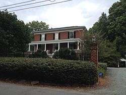
Morea |
|
May 3, 1984
(#84003522) |
209-211 Sprigg Lane
38°02′22″N 78°30′32″W / 38.039444°N 78.508889°W / 38.039444; -78.508889 (Morea) |
|
| 38 |
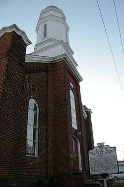
Mount Zion Baptist Church |
|
October 15, 1992
(#92001388) |
105 Ridge St.
38°01′48″N 78°29′08″W / 38.030000°N 78.485556°W / 38.030000; -78.485556 (Mount Zion Baptist Church) |
|
| 39 |
North Belmont Neighborhood Historic District |
|
May 31, 2018
(#100002528) |
Roughly Avon, Castalia, Church, Douglas, Goodman, Graves, Levy, Little Graves, Meridian, Rialto, & Sonoma Sts, Belmont, Carlton, Hinton & Monticello Aves
38°01′20″N 78°28′35″W / 38.0221°N 78.4765°W / 38.0221; -78.4765 (North Belmont Neighborhood Historic District) |
|
| 40 |
Oak Lawn |
|
May 25, 1973
(#73002204) |
Cherry Ave. and 9th St.
38°01′40″N 78°29′47″W / 38.027778°N 78.496389°W / 38.027778; -78.496389 (Oak Lawn) |
|
| 41 |
Oakhurst-Gildersleeve Neighborhood Historic District |
|
March 25, 2009
(#09000161) |
Oakhurst Circle, Gildersleeve Wood, Valley Rd., Valley Circle, and parts of Maywood Lane and Jefferson Park Ave.
38°01′51″N 78°30′24″W / 38.030833°N 78.506667°W / 38.030833; -78.506667 (Oakhurst-Gildersleeve Neighborhood Historic District) |
|
| 42 |
Patton Mansion |
|
October 21, 1982
(#82001809) |
1018 W. Main St.
38°01′57″N 78°29′44″W / 38.032500°N 78.495556°W / 38.032500; -78.495556 (Patton Mansion) |
|
| 43 |
Paxton Place |
|
October 21, 1982
(#82001810) |
503 W. Main St.
38°01′52″N 78°29′16″W / 38.031111°N 78.487778°W / 38.031111; -78.487778 (Paxton Place) |
|
| 44 |
Peyton-Ellington Building |
|
October 21, 1982
(#82001811) |
711 W. Main St.
38°01′54″N 78°29′25″W / 38.031667°N 78.490139°W / 38.031667; -78.490139 (Peyton-Ellington Building) |
|
| 45 |
Piereus Store |
|
August 10, 1983
(#83003272) |
1901 E. Market St.
38°01′18″N 78°27′22″W / 38.021667°N 78.456111°W / 38.021667; -78.456111 (Piereus Store) |
|
| 46 |
Pitts-Inge |
|
October 21, 1982
(#82001812) |
331-333 W. Main St.
38°01′50″N 78°29′11″W / 38.030694°N 78.486389°W / 38.030694; -78.486389 (Pitts-Inge) |
|
| 47 |
Preston Court Apartments |
|
October 29, 2007
(#07001134) |
1600 Grady Ave.
38°02′29″N 78°29′56″W / 38.041389°N 78.498889°W / 38.041389; -78.498889 (Preston Court Apartments) |
|
| 48 |
Recoleta |
|
August 11, 2004
(#04000858) |
120 Rothery Rd.
38°02′23″N 78°30′34″W / 38.039722°N 78.509444°W / 38.039722; -78.509444 (Recoleta) |
|
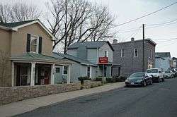
| 49 |
Ridge Street Historic District |
|
October 21, 1982
(#82001813) |
200-700 Ridge St.
38°01′40″N 78°29′12″W / 38.027778°N 78.486667°W / 38.027778; -78.486667 (Ridge Street Historic District) |
|
| 50 |
Judge William J. Robertson House |
|
December 22, 1999
(#99001601) |
705 Park St.
38°02′13″N 78°28′33″W / 38.036944°N 78.475833°W / 38.036944; -78.475833 (Judge William J. Robertson House) |
|
| 51 |
Rugby Road-University Corner Historic District |
|
February 16, 1984
(#84003523) |
Roughly bounded by University Ave., Wayside Pl., 14th St., and U.S. Route 29
38°02′08″N 78°30′03″W / 38.035556°N 78.500833°W / 38.035556; -78.500833 (Rugby Road-University Corner Historic District) |
Extends into Albemarle County |
| 52 |
Stonefield |
|
January 10, 1984
(#84003524) |
1204 Rugby Rd.
38°02′53″N 78°29′31″W / 38.047917°N 78.491944°W / 38.047917; -78.491944 (Stonefield) |
|
| 53 |
Sunnyside |
|
October 23, 2003
(#03001086) |
2150 Barracks Rd.
38°03′20″N 78°30′13″W / 38.055694°N 78.503611°W / 38.055694; -78.503611 (Sunnyside) |
|
| 54 |
Timberlake-Branham House |
|
January 10, 1984
(#84003525) |
1512 E. Market St.
38°01′27″N 78°27′46″W / 38.024167°N 78.462778°W / 38.024167; -78.462778 (Timberlake-Branham House) |
|
| 55 |
Benjamin Tonsler House |
|
August 10, 1983
(#83003274) |
327 6th St.
38°01′42″N 78°29′26″W / 38.028333°N 78.490417°W / 38.028333; -78.490417 (Benjamin Tonsler House) |
|
| 56 |
Turner-LaRowe House |
|
August 10, 1983
(#83003275) |
1 University Court
38°02′16″N 78°29′54″W / 38.037778°N 78.498333°W / 38.037778; -78.498333 (Turner-LaRowe House) |
|
| 57 |
Robert L. Updike House |
|
August 10, 1983
(#83003276) |
620 Prospect Ave.
38°01′31″N 78°29′39″W / 38.025278°N 78.494167°W / 38.025278; -78.494167 (Robert L. Updike House) |
|
| 58 |
John Vowles House |
|
November 2, 1989
(#89001928) |
1111-1113 W. Main St.
38°01′59″N 78°29′48″W / 38.033194°N 78.496528°W / 38.033194; -78.496528 (John Vowles House) |
|
| 59 |
Wertland Street Historic District |
|
February 14, 1985
(#85000298) |
Wertland St. between 10th and 14th Sts.
38°02′05″N 78°29′47″W / 38.034722°N 78.496389°W / 38.034722; -78.496389 (Wertland Street Historic District) |
|
| 60 |
West Main Street Historic District |
|
September 18, 2017
(#100001641) |
Parts of W. Main St., 6th, 4th, and 8th Sts., NW., and Ridge St.
38°01′52″N 78°29′19″W / 38.031111°N 78.488611°W / 38.031111; -78.488611 (West Main Street Historic District) |
|
| 61 |
White Cross-Huntley Hall |
|
October 21, 1982
(#82001814) |
152 Stribling Ave.
38°01′20″N 78°31′12″W / 38.022361°N 78.520000°W / 38.022361; -78.520000 (White Cross-Huntley Hall) |
|
| 62 |
Woolen Mills Chapel |
|
October 21, 1982
(#82001815) |
1819 E. Market St.
38°01′19″N 78°27′23″W / 38.021944°N 78.456389°W / 38.021944; -78.456389 (Woolen Mills Chapel) |
|
| 63 |
Woolen Mills Village Historic District |
|
April 12, 2010
(#10000196) |
Parts of Chesapeake, Franklin, Steephill, 18th NE., and E. Market Sts., and Riverside Ave.; and parts of Pireus Row and Marchant and E. Market St.
38°01′23″N 78°27′33″W / 38.023056°N 78.459167°W / 38.023056; -78.459167 (Woolen Mills Village Historic District) |
Extends into Albemarle County |
| 64 |
Wynhurst |
|
October 21, 1982
(#82001816) |
605 Preston Pl.
38°02′30″N 78°29′55″W / 38.041667°N 78.498611°W / 38.041667; -78.498611 (Wynhurst) |
|
| 65 |
Young Building |
|
October 21, 1982
(#82001817) |
1102 Carlton Ave.
38°01′17″N 78°28′03″W / 38.021250°N 78.467500°W / 38.021250; -78.467500 (Young Building) |
|
.jpg)